----------------------------------------------------------------------------
Words by Colton Stiffler
Images by Colton Stiffler and Hanna Crosby
Instagram: @coltonstiffler
Website: www.coltonstifflerphotography.com
In Collaboration w/ Zeal Optics (www.zealoptics.com)
Trip organization by Nuyama (www.nuyama.com)
----------------------------------------------------------------------------
When it comes to deciding on a long distance hiking route, there is an overwhelming number of trail possibilities to choose from. One particular trail however stands tall among the crowd and repeatedly finds itself listed in top ten lists of the World’s best hikes and for good reason as it covers a distance of nearly 110 miles through three countries (France, Italy, and Switzerland), circumnavigating the Mont Blanc massif in the Alps. That trail is known as the Tour du Mont Blanc, or the TMB for short. Yet, six months ago when I was asked if I would be interested in hiking the TMB, I quickly realized that I had no idea of what the trip would entail. After doing a little research, I was surprised that this trip had all of the ingredients for an epic adventure and it quickly moved up to the top of the rank on my perpetually expanding list of things that I definitely need to do before I die.
This would be the first big international trip for my girlfriend, Hanna, and I since COVID hit, and we both agreed that we wanted to take our time on this hike, and enjoy it to the fullest. We configured our TMB trip to be 11 days long, hiking counter-clockwise along the route, starting and ending in Chamonix, France. Based on this schedule, we would be hiking 10-16 miles per day, with decent elevation gains and losses. I reached out to my friends at Nuyama to help with booking, and within a day, all of our reservations for each night along the way had been made. Shortly after, I cashed in on some frequent flyer miles for a plane ticket, and the trip was a sealed deal.

Map of the Tour du Mont Blanc, starting and ending in Chamonix, France and counter-clockwise route.
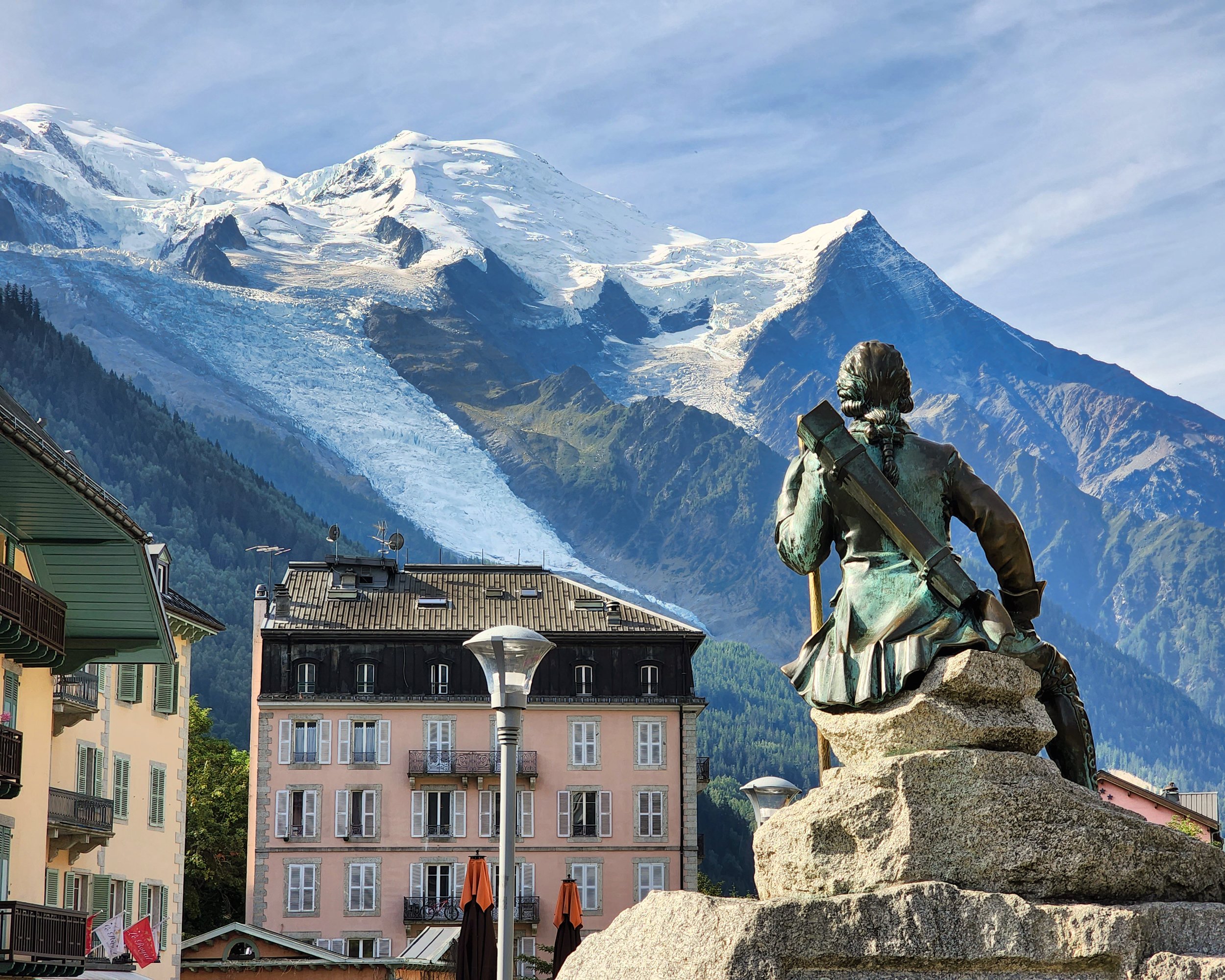
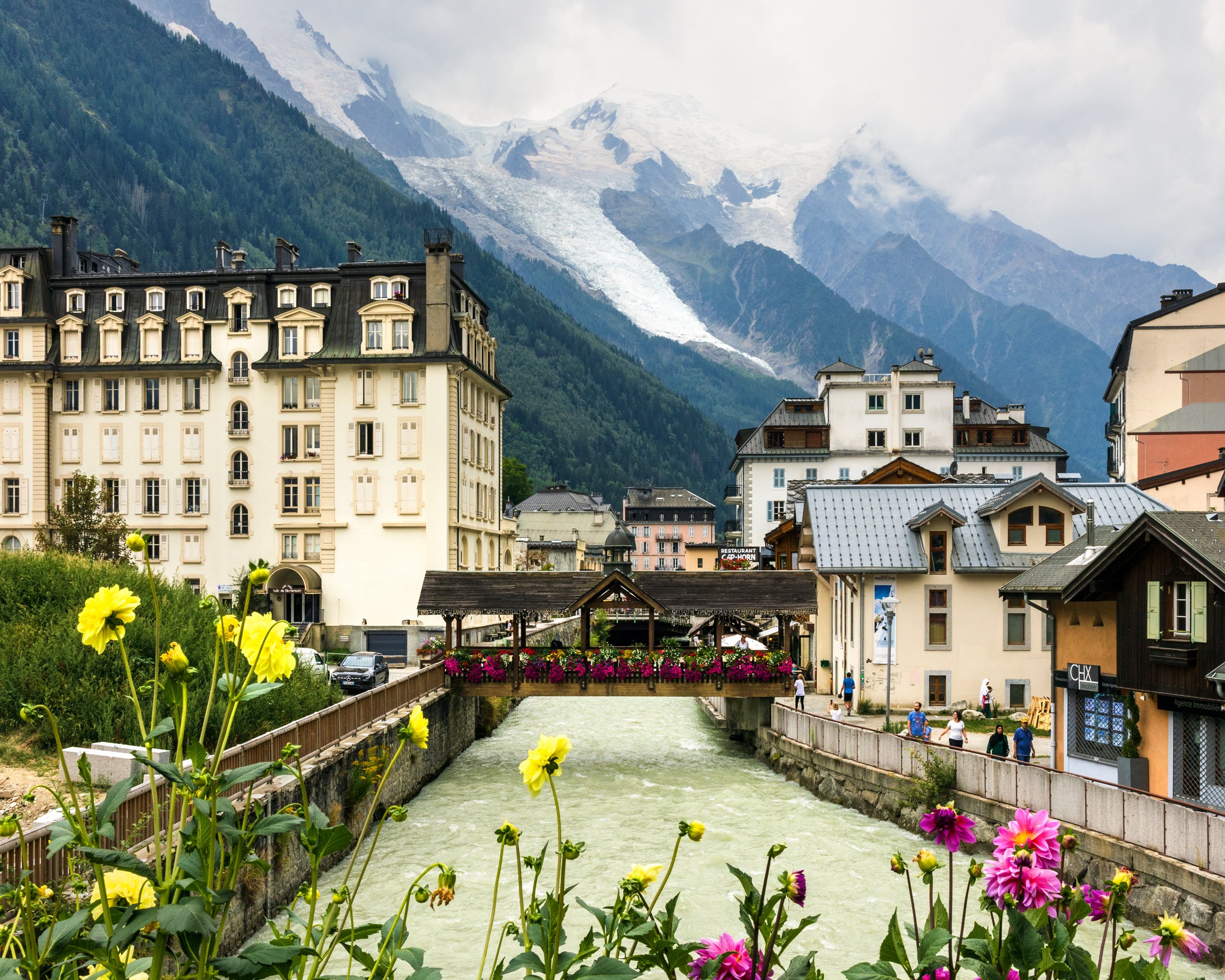
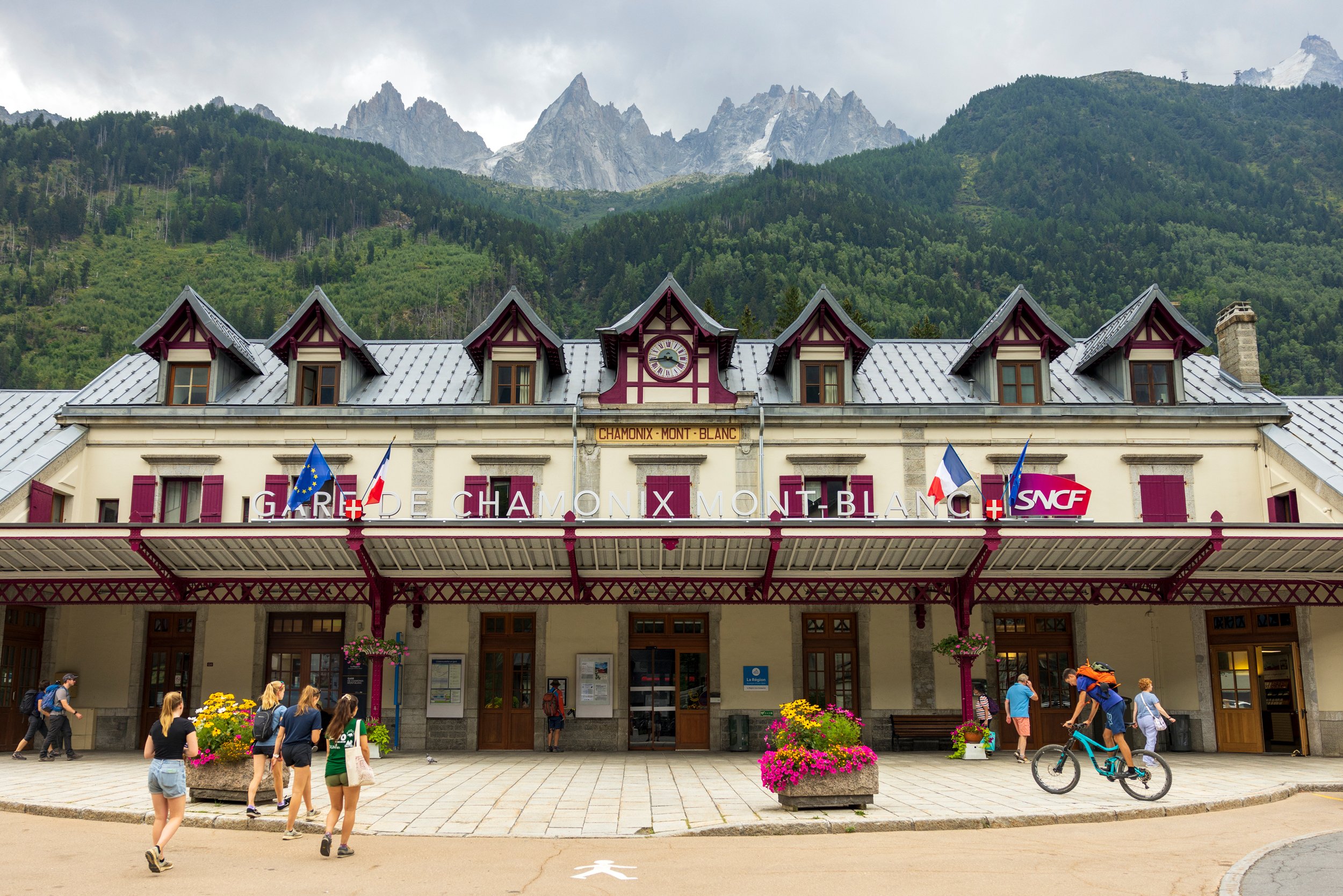
After 20 hours of travel from the Bozeman airport we arrived in Geneva with zero complications (other than the expected time travel/jet-lag syndrome). We slept off some of our jet lag at the Nash airport hotel in Geneva, caught a bus to Chamonix (the next day) , checked into our room at Hôtel Le Refuge des Aiglons, and headed out to explore the streets of this magical mountain town at the base of the Mont Blanc massif.
As a lifelong skier, Chamonix has always been on my radar. It has been a dream of mine to visit this place in the winter and to ski some of the iconic, lift-accessed lines that are here. Little did I know that my first trip would be during the warm summer months, but hey, I’ll take Chamonix whenever I can get some. This place has a dreamy, almost mysterious atmosphere about it. People from all walks of life are here to experience the big mountain history and culture as well as the breathtaking views.
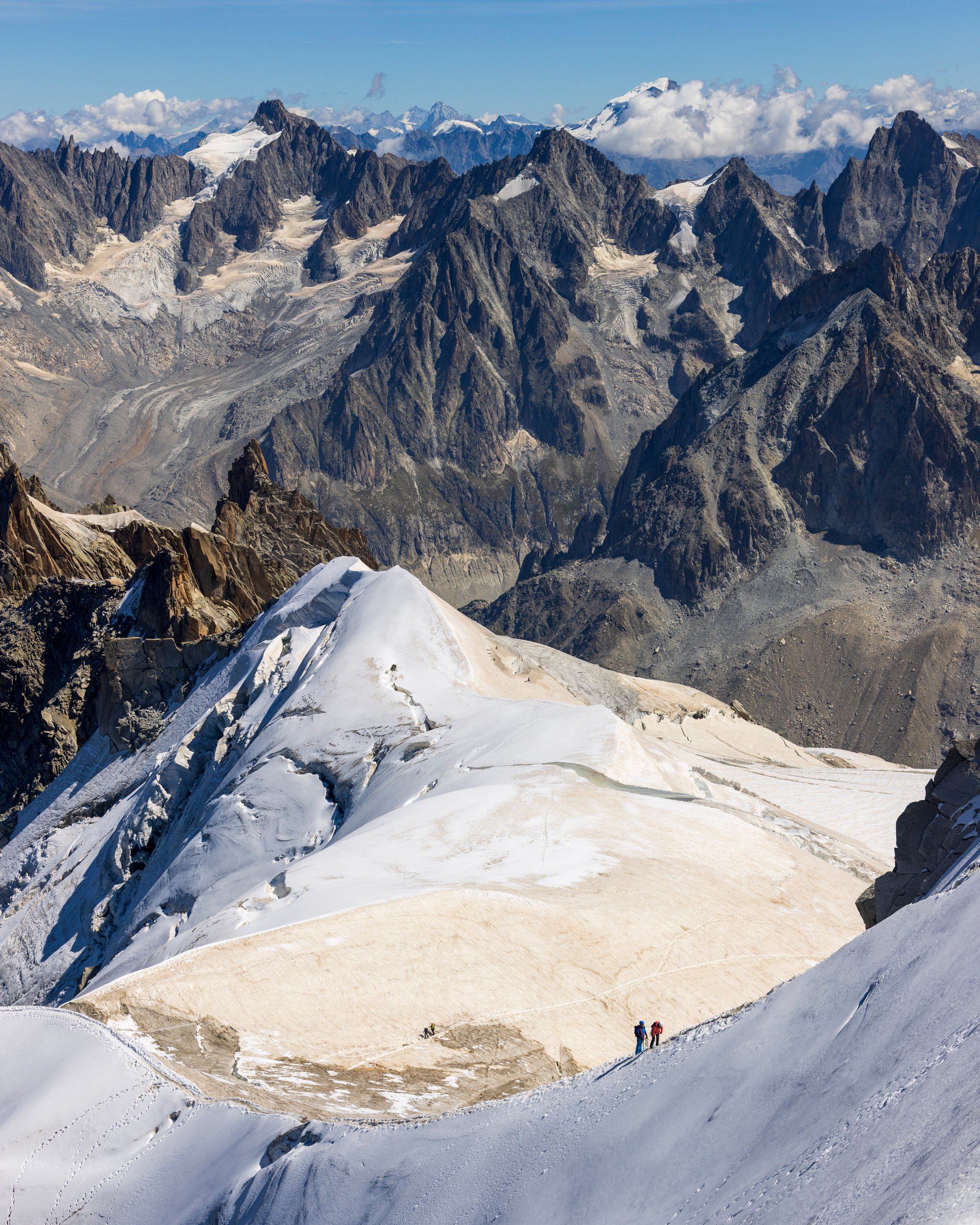
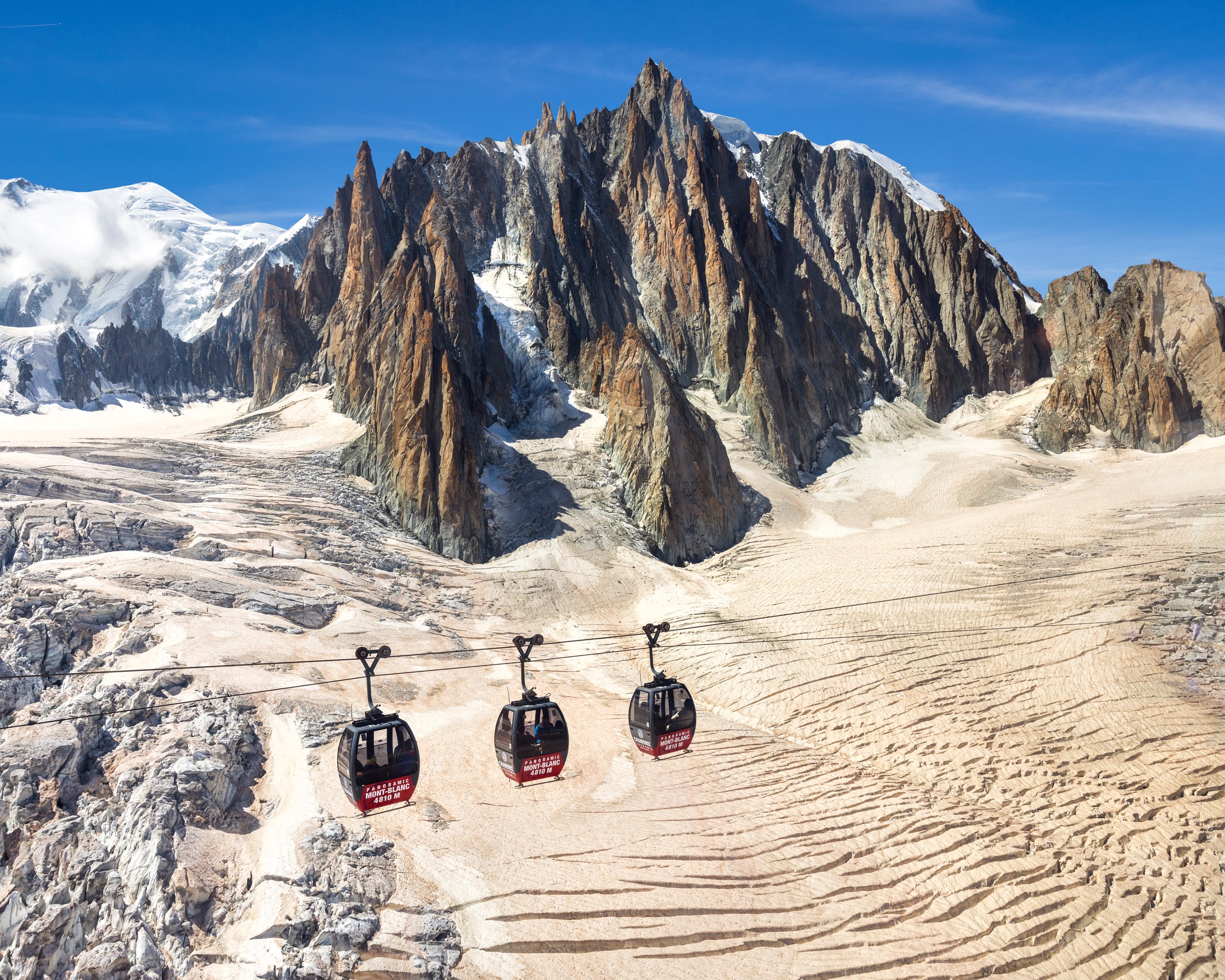
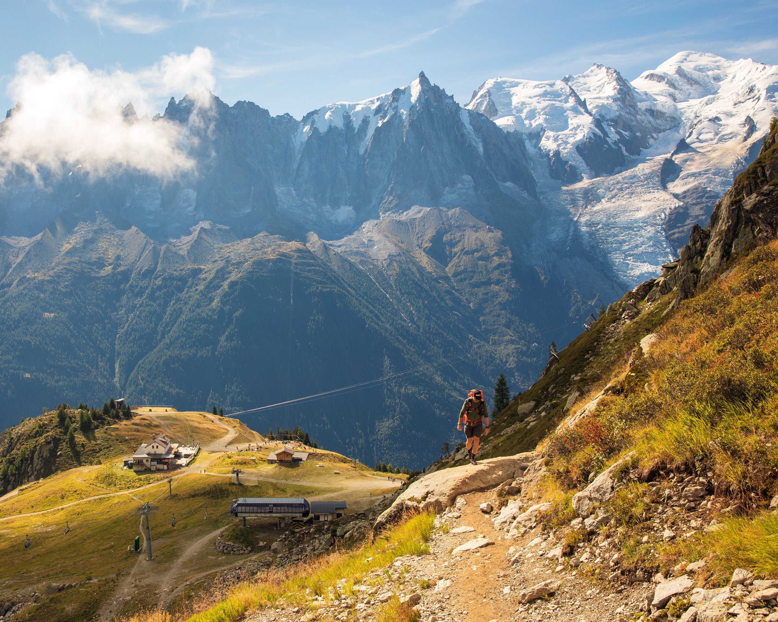
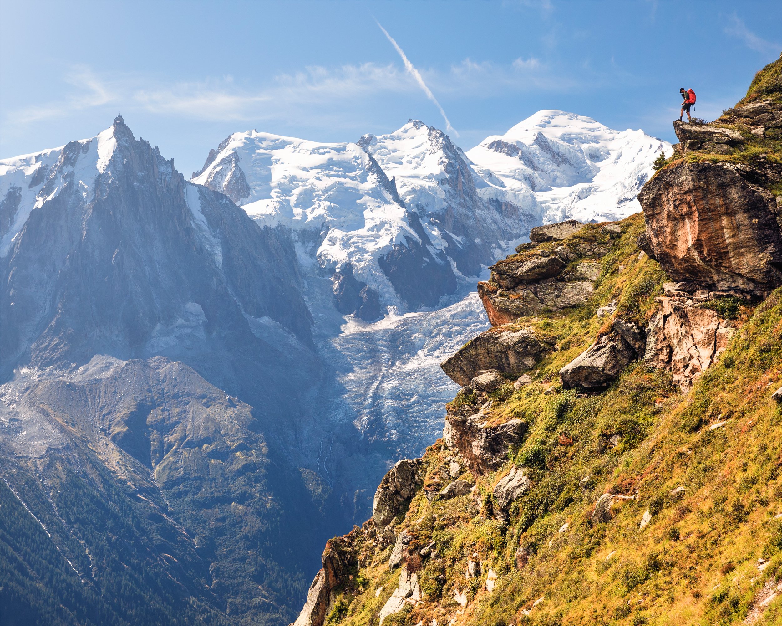
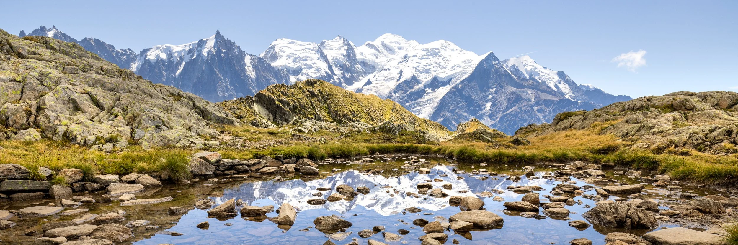
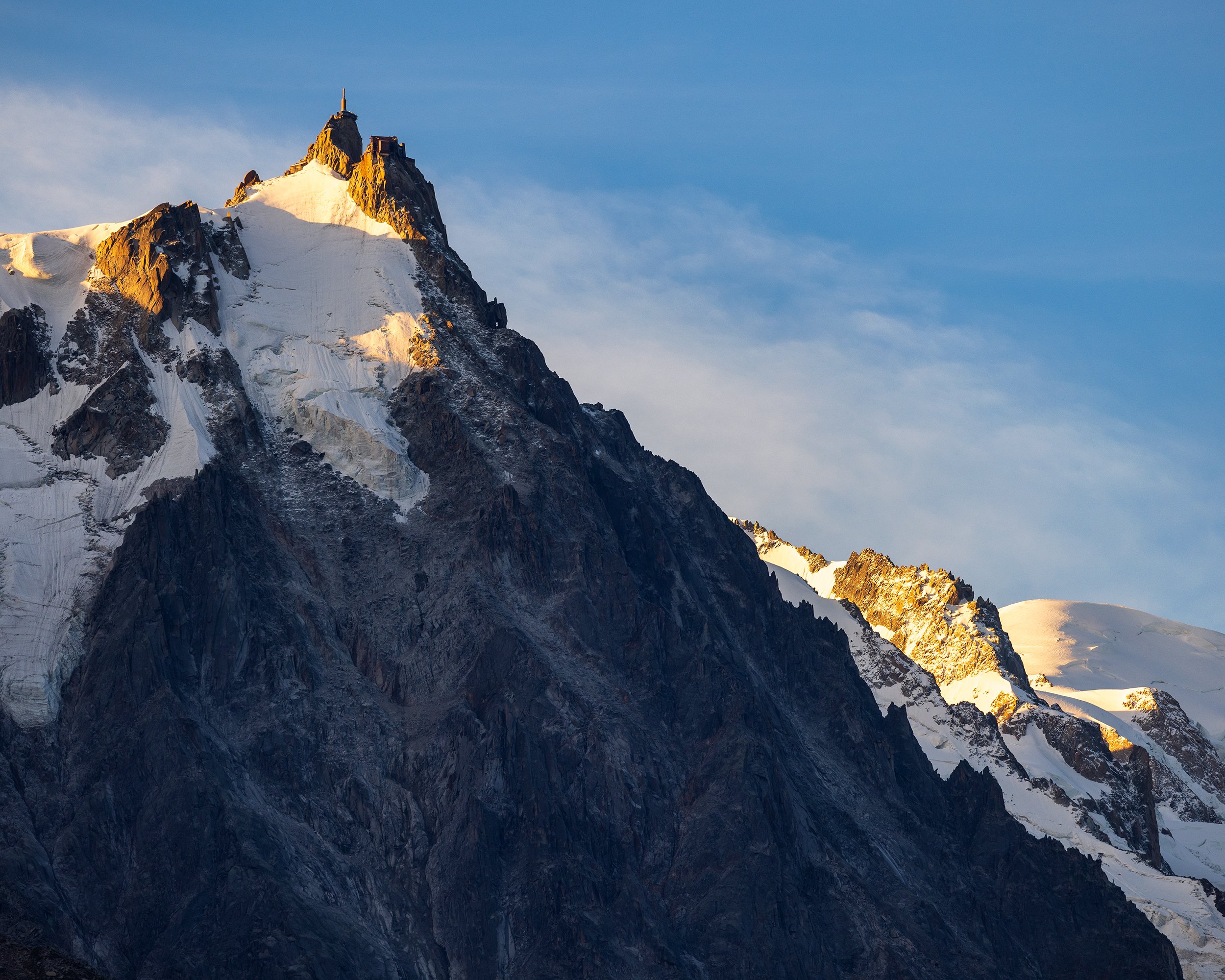
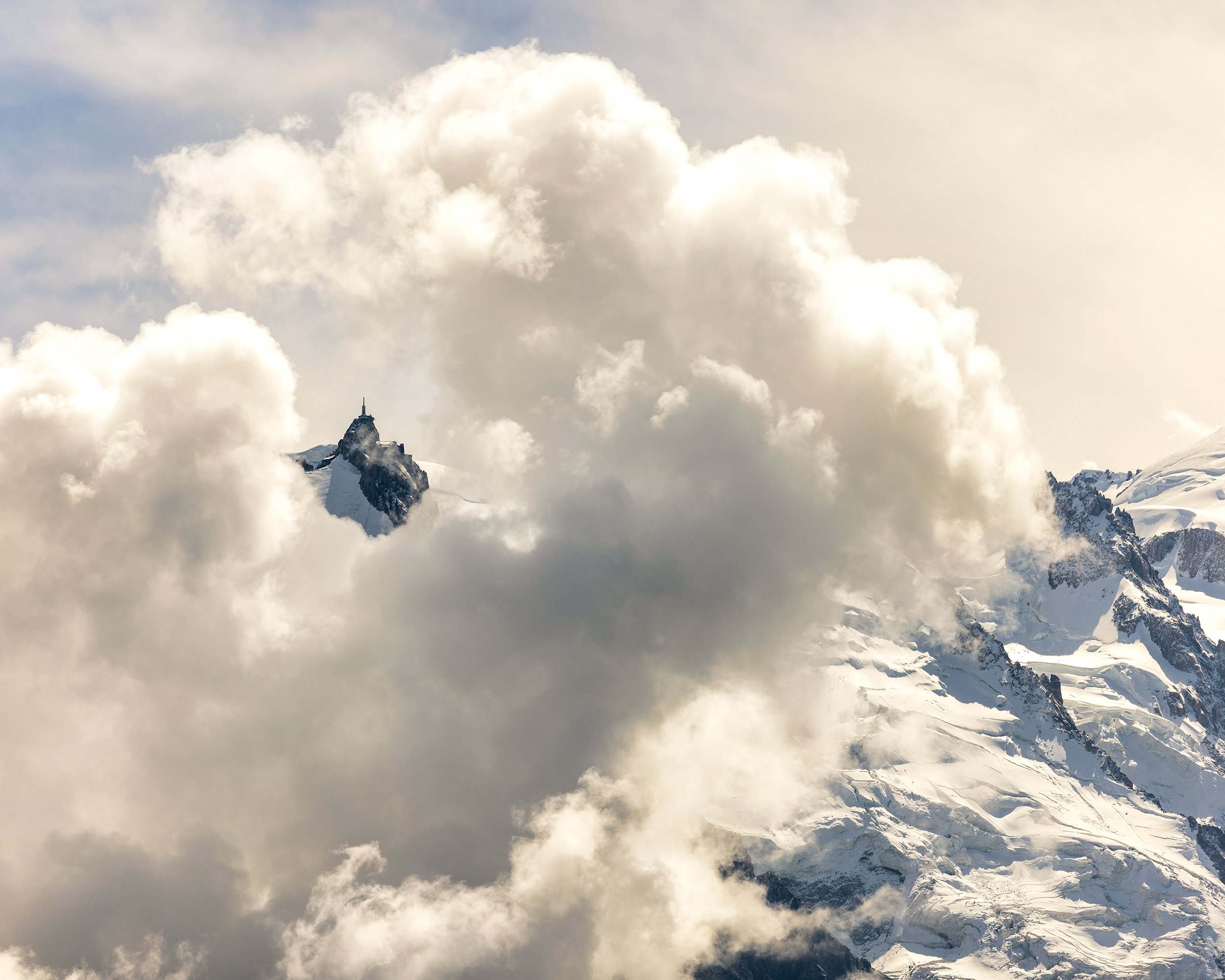
We immediately booked tickets for the Aiguille du Midi and hopped aboard the vertigo-inducing tram, for a 9000-foot ascent up to the top where we were exposed to overwhelming views of the Mont Blanc summit, as well as the surrounding peaks, and glaciers. From here, I quickly realized the gravity, power, and seriousness that these mountains have. From the top, we also rode the Skyway Monte Bianco cable car that connects the Aguille du Midi with Punta Helbronner, situated high above the mountain town of Courmeyeur, Italy. The slow journey in a small capsule-shaped gondola back and forth across the France/Italy border was well worth the time and money, as it offers spectacular views overlooking the Vallée Blanche, including the Géant and Miage Glaciers, as well as a multitude of prominent peaks such as Pointe Lachenal and Grand Capucin.


Day One - Chamonix to Les Houches via Brévent
Distance: 12.1km, Elevation Gain: 540m, Elevation Loss: 1560m
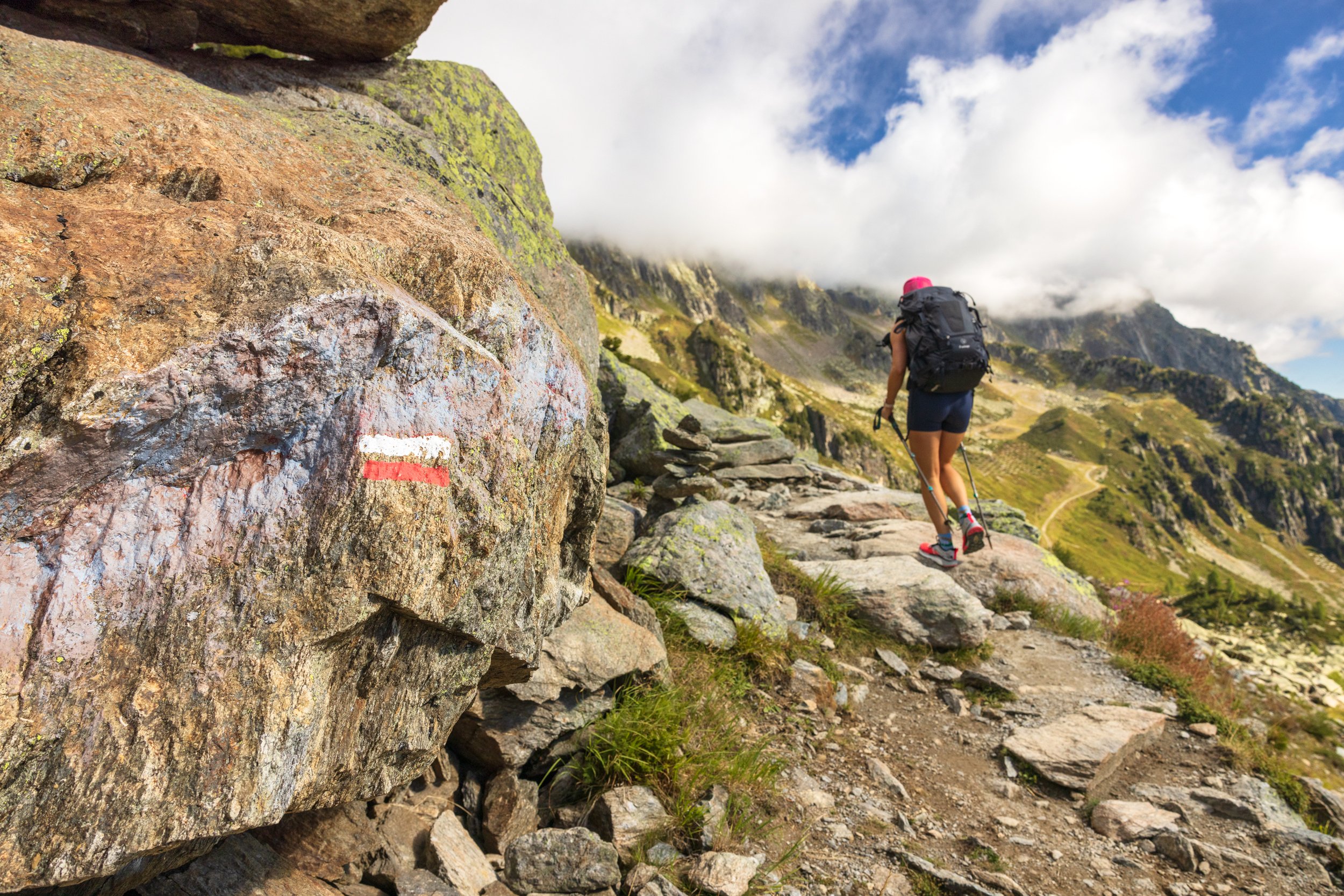
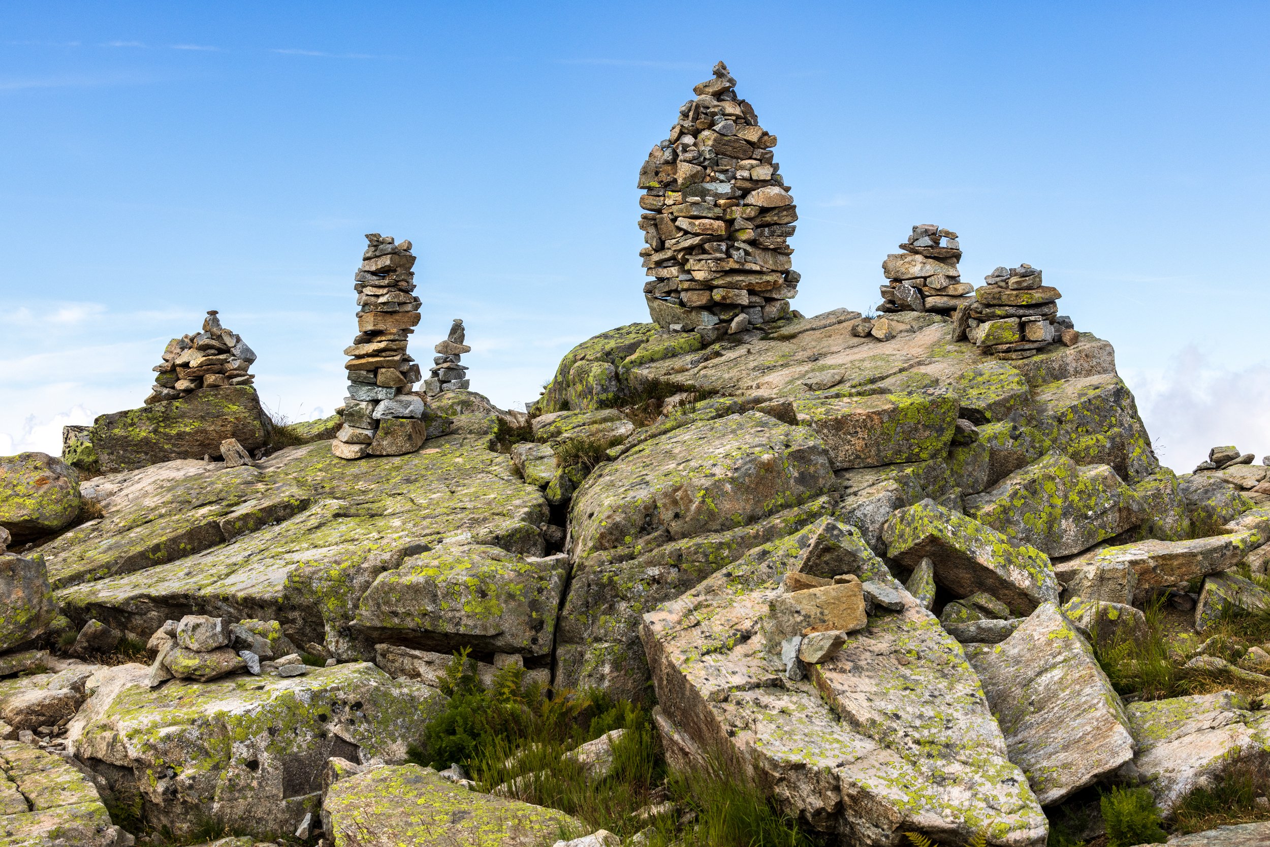
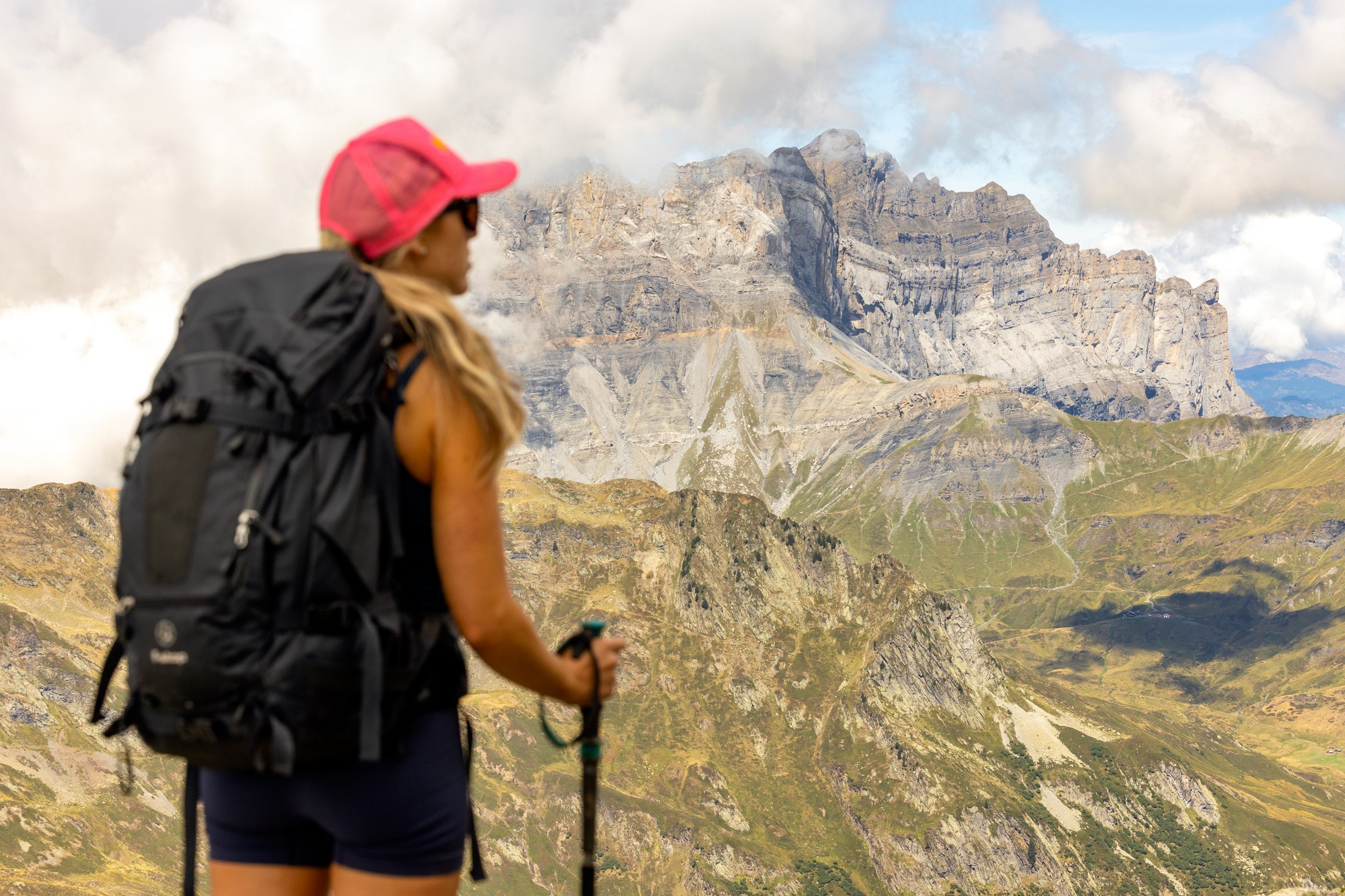
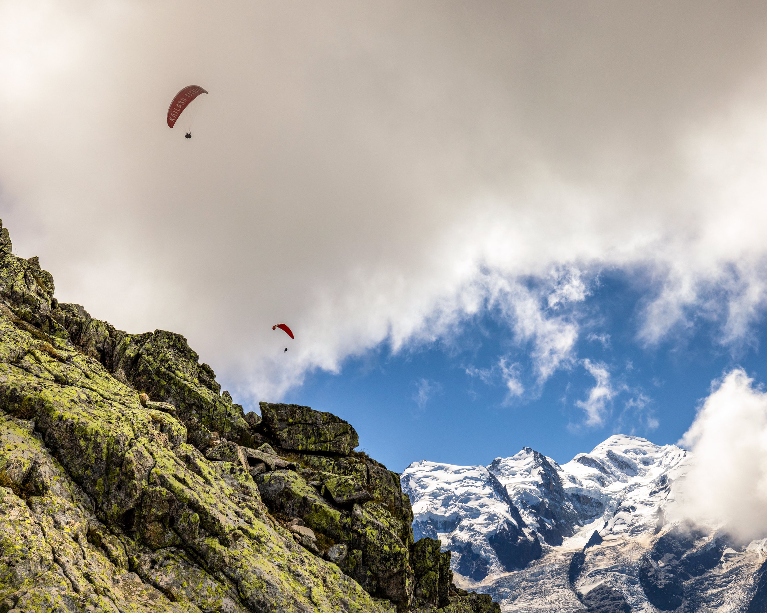
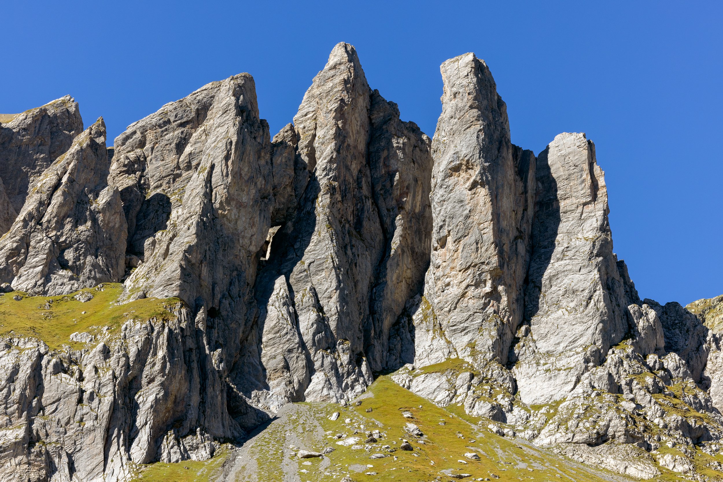
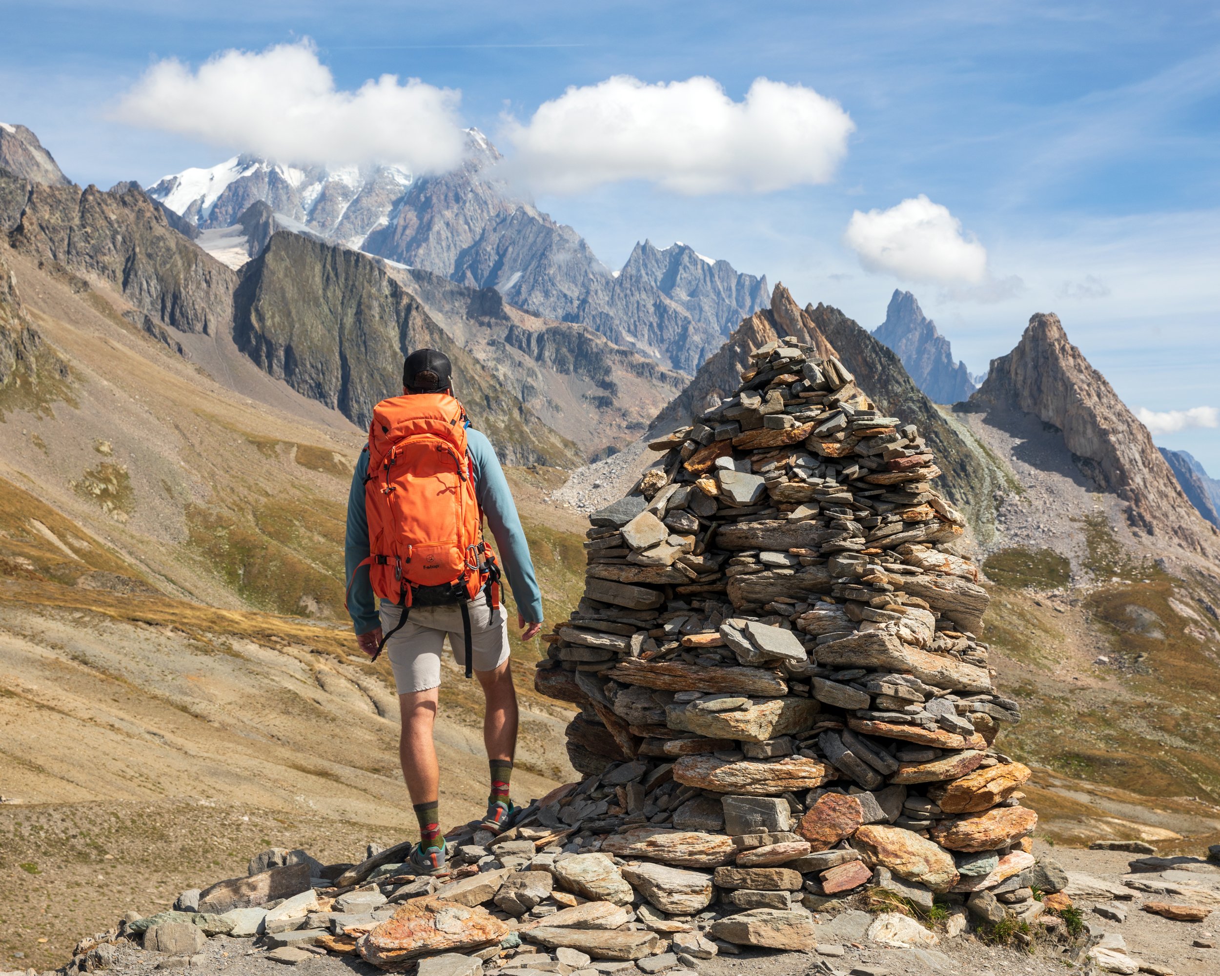
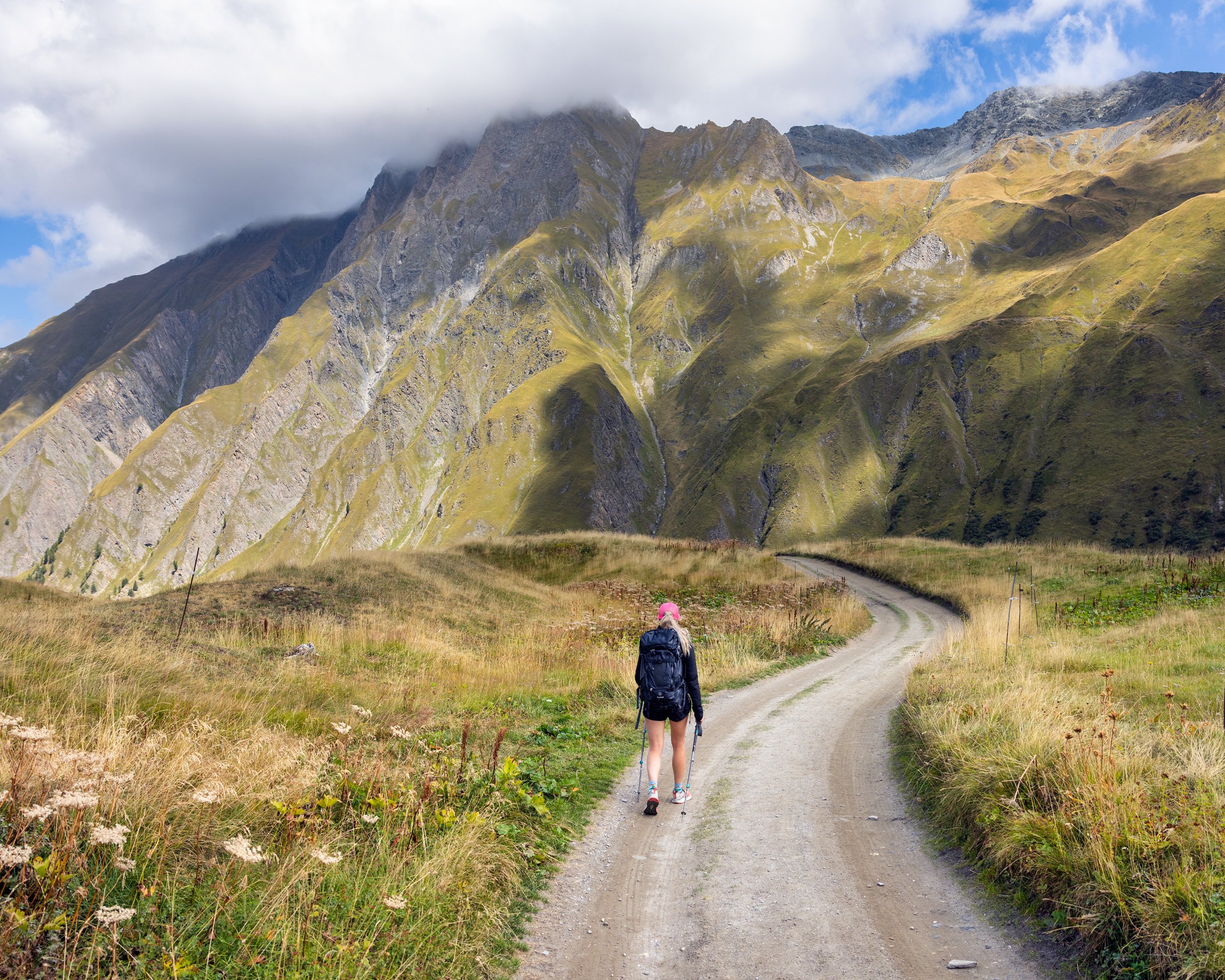
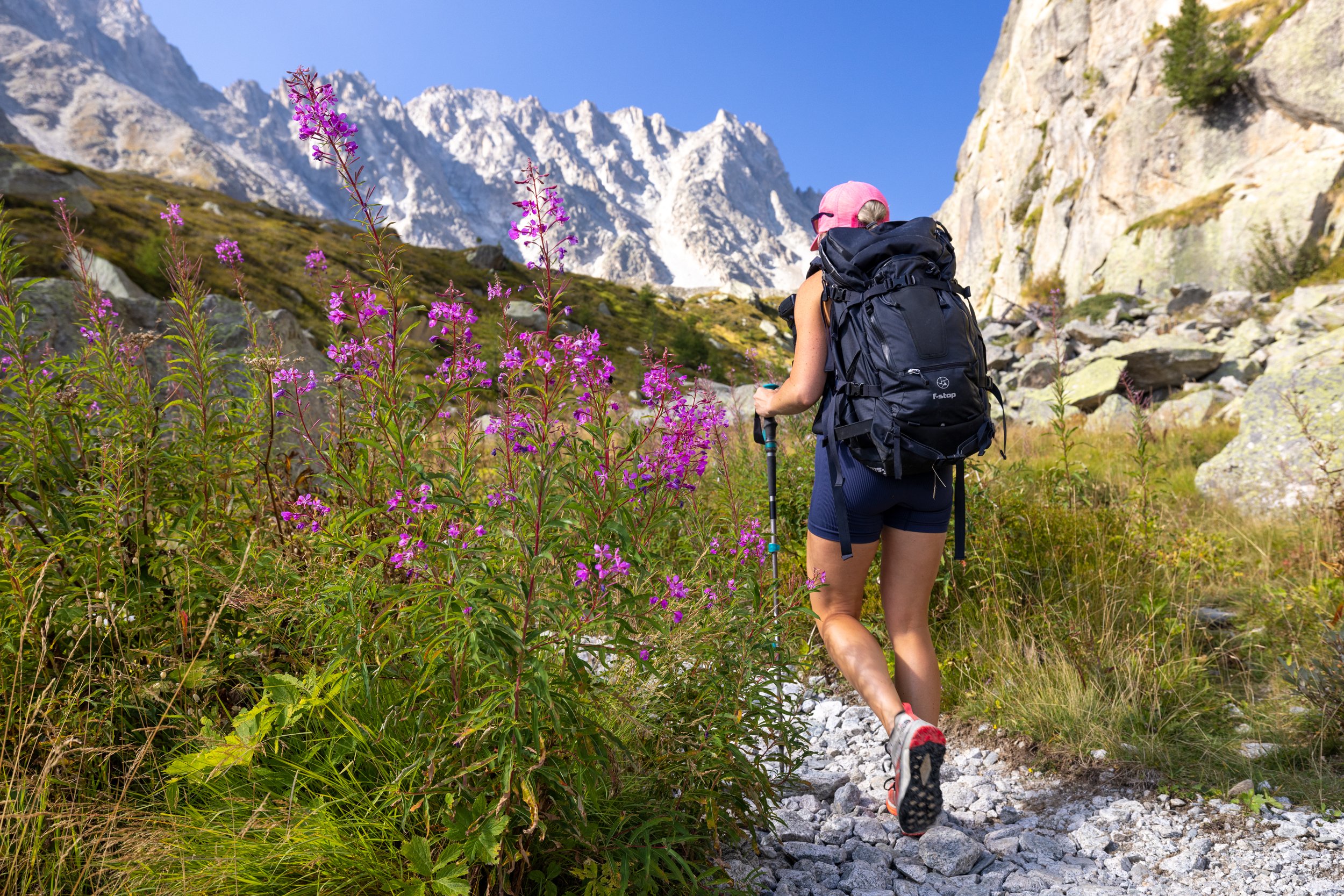
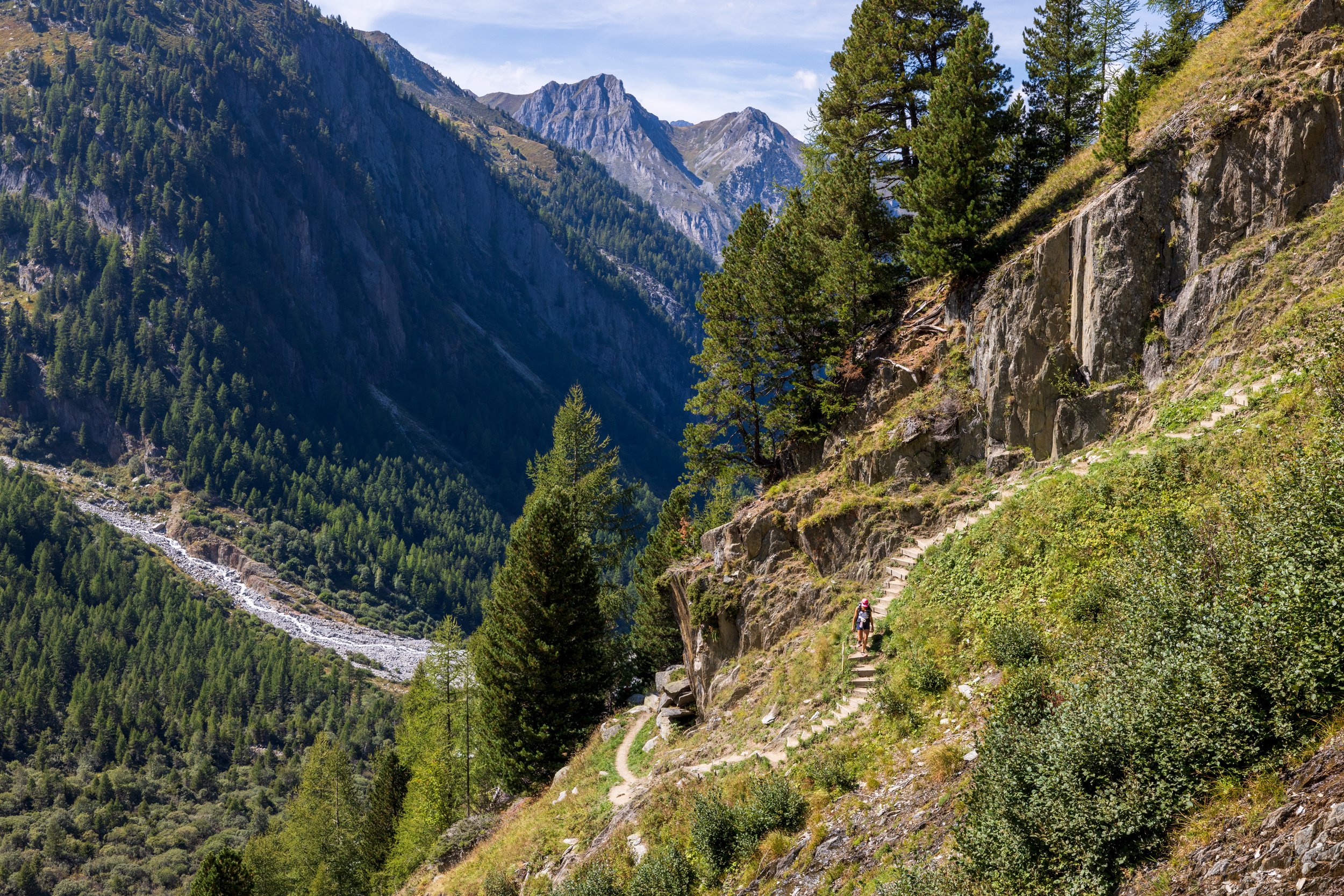
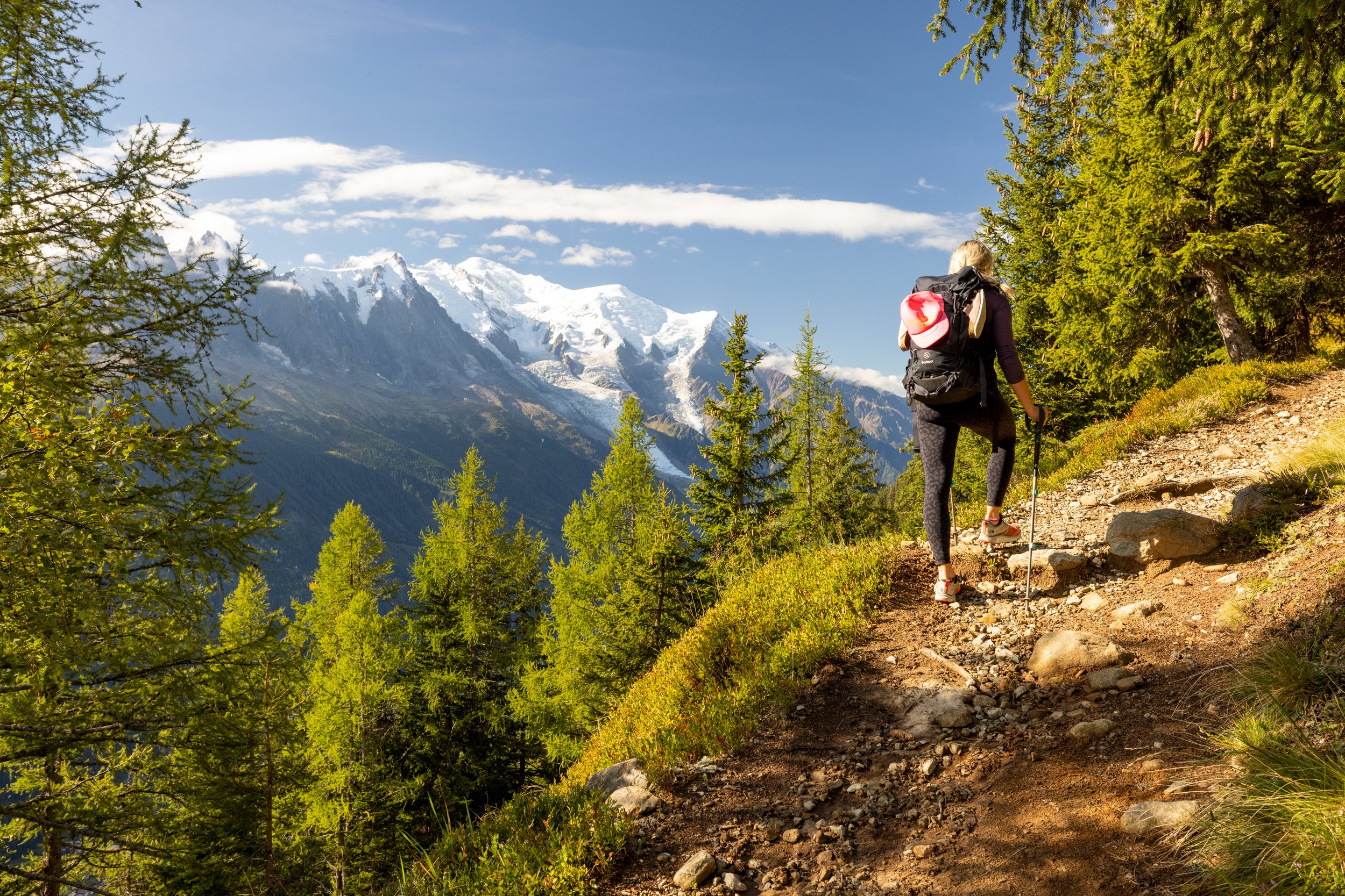
There was a bit of nervousness and excitement in the morning as we were gearing up to start our hike, and rightfully so as the distance to the finish line seemed incredibly far away. As recommended by our guiding company, we opted to take the gondola from town up to the top of Planpraz to start our hike. Once at the top, we began to follow the path towards the mountain pass of Brévent (Col du Brévent), across a very rocky path along the north side of the Aiguilles Rouges range of the French Prealps. The path continued south on Brévent pass, through pockets of crumbled granite where a mixture of rock cairns, sign posts, and painted TMB indicators helping guide us along the way. Off in the distance, we could frequently hear thunderous echoes of falling rock and ice reverberating throughout the Chamonix valley. Once we reached the summit of Brévent, we were treated to awe inspiring views of the sprawling Mont Blanc range, situated eye-level to us directly across the valley. The weather was perfect and the clear blue skies seemed to act like a lens magnifying the size of the surrounding mountains. In the distance, endless flocks of paragliders drifted overhead in the warm summer air.
We continued south from Brévent towards the Carlaveyron Plateau, zigzagging down scree slopes before following the southern edge of the plateau eventually leading us to the Bellachat hut, where we stopped for a plate of charcuterie and a beer. It was at this moment, sitting high above the Chamoix valley that all of my nervousness about the trip seemed to evaporate. Looking across the table at the giant smile on Hanna’s face, I couldn’t help but feel an intense wave of happiness come over me as well.
After a short break, we continued southwest down the path towards Les Houches, switchbacking through multiple hairpins and traversing across the Lapaz stream, before descending steeply down through the forest above the Merlet wildlife park. Once we reached the Les Houches railway station, we crossed a bridge over the highway and arrived, tired and hungry, at the Chalet Hotel du Bois in Les Houches. Overall the hotel was very clean, and the dinner and breakfast included in our half bord accommodations were very good as well.
Day 2 - Les Houches to Les Contamines Montjoie
Distance: 11.7km, Elevation Gain: 680m, Elevation Loss: 1310m
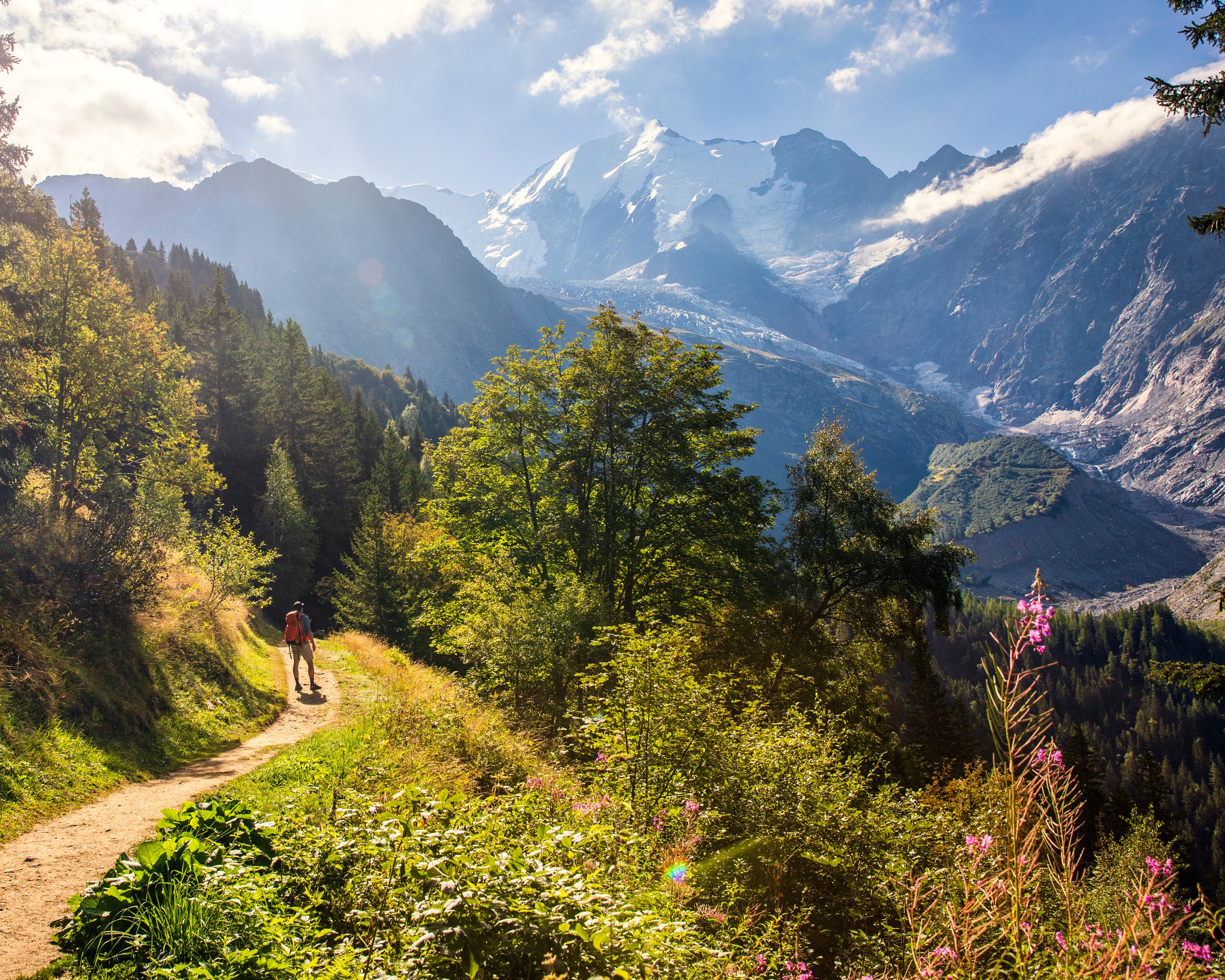
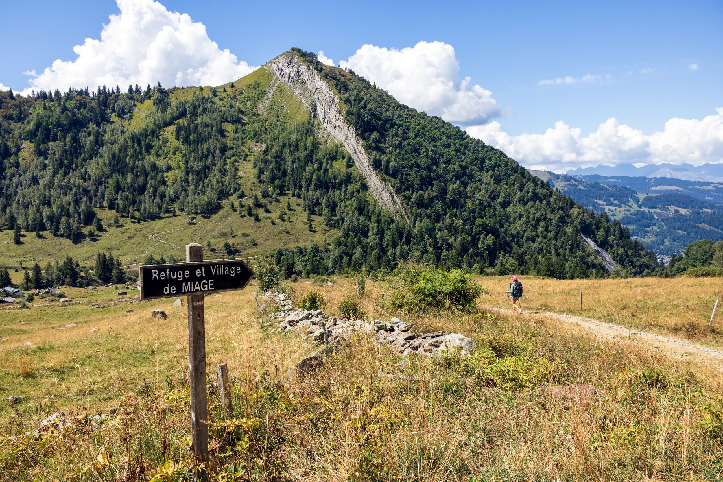
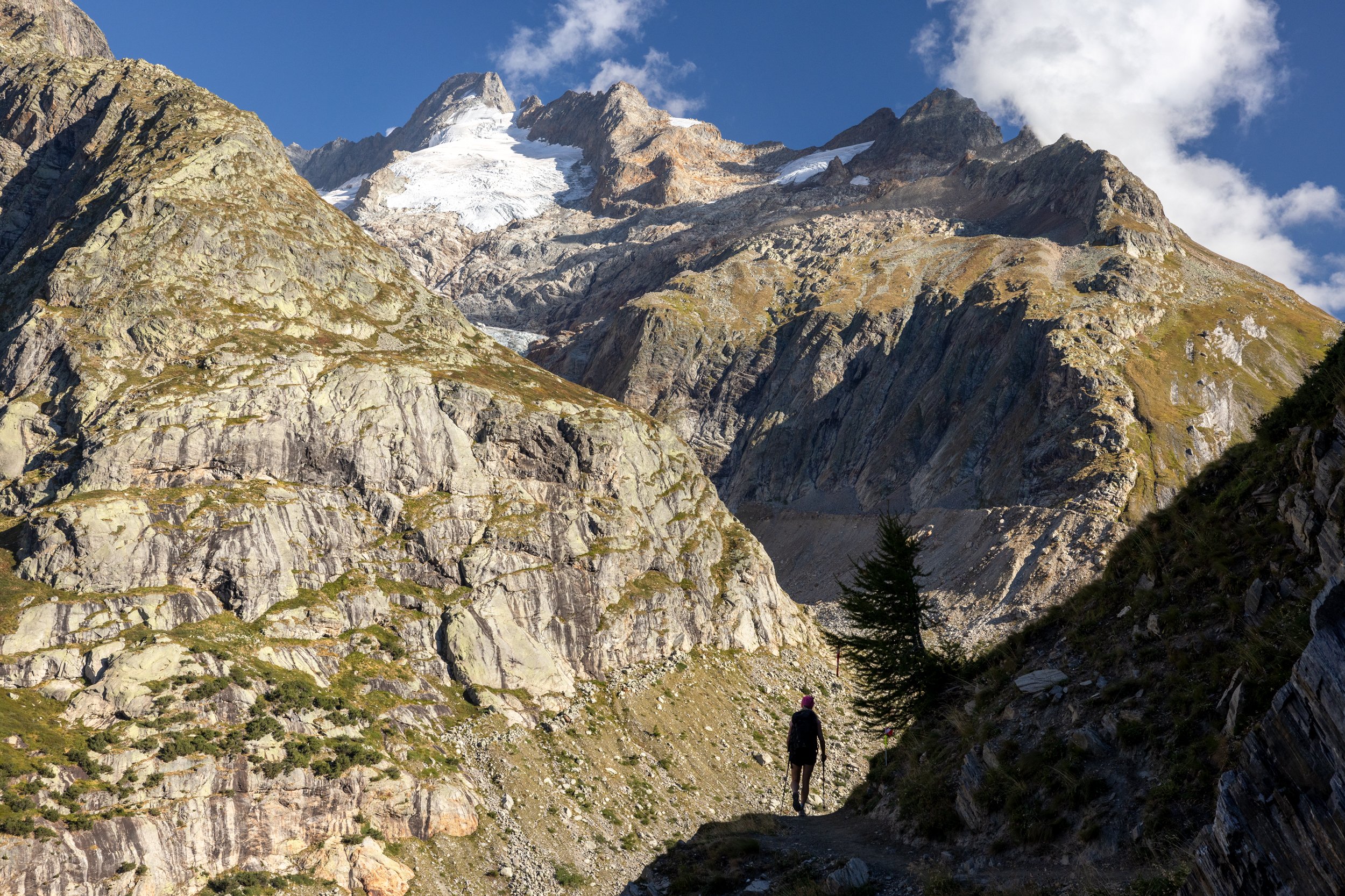
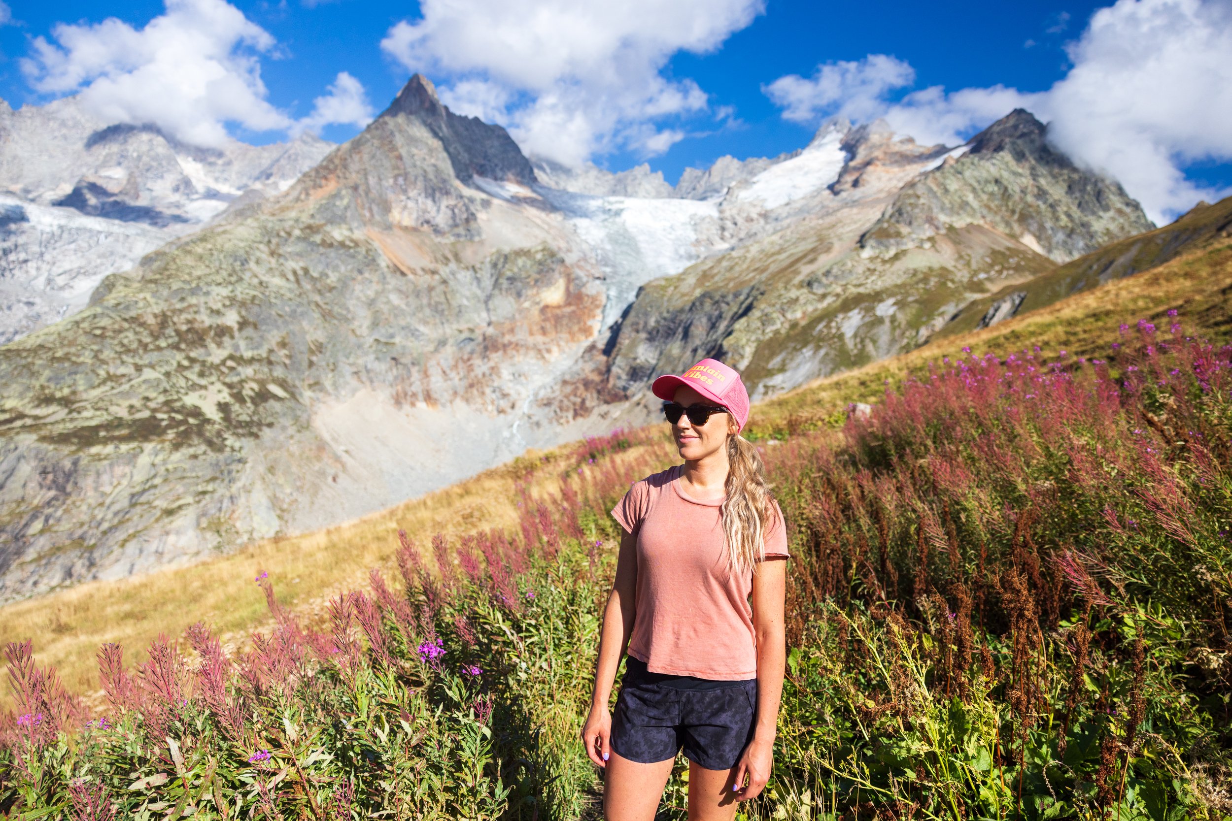
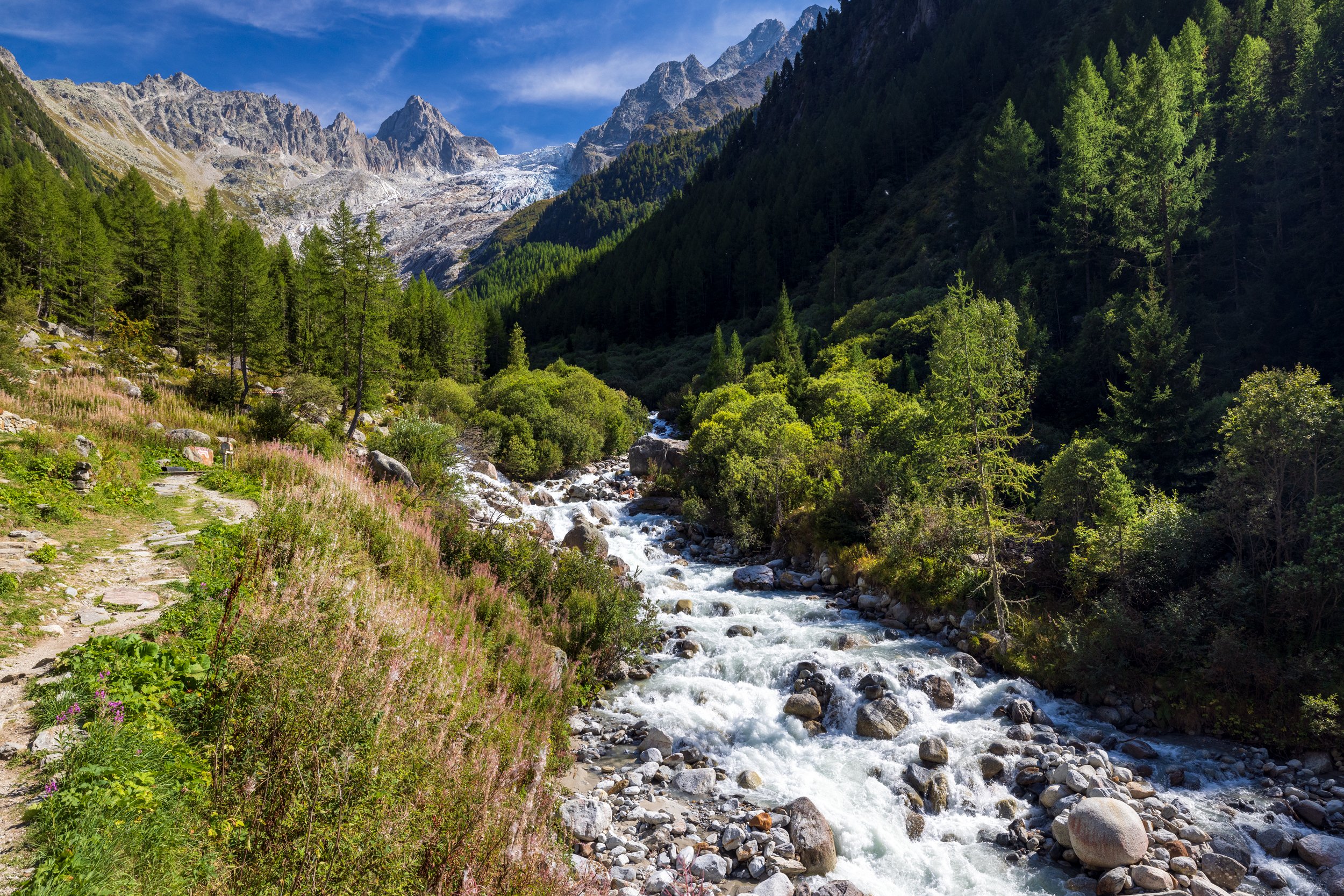
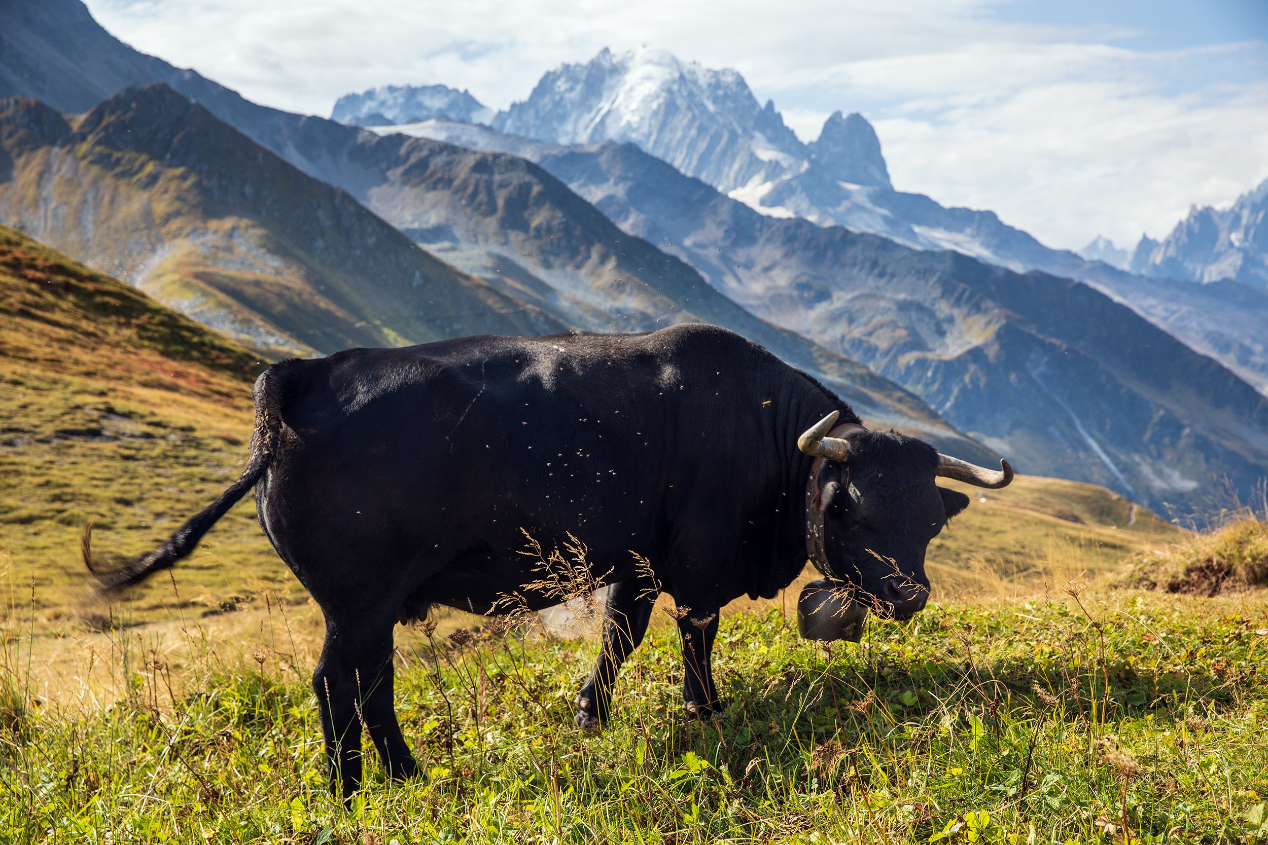
The day started with a casual stroll through the sleepy town of Les Houches to the Bellevue Tramway, where we caught a cable car ascent up to the Bellevue plateau. Once on top, the path traversed through a beautiful forest above the Bionnassay Valley. We passed under the tongue of the spectacular Bionnassay (Glacier de Bionnassay), before crossing a Nepali-style suspension bridge that was hanging over the Bionnassay Stream (Torrent de Bionnassay). Next, we ascended the gentle slopes and alpine pastures towards Tricot Pass (Col de Tricot), which was a perfect place to stop for a snack and take in the panorama views of the surrounding Contamines-Montjoie valley. On the back side of the Col de Tricot, was a steep descent that led us to the quaint village of Miage, before ascending again up a short and steep section of switchbacks leading to another beautiful alpine meadow. Herds of dairy cows were scattered along the hillside, adorned with large cowbells that produced a significant chorus of sound as they grazed in the warm afternoon sunshine.
The final descent led us into the town of Les Contamines-Montjoie and to the small guesthouse of Gîte Les Mélèzes where we were welcomed by the extremely friendly hosts, Eric and Juliet. Once situated in our small room, we were invited to have appetizers and wine with the other guests that were staying here. A dinner of homemade sausage and potatoes was served shortly after, and we finished with some homemade Genepi (a traditional herbal liqueur) as a night cap.

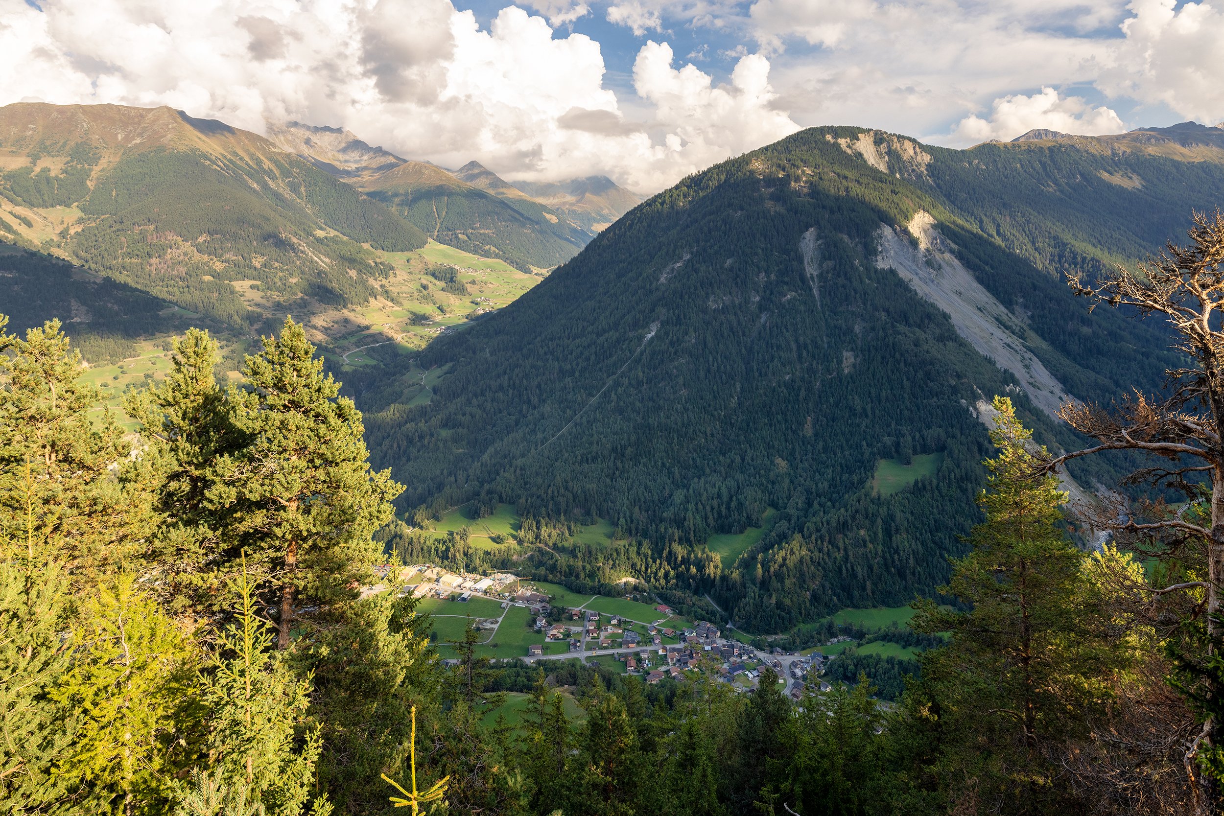
Early morning light over the summit of Aguille du Midi, as seen from Les Houches.


Day 3 - Les Contamines to Les Chapieux
Distance: 15km, Elevation Gain: 1295m, Elevation Loss: 950m
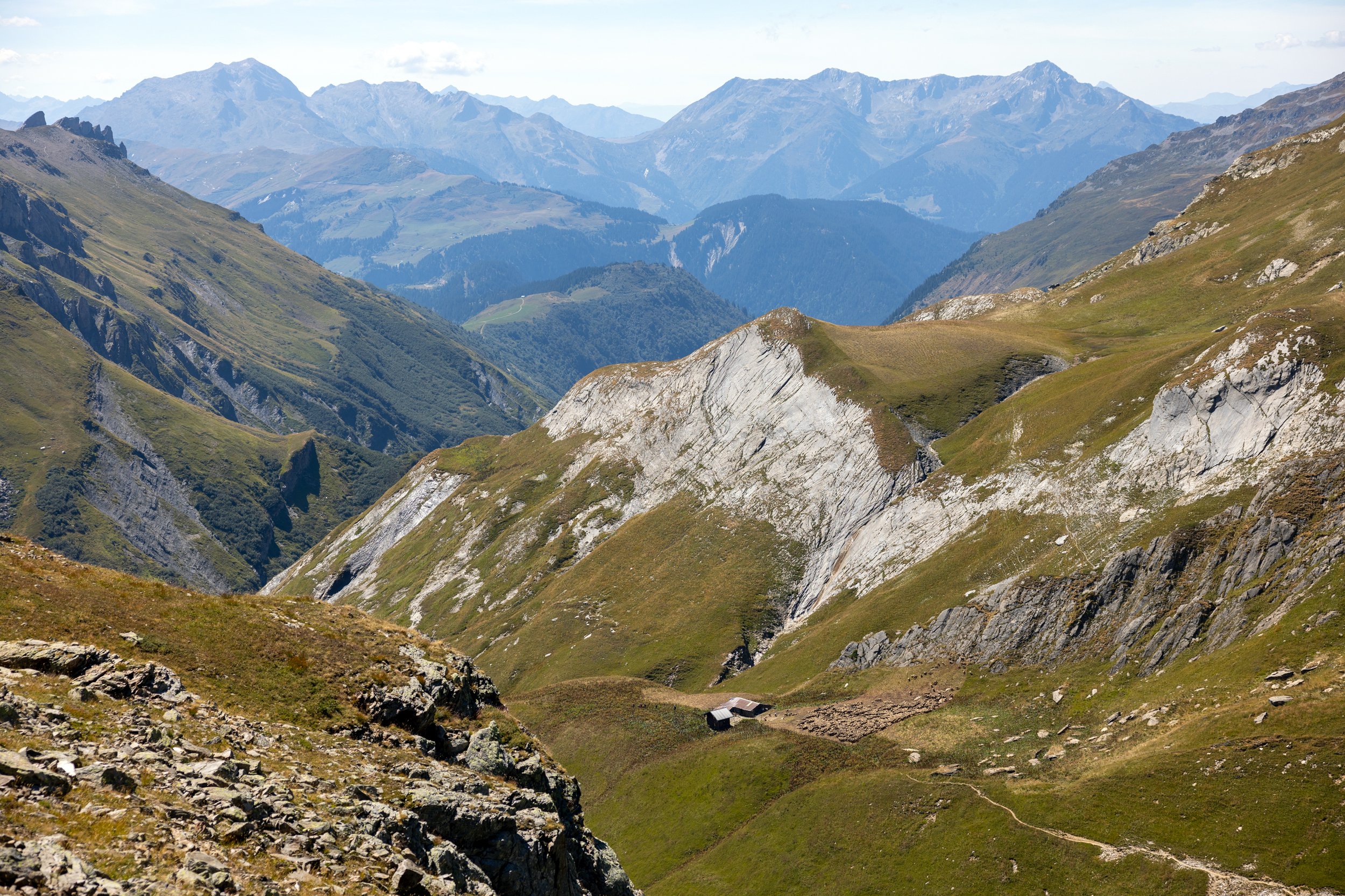
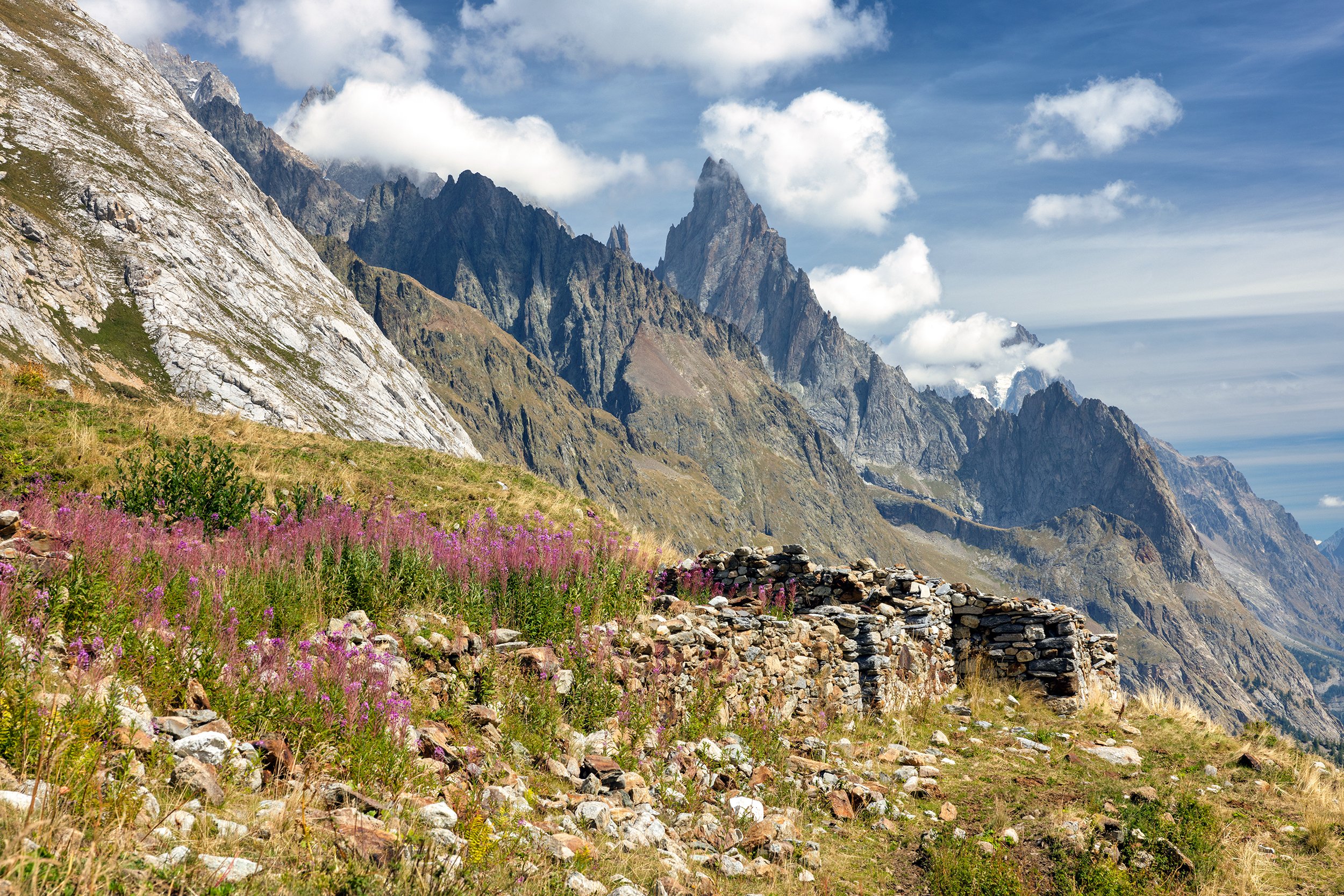
After a good nights sleep and a quick breakfast, we said farewell to our hosts and began our walk, leading us through town along the right side of the Bon Nant stream past the the Notre-Dame de la Gorge, a 13th century parish church built for residents of the valley. From here, we began our ascent up a steep Roman road, crossing an old Roman bridge along the way. We continued on through the forest before emerging at a wide valley leading to steeper slopes towards the Balme hut, where we stopped for a quick break and to refill our water bottles. Next, there was a brief but steep section of trail that led us to a high alpine plateau, across the the marshy plateau of Plan des Dames, and eventually reaching the mountain pass of Bonhomme (Col du Bonhomme) situated between the Mont Blanc and Beaufortain massifs. We enjoyed a blue-bird day, but with minimal shade along the trail we felt progressively hotter as the sun moved across the sky.
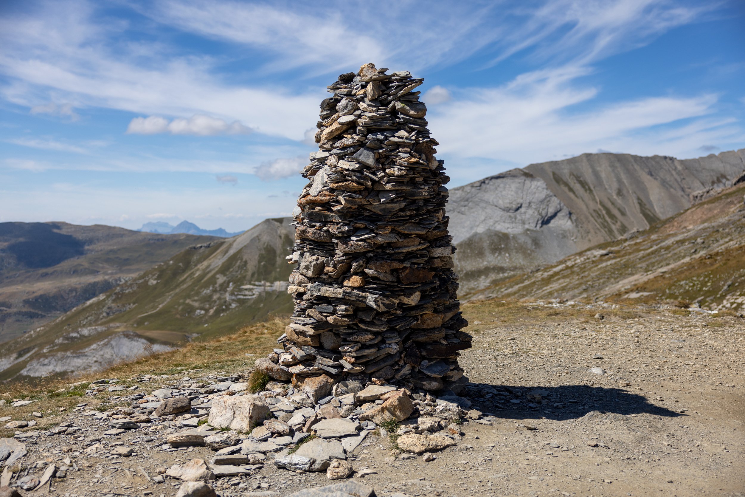
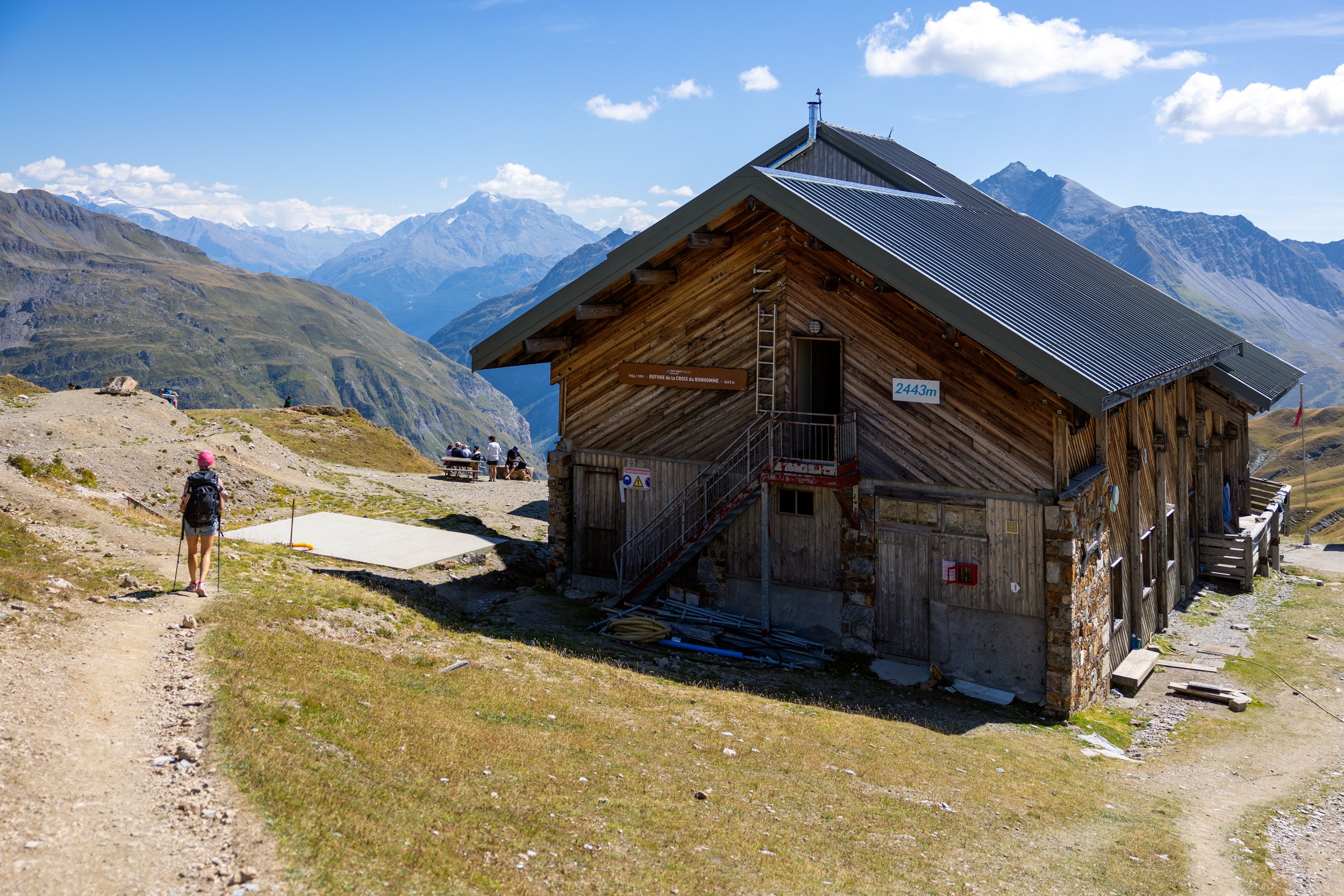
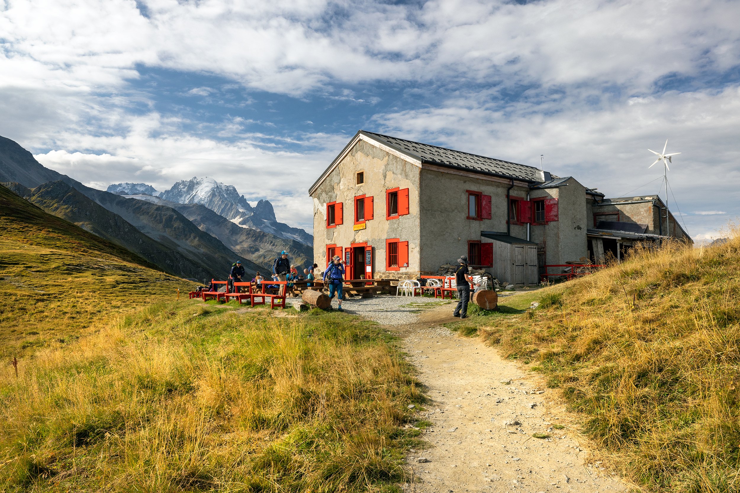
After a snack break, we continued across the west-facing slopes to the south of the Col du Bonhomme, over a rocky outcropping followed by an up-and-down traverse leading to a small gorge. We scrambled across the gorge and up to the ridge where a large rock cairn marked the point of the Croix du Bonhomme Pass. From this point, we were treated to a beautiful panoramic view of Mount Pourri off in the distance, and we made sure to stop at the Croix du Bonhomme hut to relax and enjoy a cold beer in the warm mountain air.
Next, we headed east-southeast along a smooth trail, traversing across several small ravines and areas of loose rock before descending through the meadows past a collection of farm buildings at La Raja, moving through open fields that had Sound of Music vibes. It was a perfect day, in a perfect place. All in all, the descent to Les Chapieux was long but not very challenging. Once there, we checked into our small room at the hostel of Auberge-Refuge de la Nova, one of the only places to stay in Les Chapieux. The room consisted of two, uncomfortable twin sized bunk beds, but at least the room had it’s own private shower. After freshening up, we headed downstairs to the patio, ordered Aperol Spritz, and played cribbage in the late afternoon sunshine. Our simple dinner consisted of stewed meat and potatoes and red wine. Once finished, we headed off to bed early, exhausted from the day’s long hike.
Day 4 - Les Chapieux to Courmayeur via Col de la Seigne
Distance: 15.1km, Elevation Gain: 755m, Elevation Loss: 880m
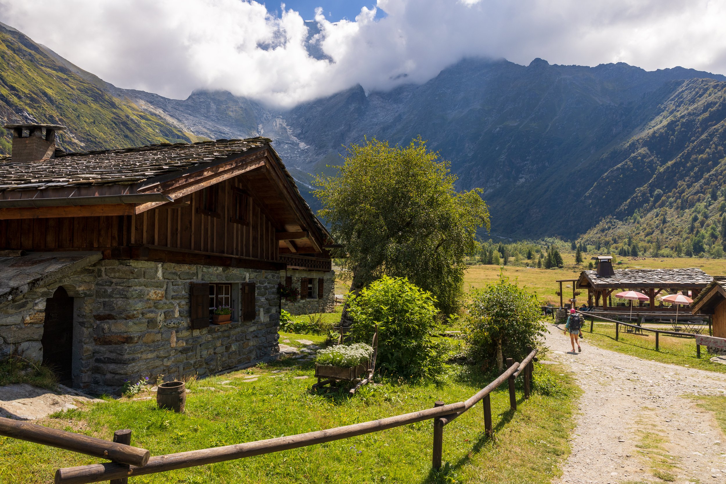
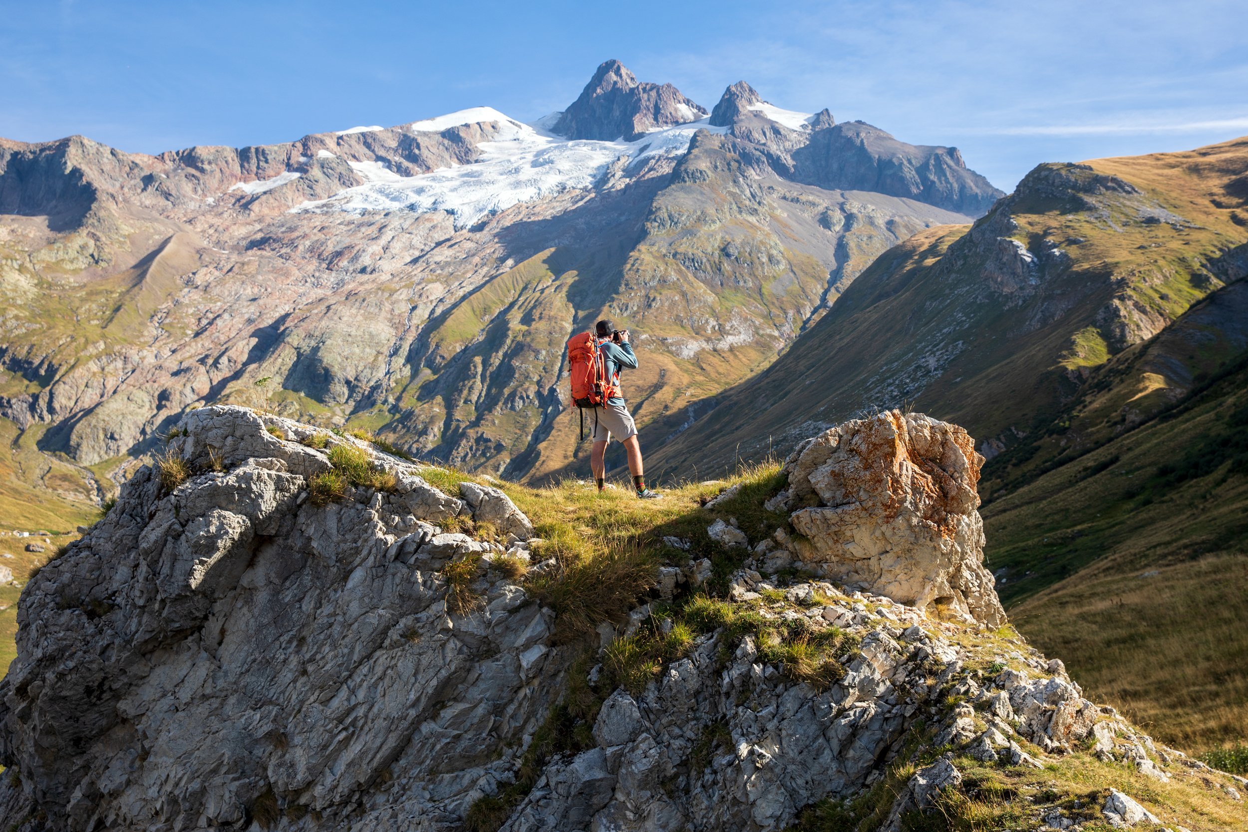
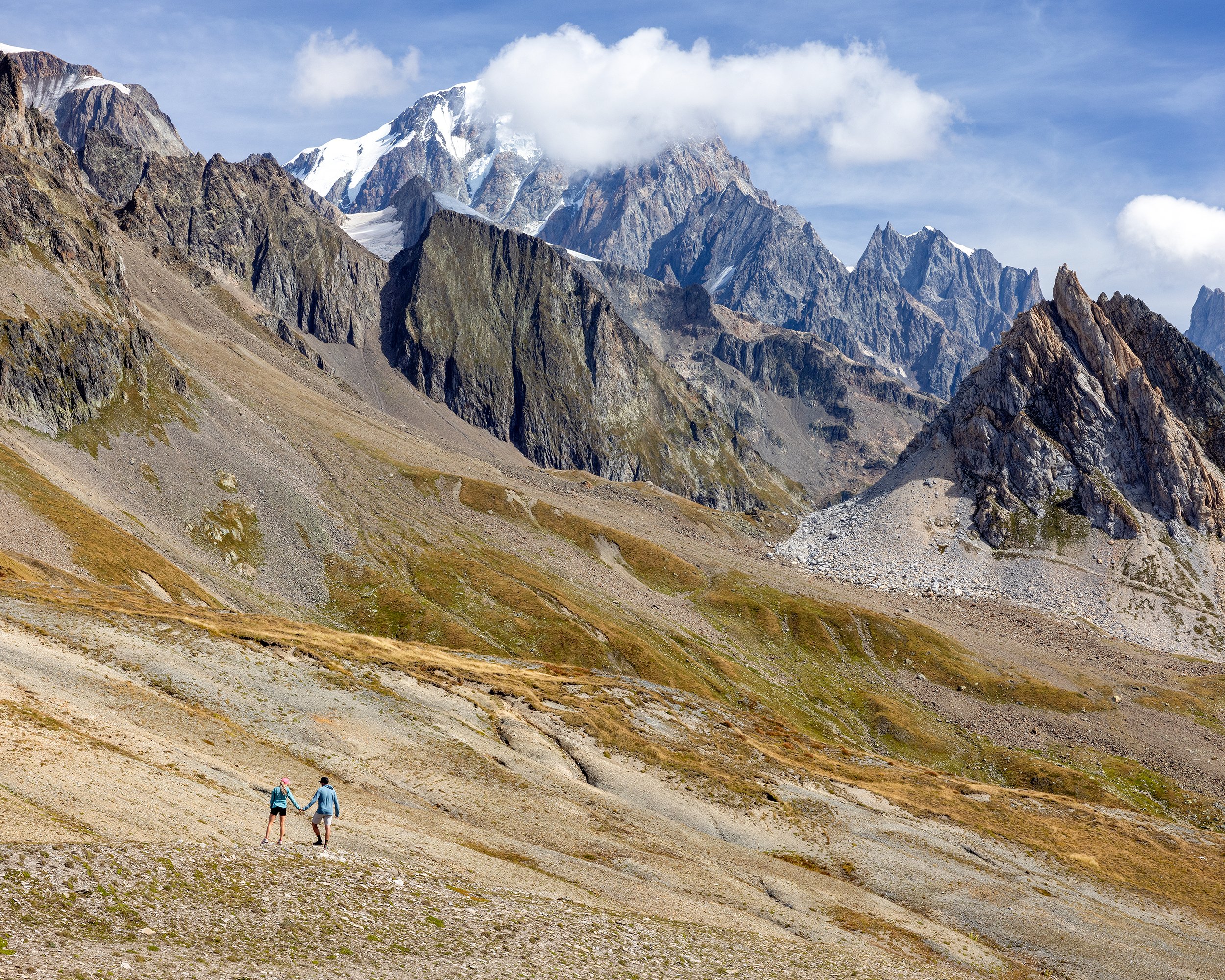
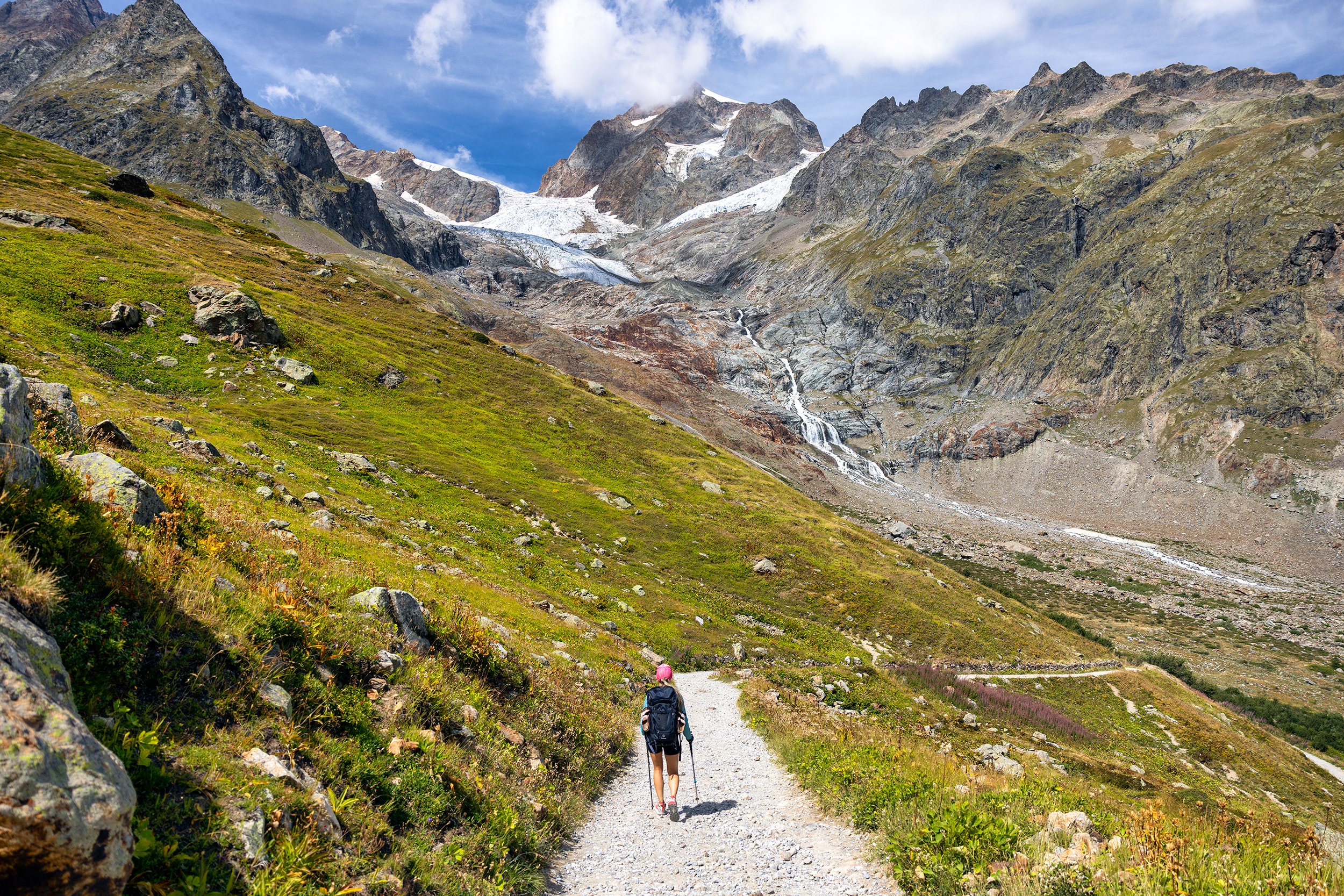
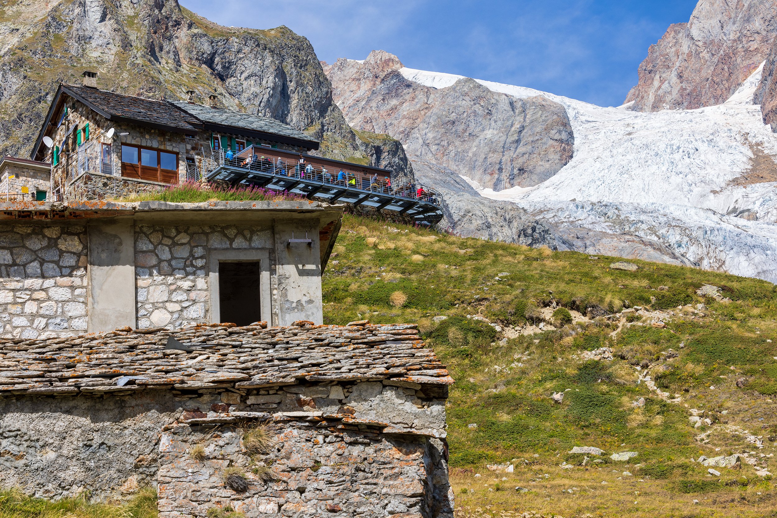
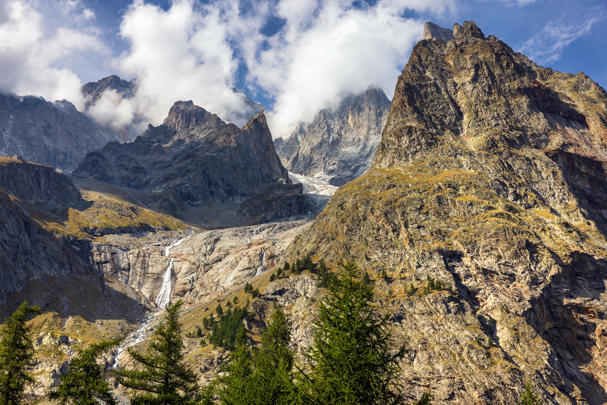
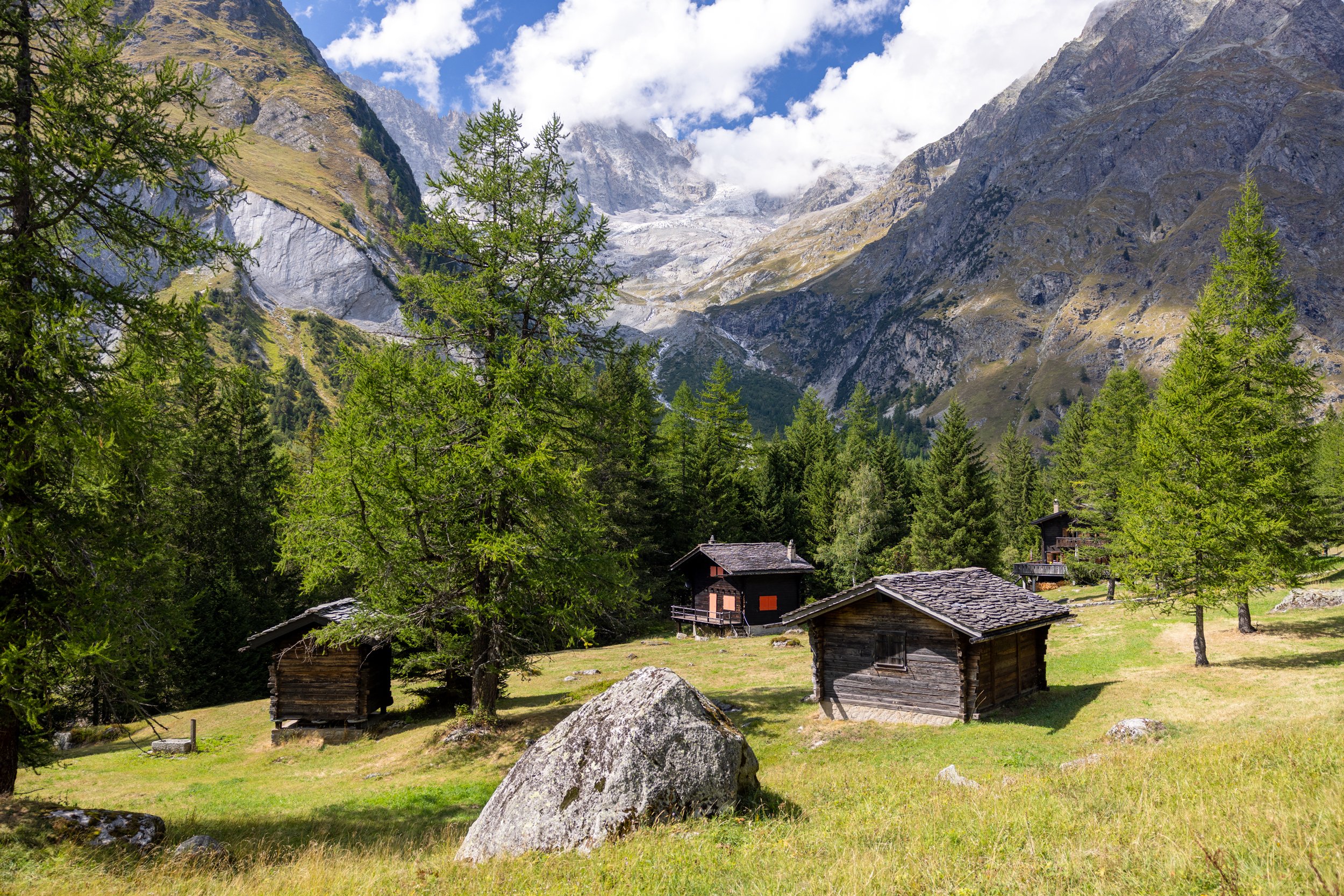
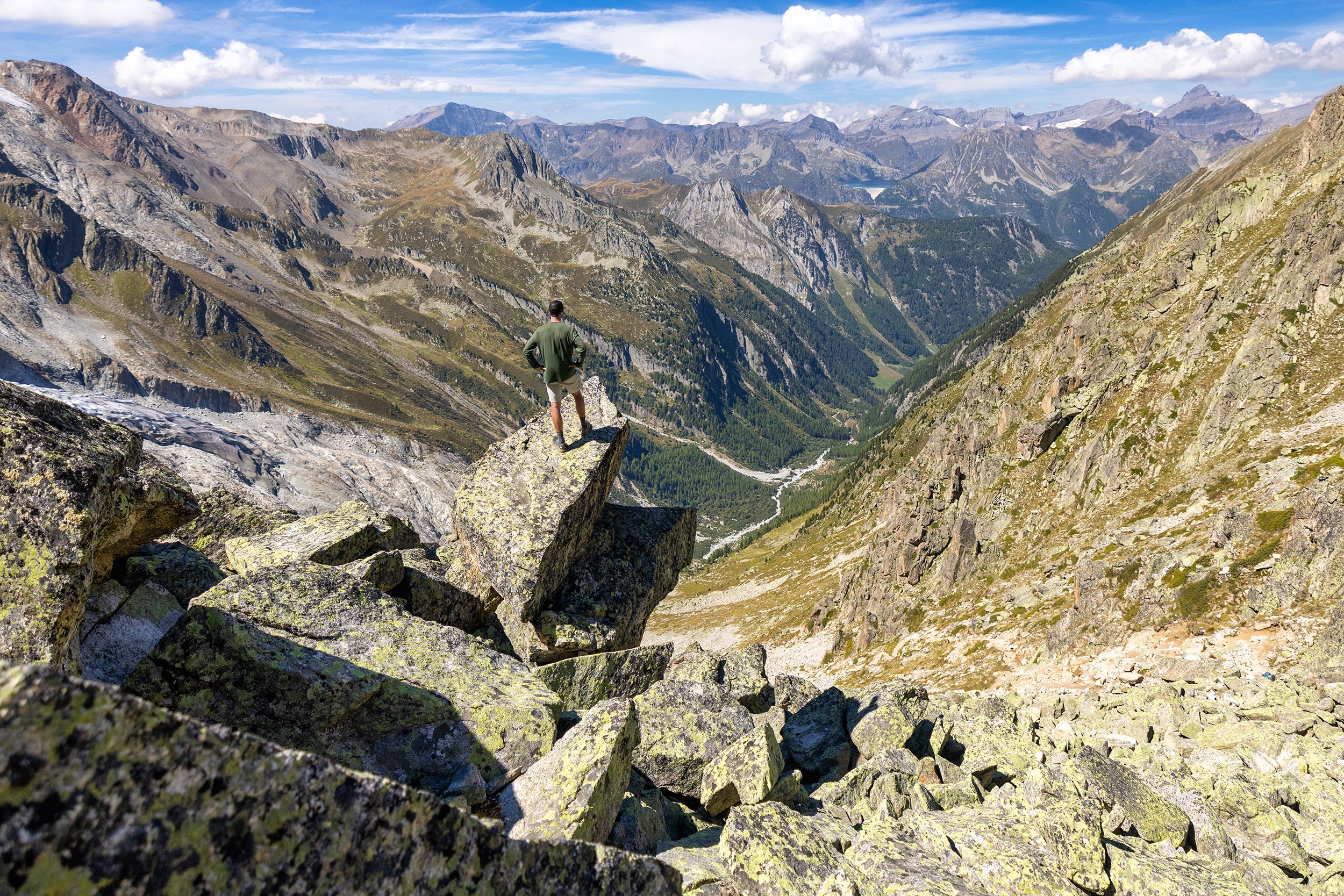
After a sleepless night, we ate breakfast and drank coffee, and caught a quick shuttle ride from Les Chapieux to the trailhead at La Ville des Glaciers, ultimately saving us from a couple miles of walking on the pavement. From there, the trail followed the Grand Praz stream, through open meadows and winding paths before heading up a vast, gently sloping plateau towards a large rock cairn and viewpoint indicator at the Seigne Pass (Col de la Seigne) located at the France/Italy border. From here, views of the Petite Mont Blanc, and Noire de Peuterey were laid out in front of us. We took our time at the border crossing, enjoying the warm weather. We began the descent from the pass, southeast down the gentle slopes to a rocky spur leading to La Casermetta hut. We continued to traverse across the mountainside, descending down the Val Veny, eventually making it to the rustic chalets at lower Alps of the Lée Blanche (Alpe Inférieure de la Lée Blanche) before heading up the track to the Rifugio Elisabetta Soldini Montanaro, nestled near the tongue of the beautiful Miage Glacier.
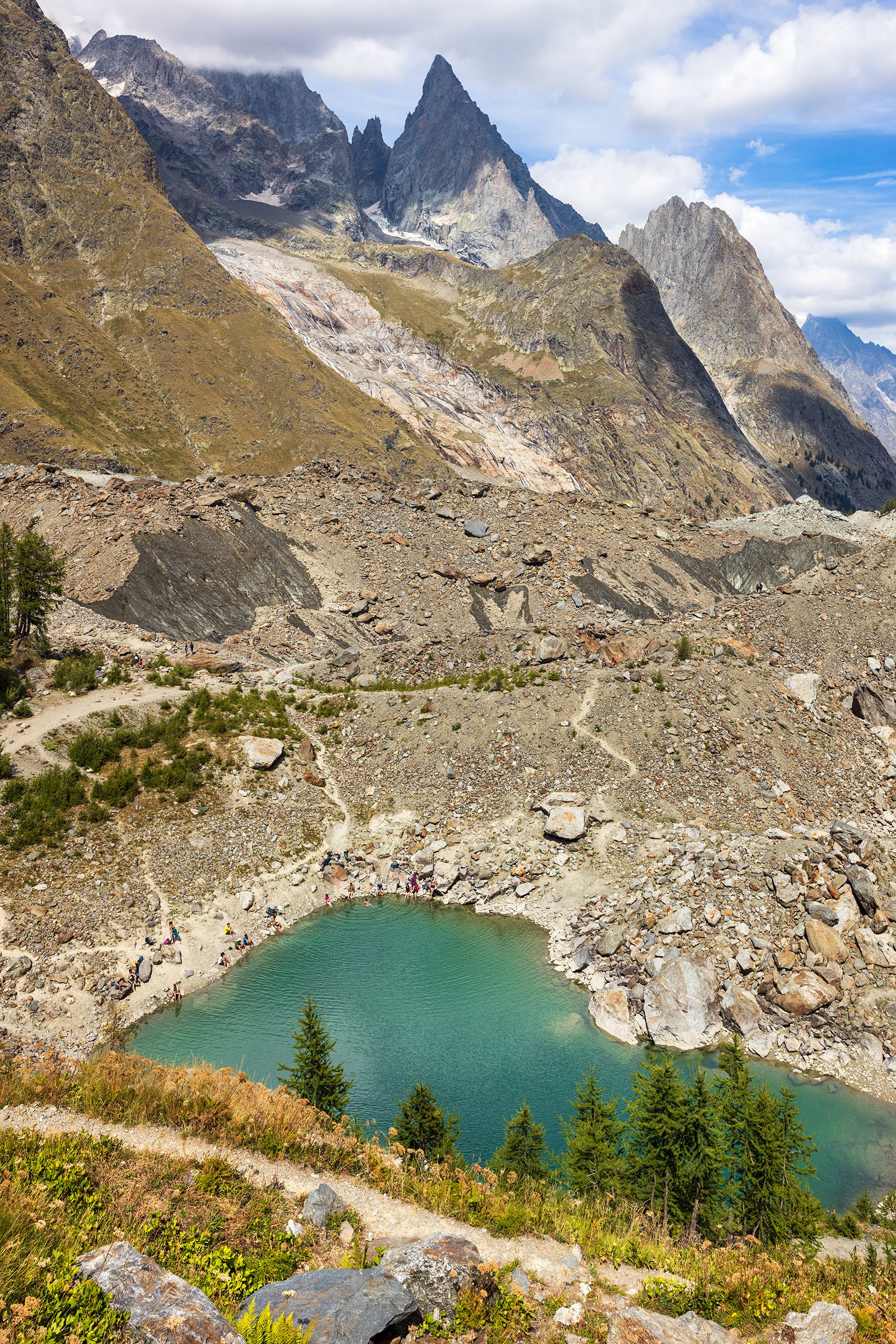
After a quick rest for lunch and a beer, we continued down the smooth gradual path to the valley floor walking on a causeway built by the Swiss Army across sprawling marshland. Once across, we opted to take a small side trail up to Combal Lake, where we both took a much needed swim in the cold glacial lake. After drying off, we continued descending down a long paved road, eventually reaching a bus stop where we grabbed a shuttle to the town center of Courmayeur and to our lodging at Hotel Croux.
We were both exhausted after this day, and the relentless sunshine left us drained of energy. We walked across the street to a nice little Italian restaurant called Ristorante La Terrazza, where the hostess seated us awkwardly facing the front door. After spending over a week in France, we quickly realized that neither of us could speak or read Italian and we easily spent a half hour flipping through the pages of the large and complicated menu before managing to order a bottle of wine, a house salad, and veal carbonada with gnocchi. We laughed at ourselves and our inability to communicate without lots of hand gestures and a random mix of French, English, and sometimes even Spanish thrown in for good measure. However, our waitress was a good sport, and I’m sure she was entertained as well. After dinner, we retreated back to our room at Hotel Croux, crashing out the instant my head hit the pillow, with a full stomach and happy heart.
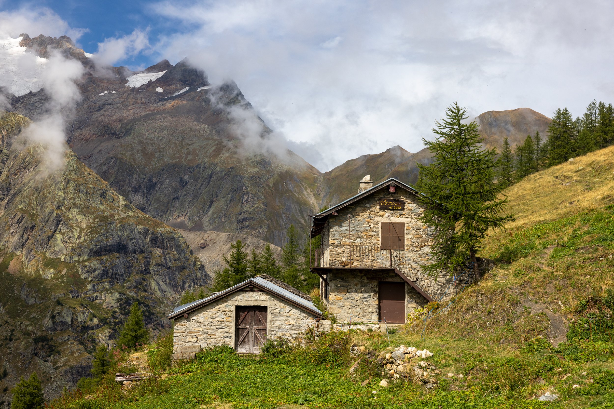
Day 5 - Courmayeur to Arnouva via Mont de la Saxe
Distance: 17.3km, Elevation Gain: 1090m, Elevation Loss: 650m
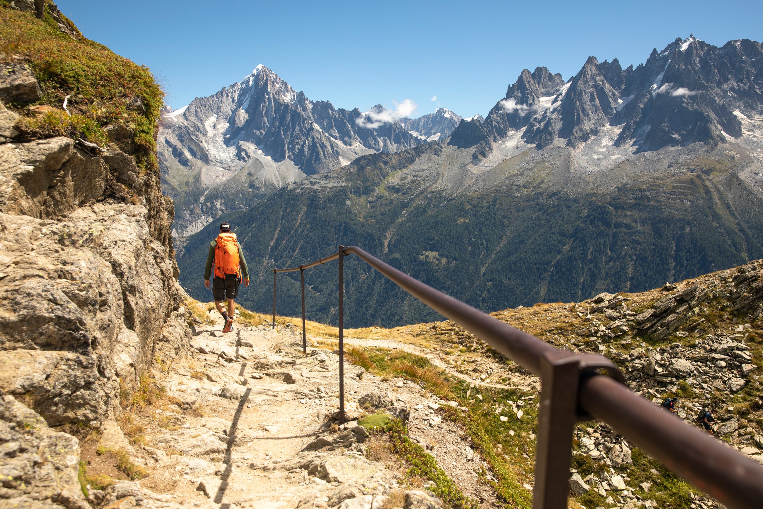
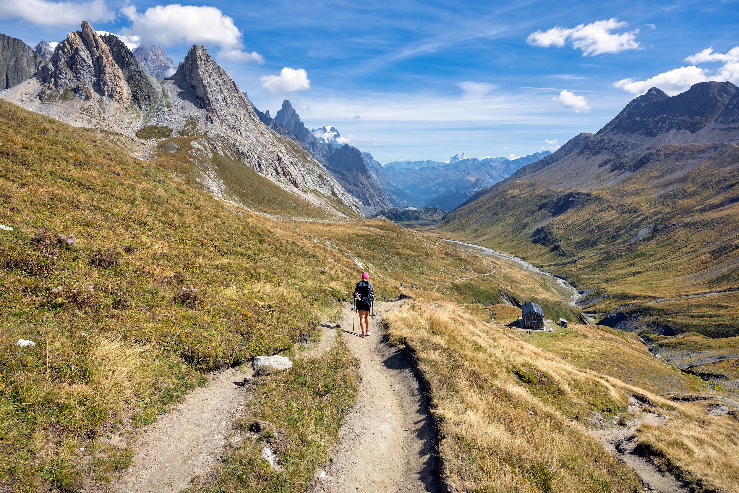
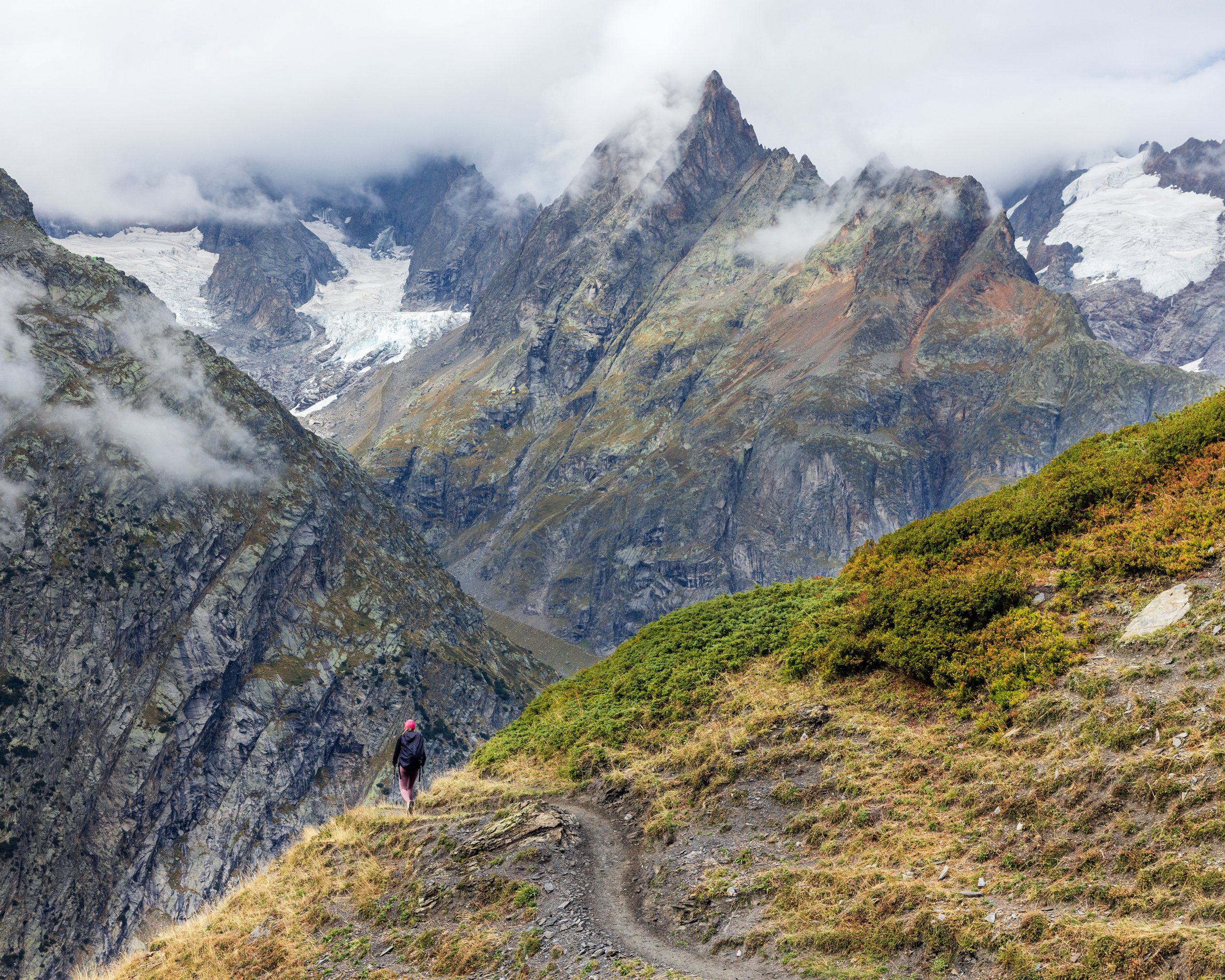
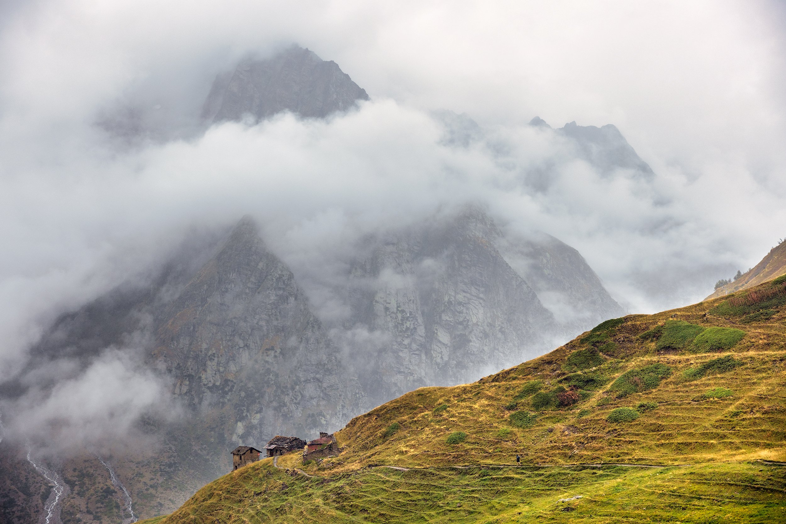
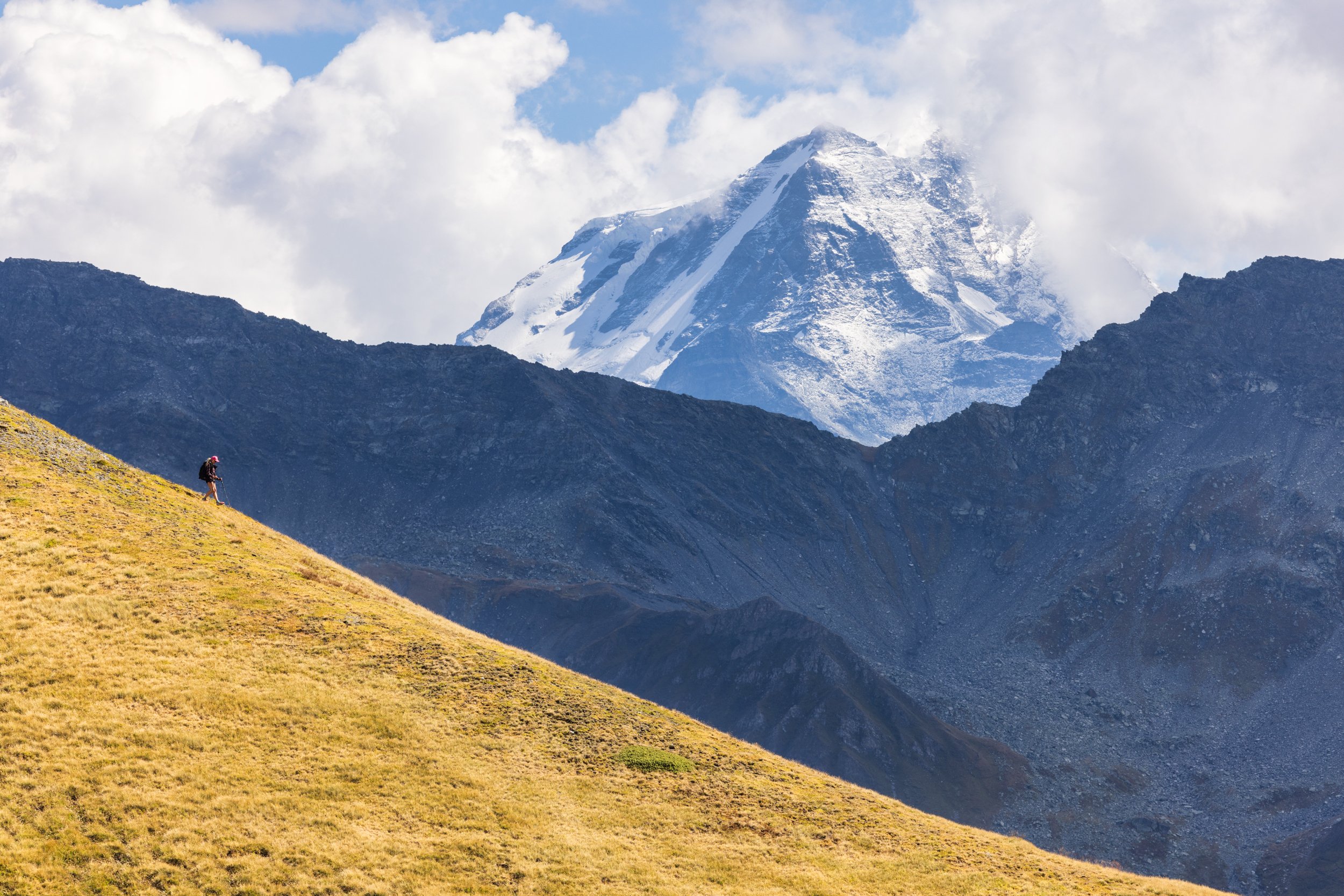
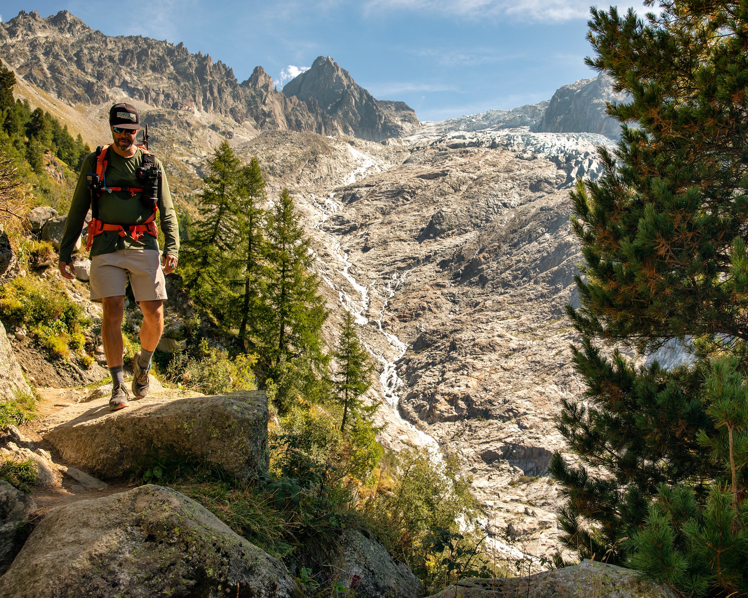
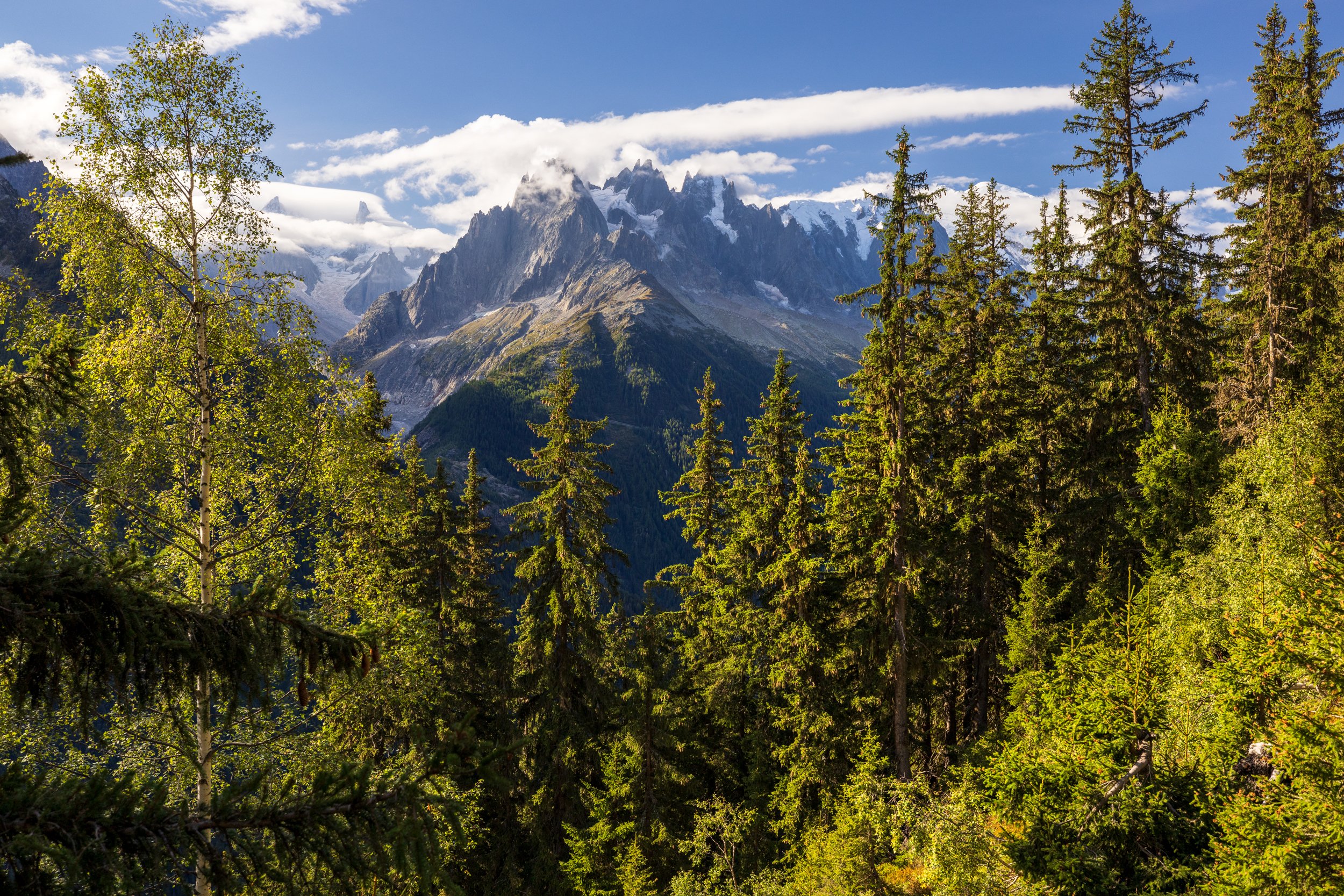
There was a feeling of melancholy on the morning we were leaving Courmayeur and wished we would have had more time to explore this town. We decided to stick around the town center long enough to witness the beginning of the “CCC” stage of the UTMB race, where runners were headed to Chamonix, nearly 110km away. There was much excitement in the town and the crowds were cheering as some 2000 runners set off. After the start of the race, we loaded up with some charcuterie and pasta salad from a local deli, and began our daily commute. We followed the narrow street towards Villair before crossing the river and ascending through the forest until we reached the Bertone hut. We stopped for a minute to watch a steady stream of CCC marathon runners passing through this race checkpoint, and quickly realized that from this point forward, we would be hiking on the same trail as all of the runners. We waited for a little gap in the action, and hopped on the trail, up the shoulder of the Montagne de la Saxe (Saxe Mountain), and then contoured across the mountainside, high above the Val Ferret valley below with the Grandes Jorasses across the valley from us. Heavy rain and fog moved in and we became drenched, even with our rain jackets on. The trail was a muddy and slippery mess, and we spent this entire section of trail dodging CCC runners, trying to find a way to let them get past us, which eventually turned into an awkward game of trying to actively dodge the joggers. After miles of muddy trail, we reached the Refugio Alpino Walter Bonatti and took shelter from the relentless rain, with dozens of drenched hikers. As we dried off and warmed up, we watched a never ending line of racers move past this stage, filling their water bottles, and trudging along.
After warming up, we headed southeast up the Malatra Valley where we passed the some ruins of the Alpe Inférieure de Malatra (Lower Alps of Malatra). The traverse continued before finally descending down to Arnouva, and the bottom of the Val Ferret. During the final hour of our hike, the storm finally cleared and the sun came out, giving us our first glimpse of the surrounding mountains in the Val Ferret valley.
We arrived in Arnouva to the small and rustic Hotel Chalet Val Ferret, checked into our room, and walked down to the bar to order an Aperol Spritz. We sat outside on the patio, playing cribbage and watching as an endless stream of CCC runners trickled through the checkpoint tent before pushing on towards Switzerland.
Our half bord dinner consisted of charcuterie and delicious homemade taglioni with porcini mushrooms and a thick cream sauce. After dinner, we headed to bed early. At 4 a.m. we were startled awake by a small group of people cheering outside our room as the first runners for the UTMB marathon race made their appearance, only 10 hours after departing Chamonix over 60 miles away. Within a few minutes, Killian Jornet reached the checkpoint and we were stoked to be able to watch him come through, as he continued on to eventually win the UTMB race and set a new world record for the course. After the excitement died down, we crashed back out for a few more hours of sleep.
Day 6 - Arnouva to La Fouly via Grand Col Ferret
Distance: 11.7km, Elevation Gain: 680m, Elevation Loss: 1310m
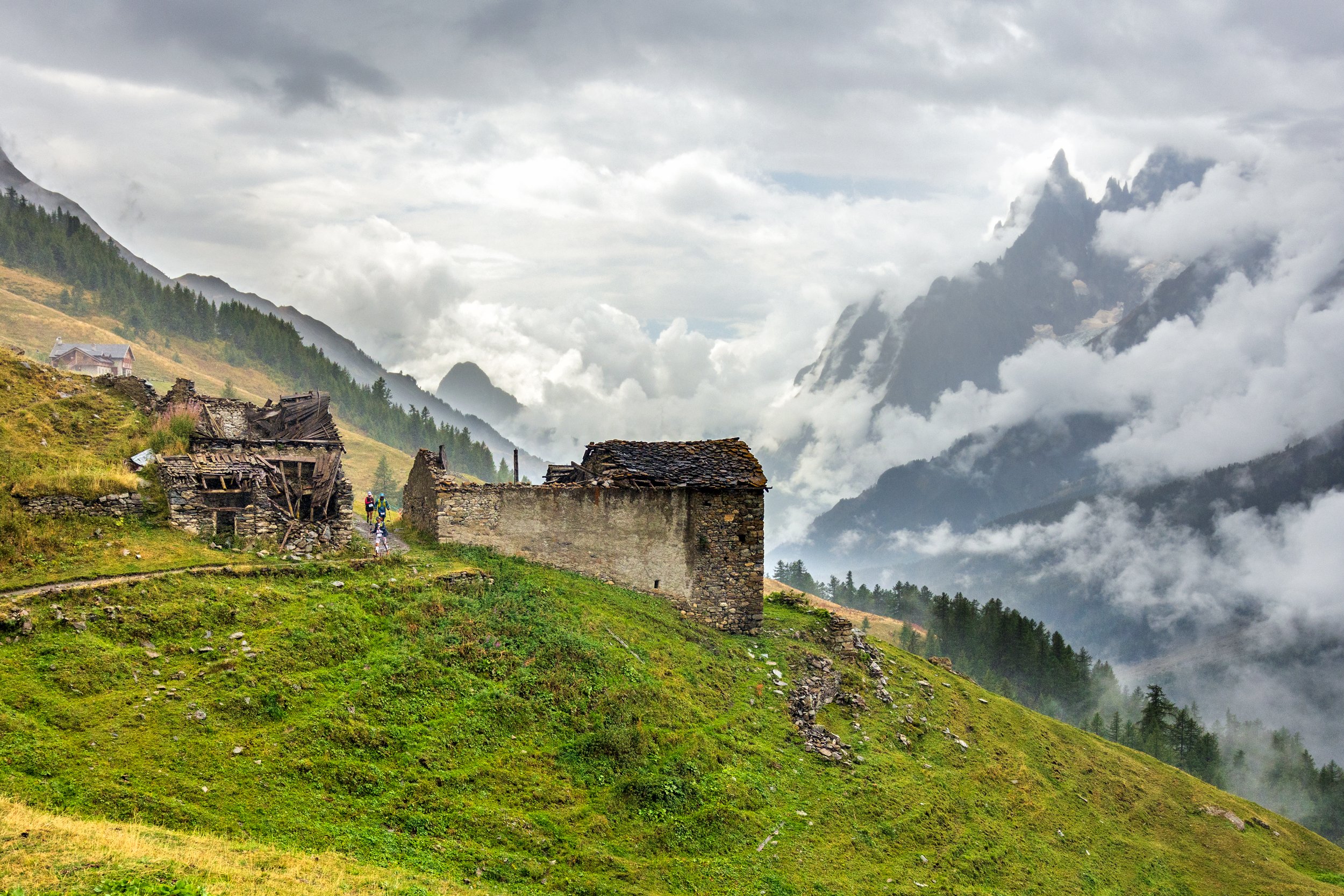
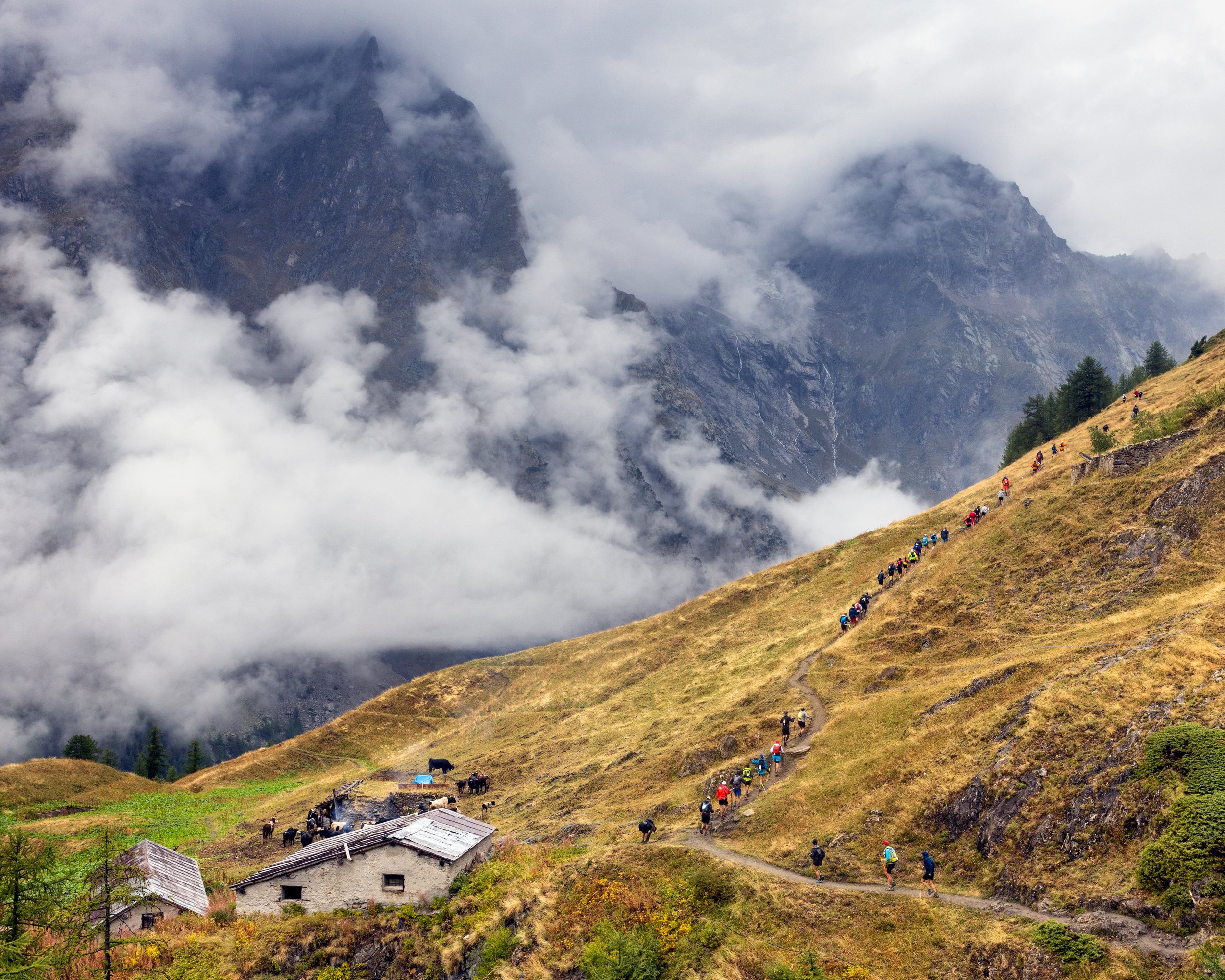
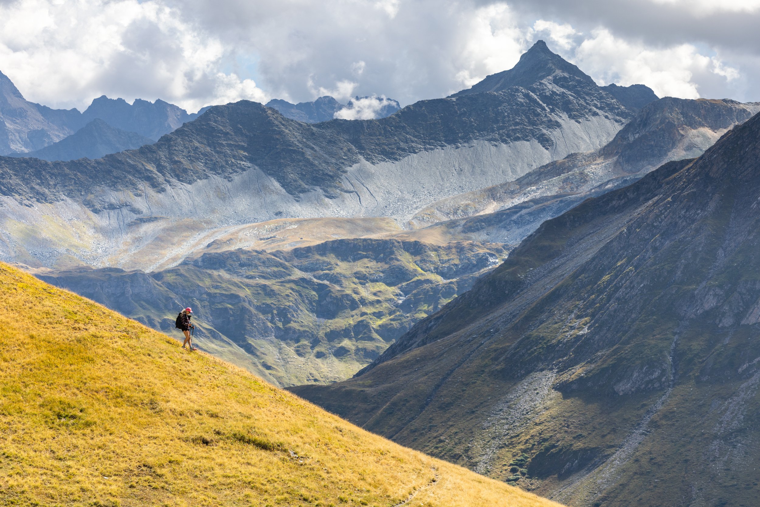
We started the morning early with a simple breakfast of cereal and coffee and set out on the trail. From Chalet Val Ferret, we hiked past several shallow ravines before reaching the Elena hut. We continued up the switchbacks, passing multiple building ruins along the way. We followed the ascending traverse, covering 2800 feet of vertical ascent across the mountainside, headed towards the Italy/Switzerland border located at the top of the Grand Col Ferret. Throughout the day, we hiked inline with the UTMB runners, mid-race in their attempt to circumnavigate the Mont Blanc range. Walking with the racers, I found myself struggling to imagine how the UTMB runners were feeling at this point, but the look on their faces suggested that the struggle was real and that they were giving it their best effort.
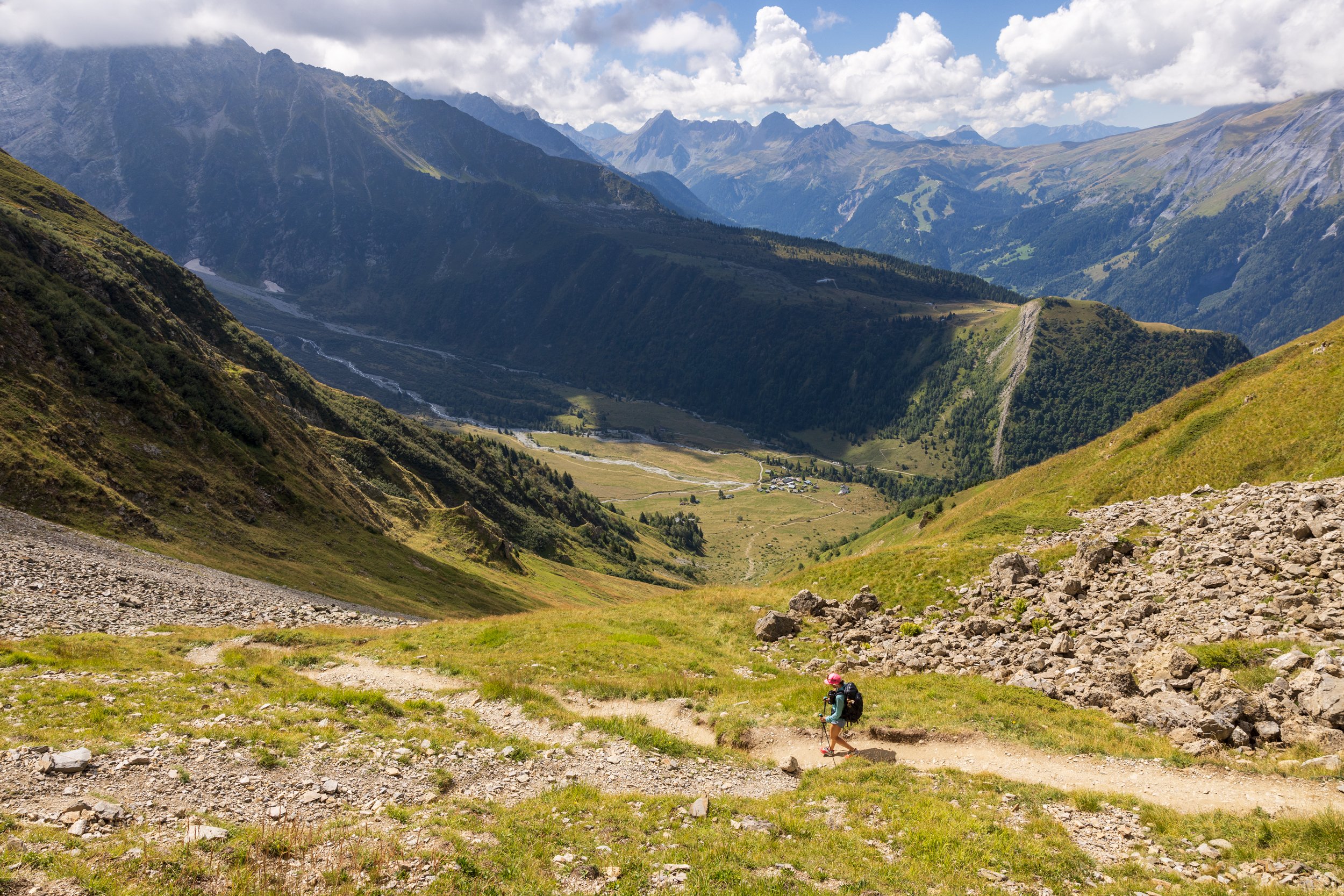
When we made it to the top of the pass, we were treated to expansive views as far as the eye could see. Carpets of green grasses blanketed the surrounding mountain sides, and we sat here for an hour admiring the unspoiled views on both sides of the pass. We began the descent, across the vast meadows at the top of the Combe de la Peule, across the south-facing slopes of the Arête des Planfins before reaching the chalets at La Peule, where we ordered a cold beer and ate lunch. After the quick break, we continued on, eventually reaching the bottom of the Val Ferret where we followed the road into the town of La Fouly.
La Fouly was full of excitement for the race, cheering all participants as they ran through. Our hotel at Auberge des Glaciers was the popular spot in town, full of race spectators on the large patio overlooking massive glacier icefields reaching towards the summit of Mont Dolent and the Tour Noir. We lounged in the late afternoon sunshine before grabbing dinner at the hotel, consisting of a very basic meal of meat and potatoes. The hotel was comfortable enough, with small rooms and common bathrooms.
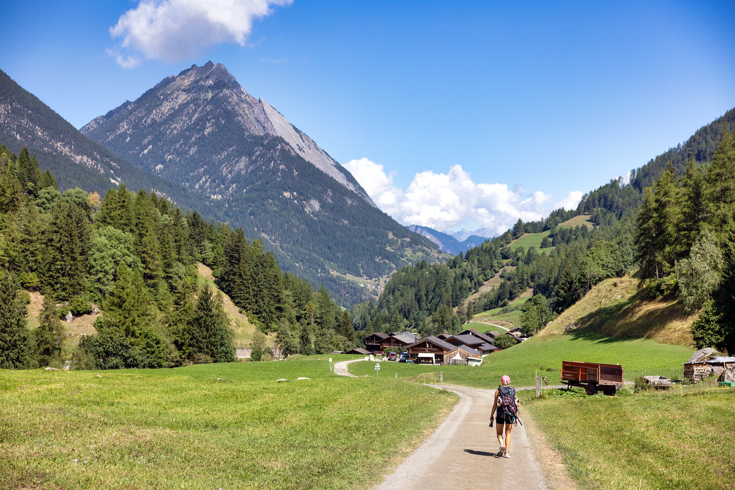
Day 7 - La Fouly to Champex-Lac
Distance: 11.7km, Elevation Gain: 680m, Elevation Loss: 1310m
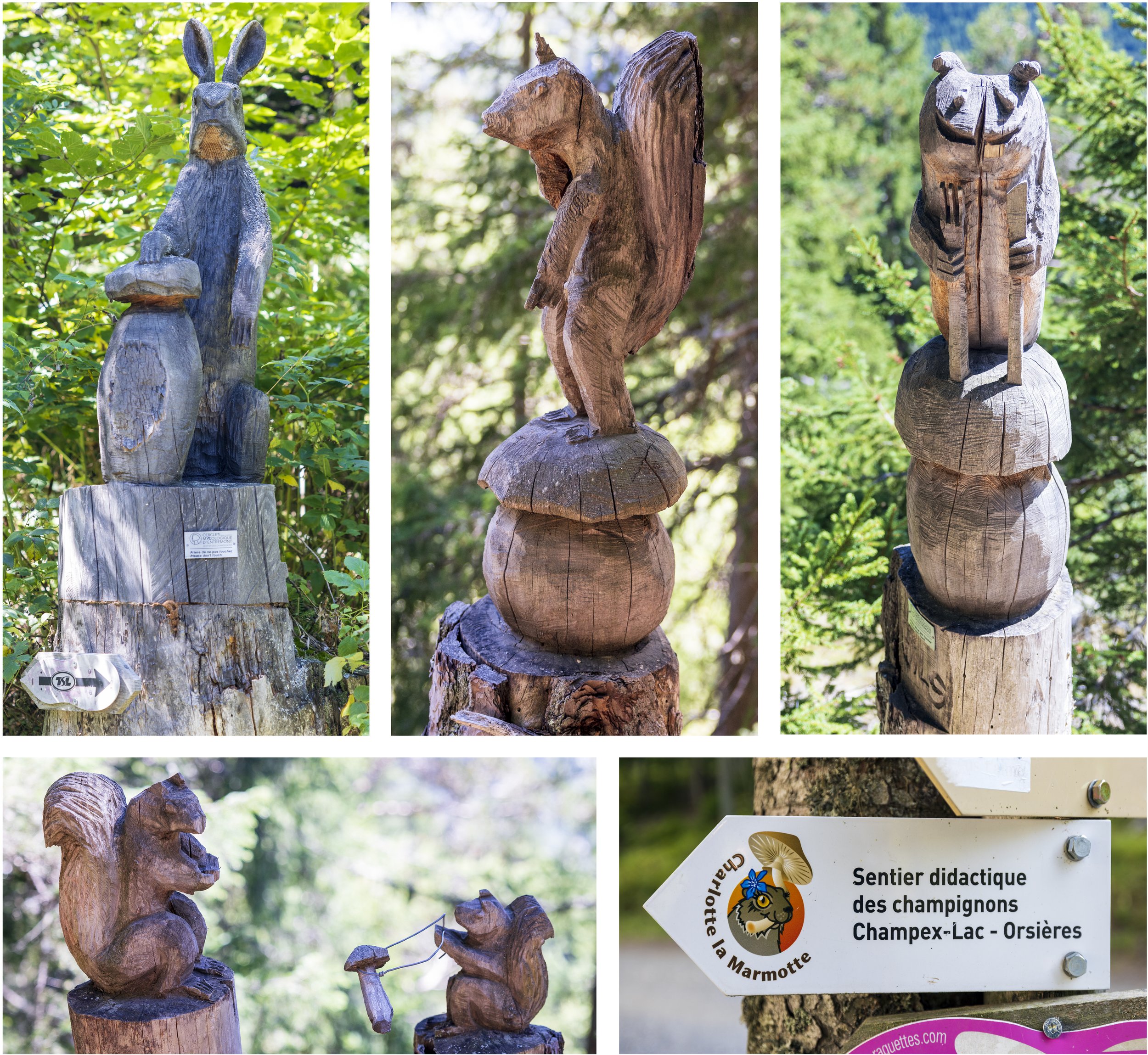
Today was expected to be one of the shortest hikes of the trip, so we took our time in the morning and walked slowly through the day. We headed south along the Val Ferret road through La Fouly before crossing the Ferret River and continuing along the easy trail to the small village of Praz de Fort, through the beautiful hamlet of Les Arlaches, and then on to Issert. Once past Issert, there was a moderate ascent through a wooded hillside up to the town of Champex. Hand carved wooden statues depicting various animals lined the hiking trail, and all of them seemed to make references to various mushrooms. Scenes of squirrels giving mushrooms as gifts, and various animals standing on mushrooms seemed to all be part of the welcoming committee on our way to Champex.
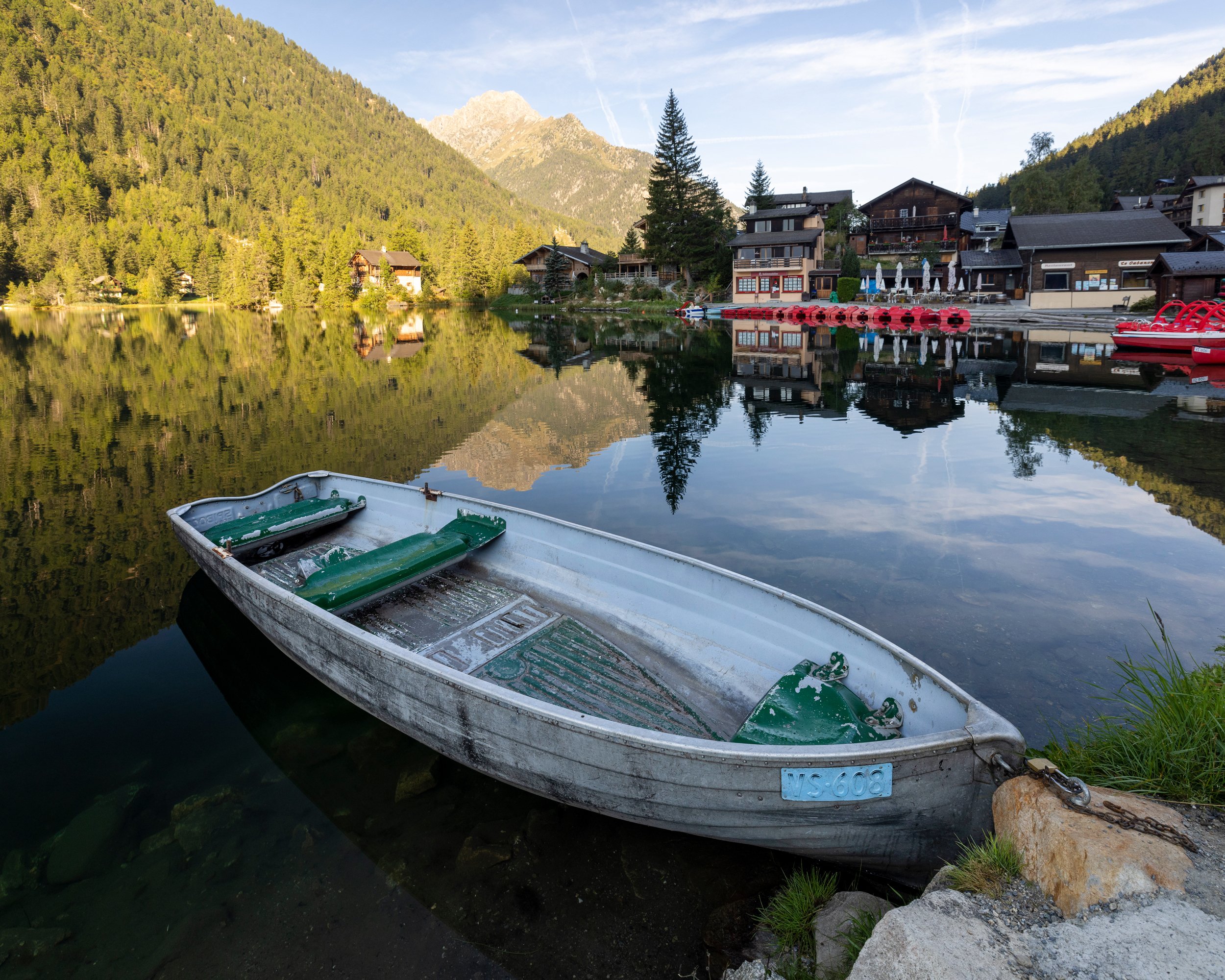
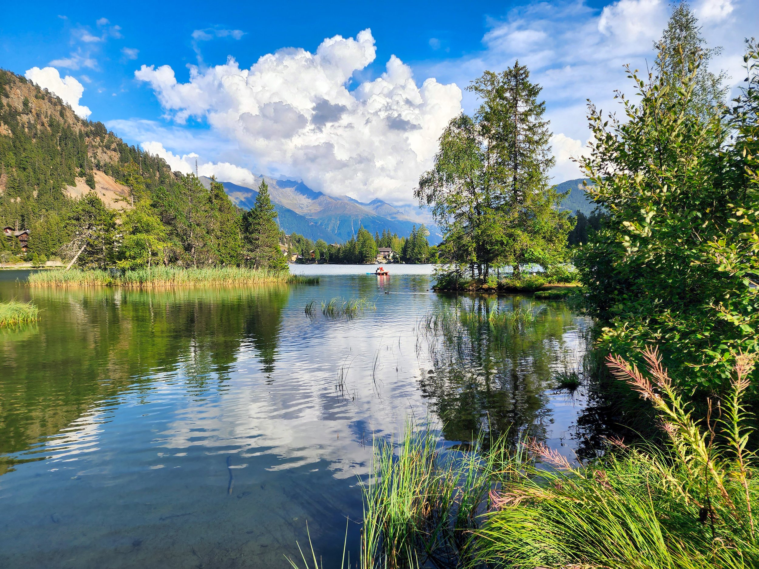
When we arrived to Champex, we were pleased to find a picturesque village nestled around a magnificent alpine lake. A small group of paddle boarders drifted effortlessly in the calm water and the sunlight reflected like a million diamonds scattered across a blue blanket.
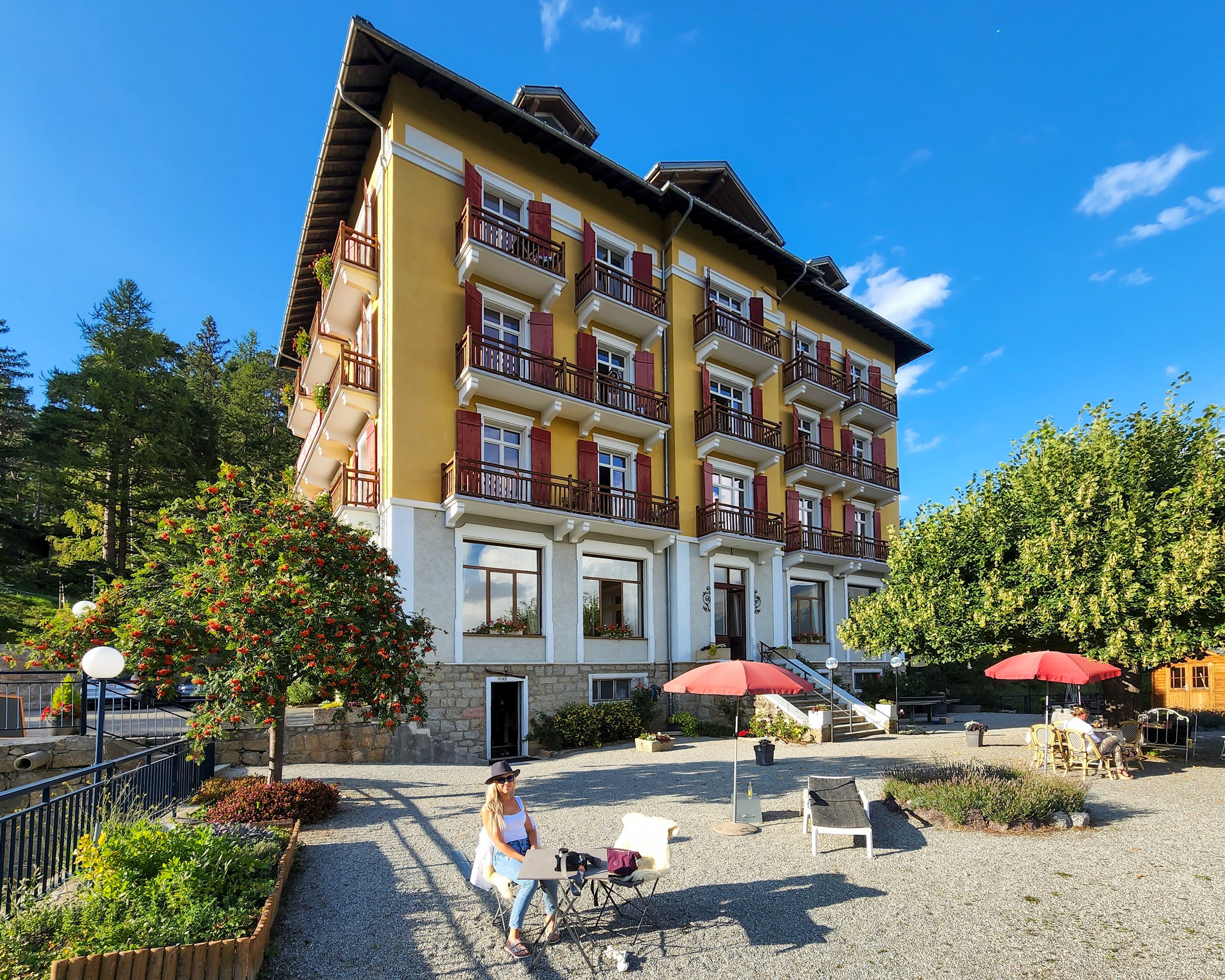
We checked into our room at the historic Hôtel Splendide, with a large outdoor terrace and amazing views of the Grand Combin valley off in the distance. This hotel, was built with a “Belle Époque” style between 1934 and 1938, has been owned and operated by four generations of the same family ever since. The simple decor, high ceilings, stained glass windows, and creaking floorboards really makes the past feel alive here. It was even occupied by the army during World War II.
Corrinne, the great-granddaughter of the original builder Mr. Lovey, greeted us at the entrance as we made our way in and gave us keys to our room. After a quick refresh at our room, we headed down to Lake Champex to grab a coffee, and stroll around in the late afternoon sunshine before a dinner of delicious raclette (melted cheese served with boiled potatoes) and wine was served back at the hotel. After dinner, it was off to bed, in anticipation of the next long day ahead…

Day 8 - Champex to Trient via Fenêtre d’Arpette
Distance: 15km, Elevation Gain: 1285m, Elevation Loss: 1240m
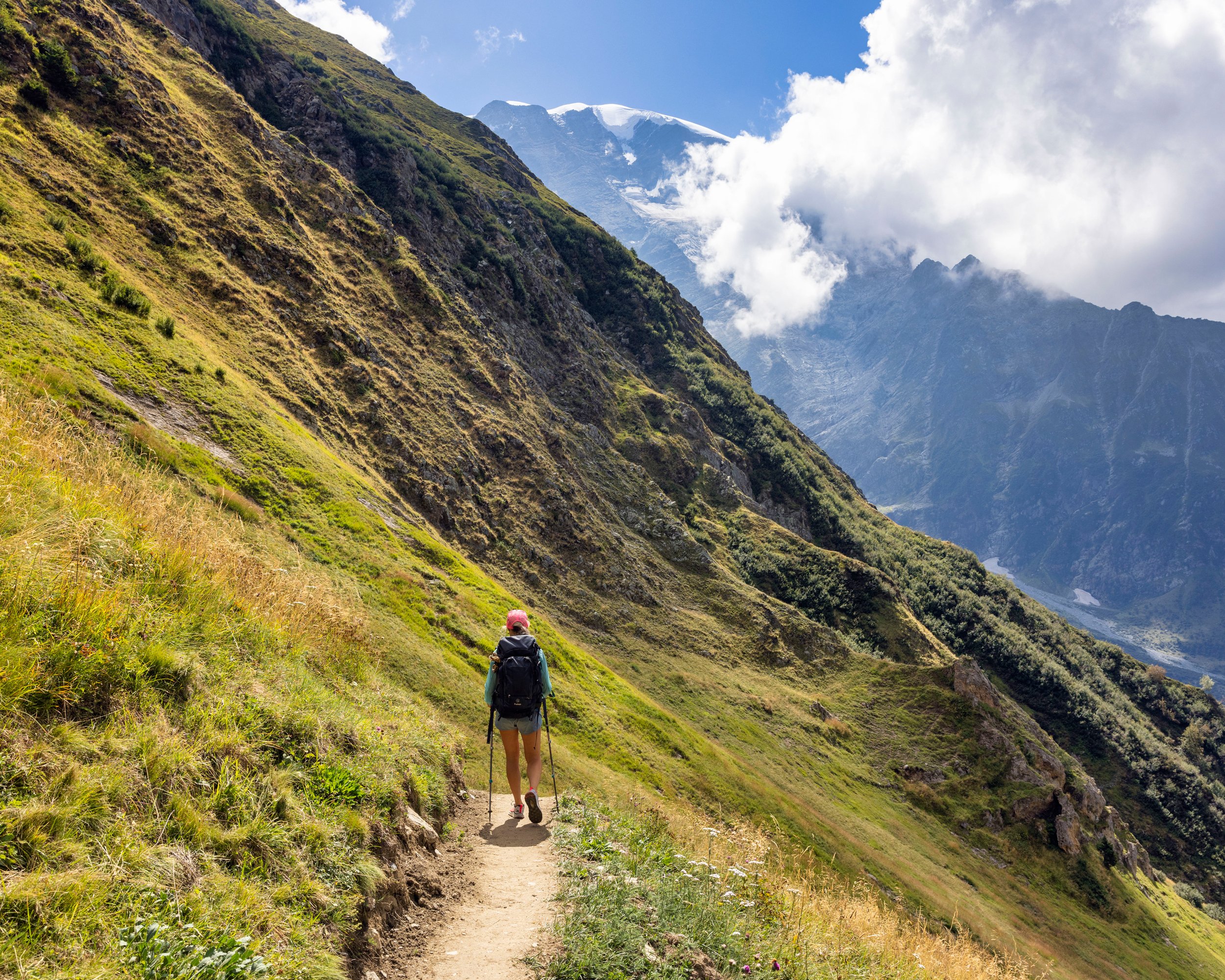
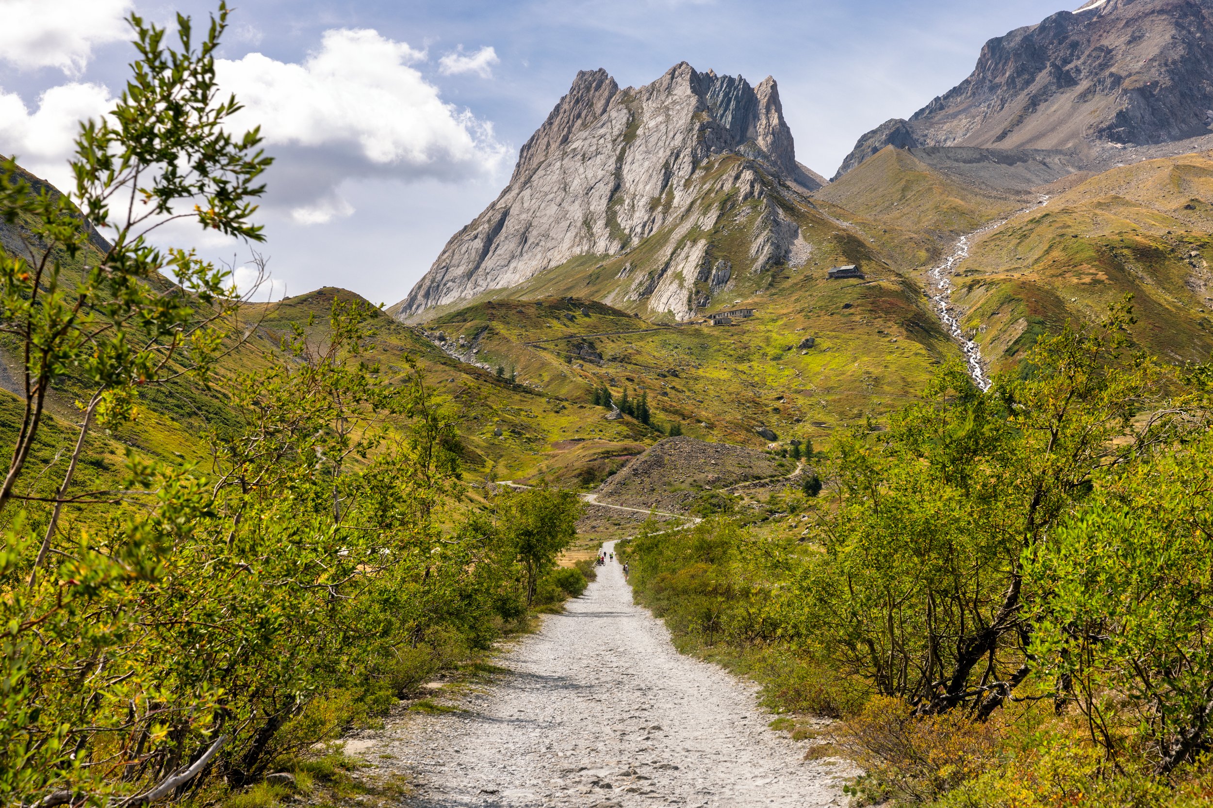
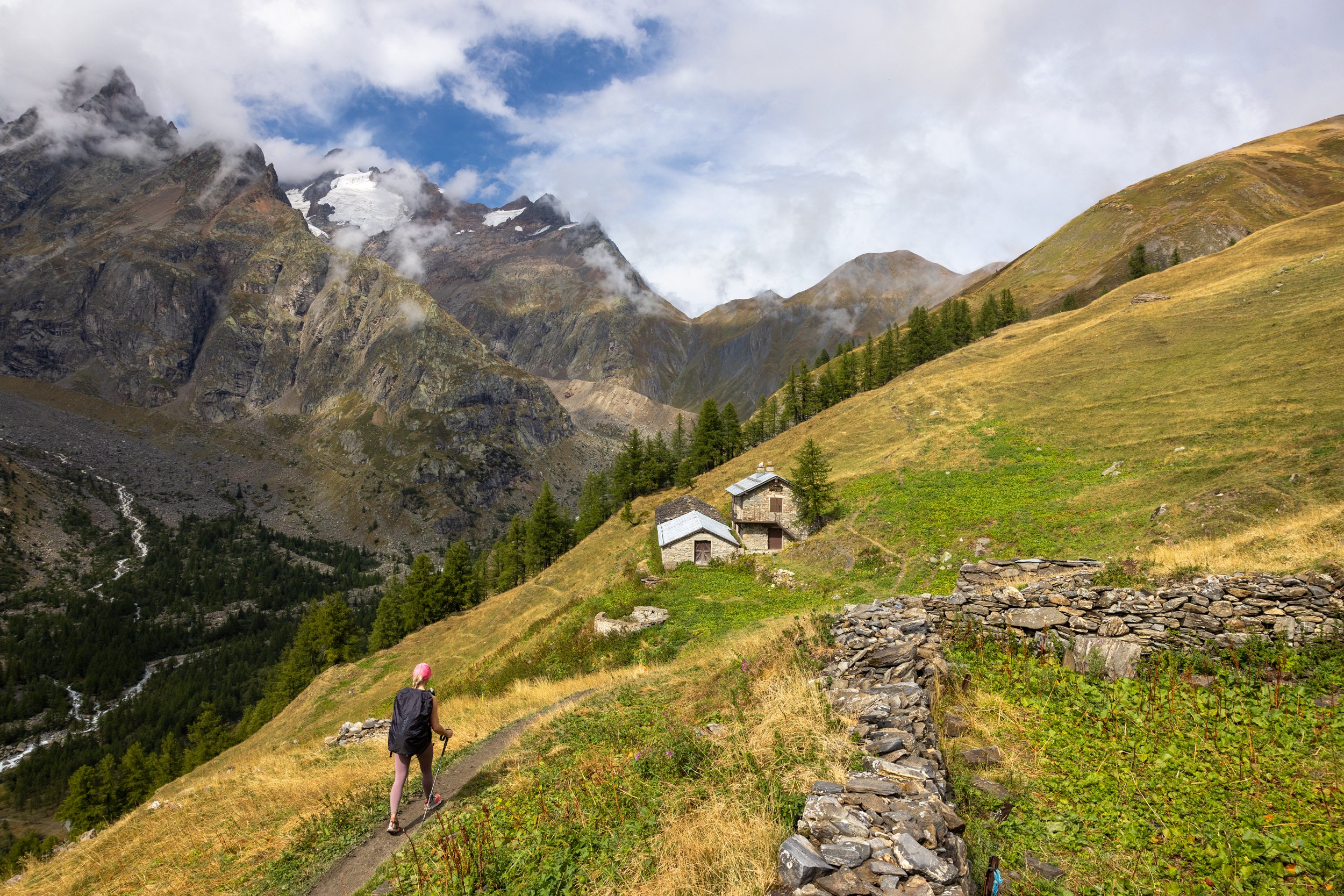
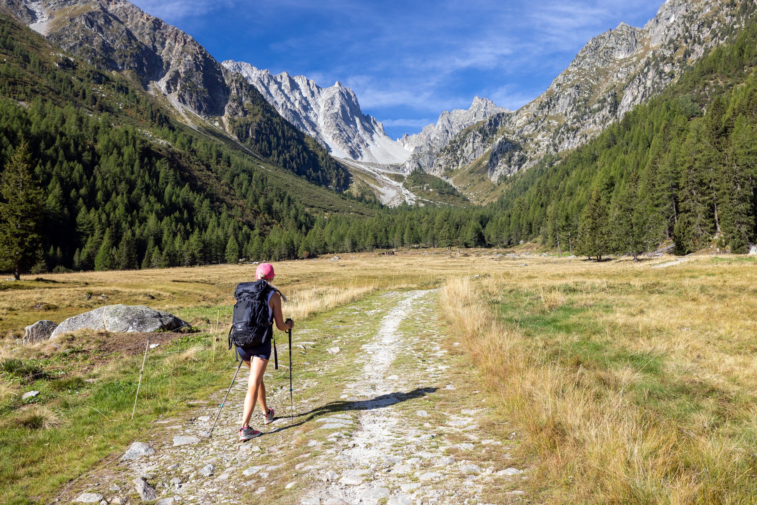
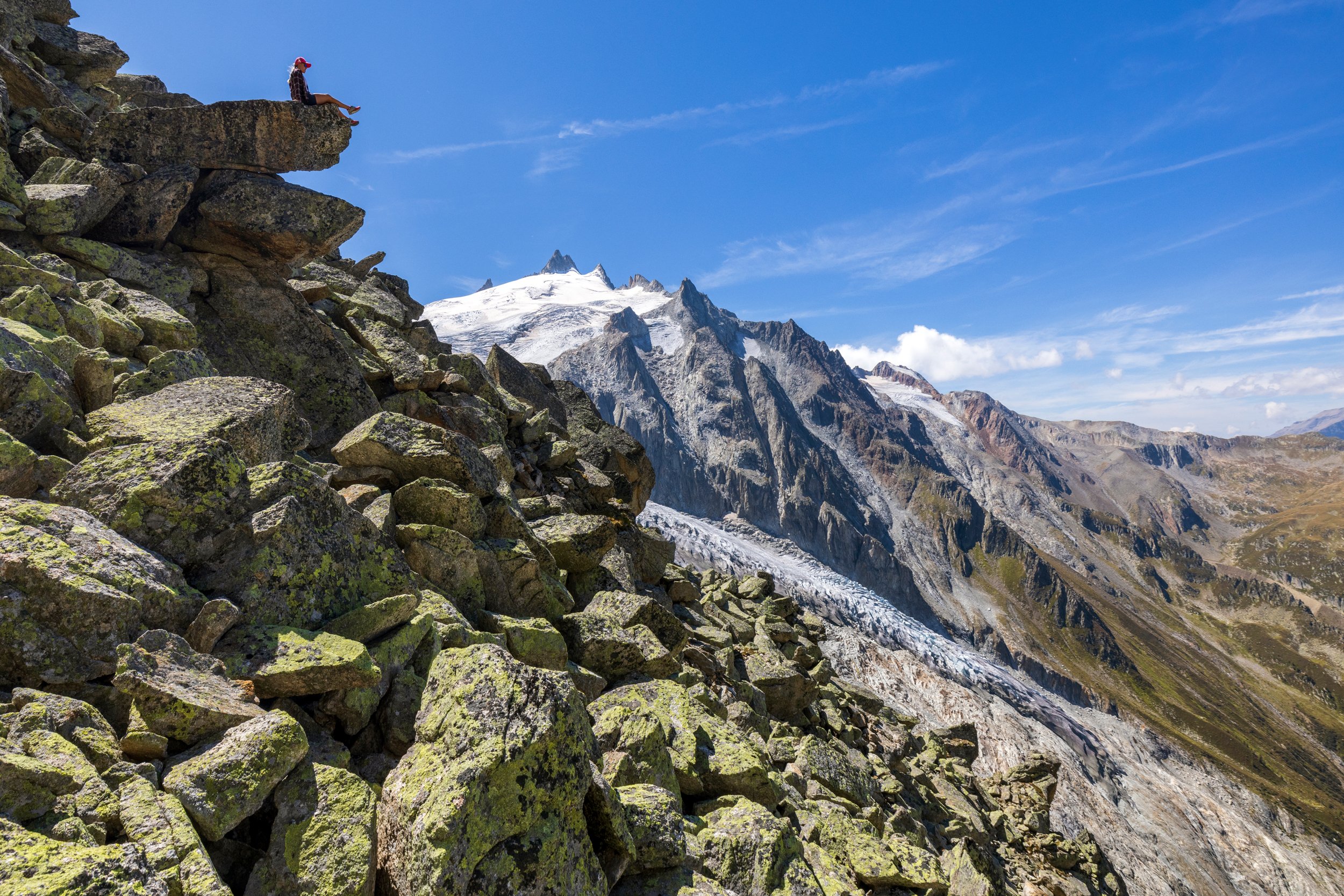
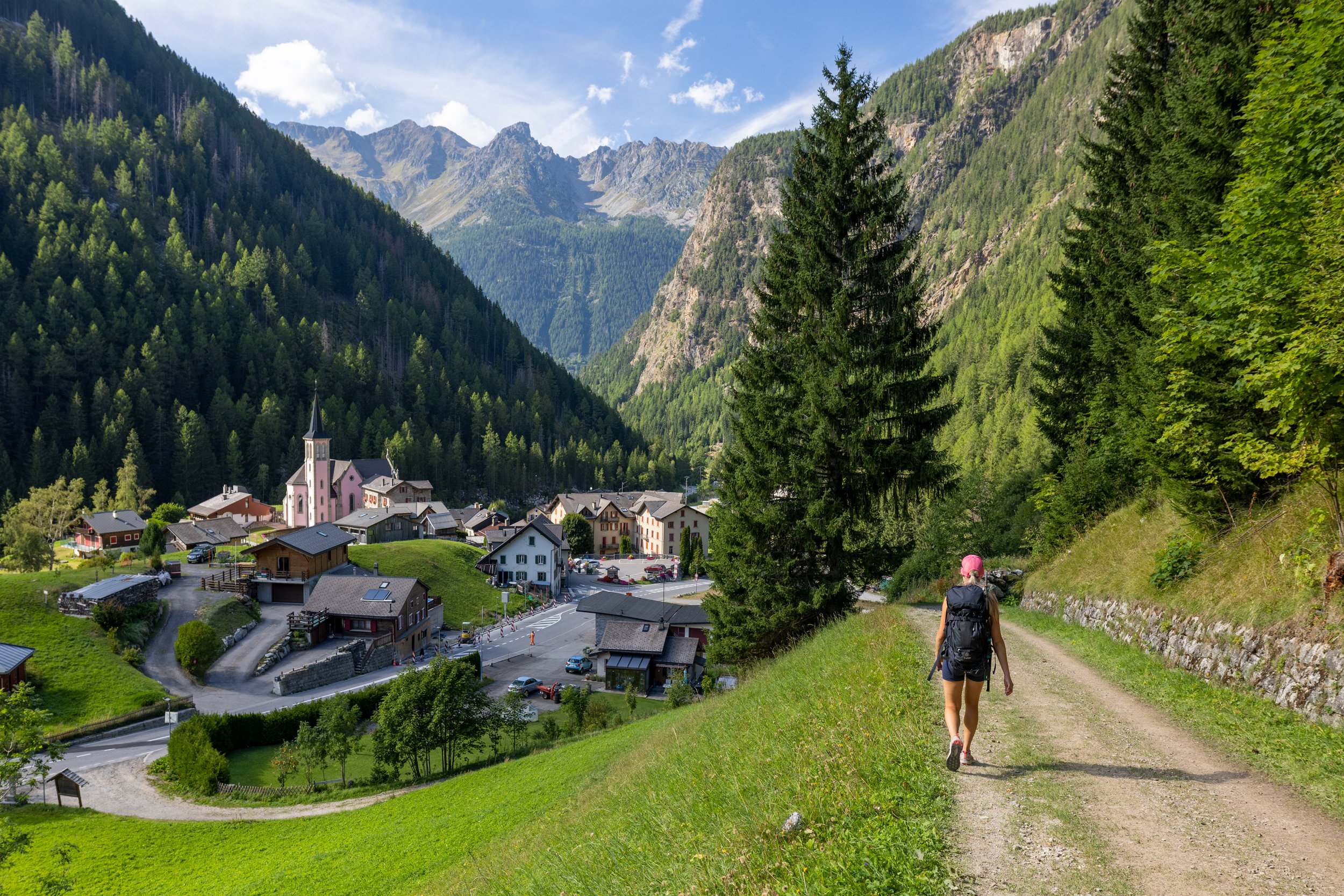
Today, we opted to take an alternative and more challenging route than the standard, Bovine Route, called the Fenêtre d’Arpette. From our hotel at Champex-Lac, we began the hike following the road through town, before reaching the dirt trail at the foot of the La Breya chairlift. From there, we followed the Petit Ruisseau trail, up to Arpette, which continued up a drivable road towards the trailhead for the Fenêtre d’Arpette. This trail follows a series of rising traverses separated by large boulder fields. Huckleberry bushes and fireweed were in abundance along this section of trail and we stopped frequently to pick the ripe berries. TMB waymarkers were strategically placed, painted on the rocks at varying intervals, and were extremely helpful in keeping us on track and moving in the right direction as we navigated through the extensive boulder field. After the boulder field, we began the final ascent up the steep and loose slope below the Arpette Pass (Col de l’Arpette). At the top of the pass, we found a perch on a rocky outcropping to enjoy the views and ate our lunch.
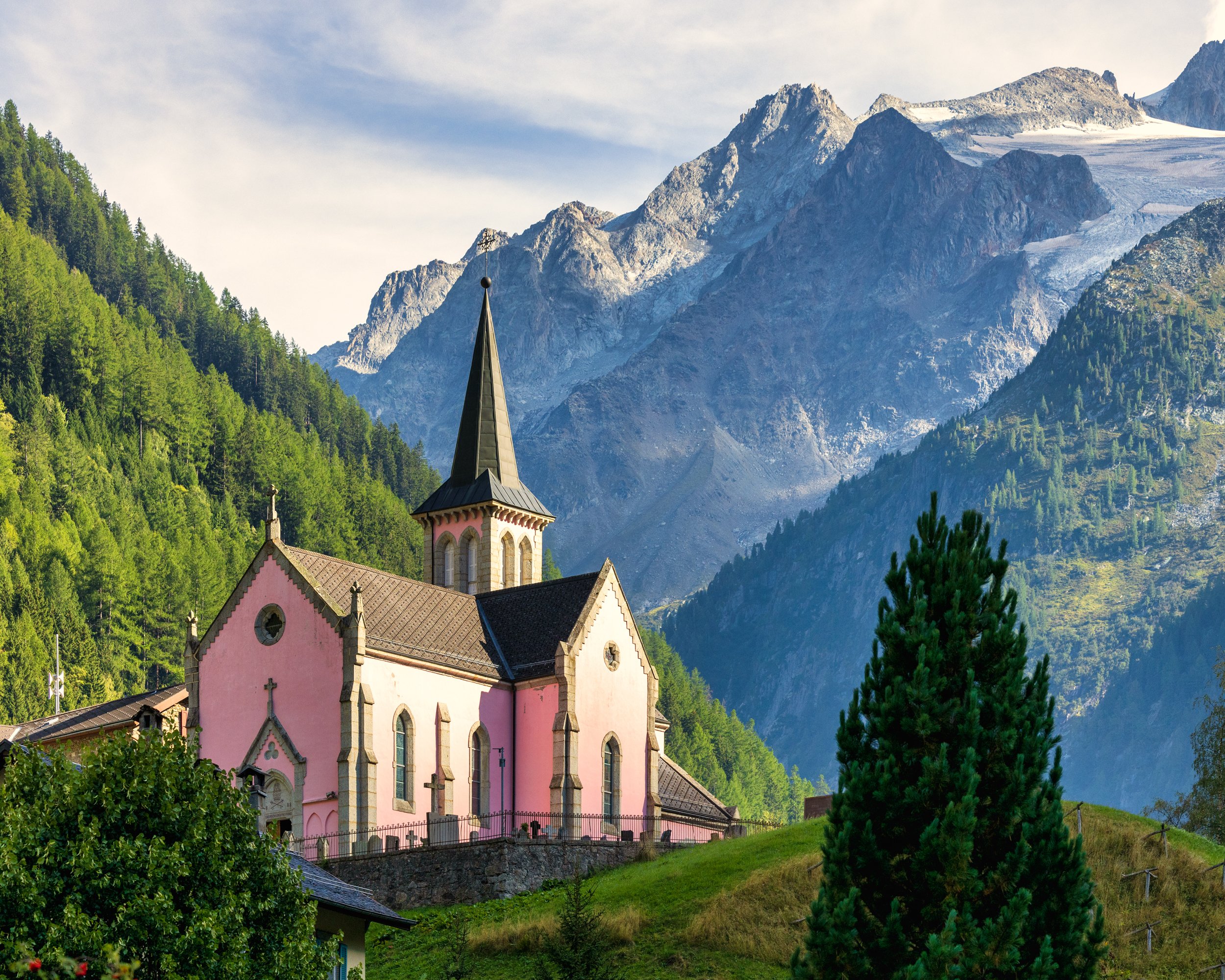
After lunch, we began the descent below the Arête de la Lys, following a poor footpath across the very steep slopes above the meadows and ruins at Vésevey, after which the walking became significantly easier, however a few sections of the traverse across the hillside are quite exposed and fortunately had chains in place to hold onto while moving through this section. At the end of the traverse, we descended to the valley floor walking adjacent to the outwash stream from the Trient Glacier before reaching a small refugio where we stopped to rest our tired legs and drink a cold beer. Once we were ready, we continued following the flat track above a large irrigation canal, before zigzagging through the forest down to the village of Trient. The late afternoon sunlight illuminated a pink church that was nestled in the center of town, and it looked postcard perfect against the rugged mountains in the background. Finally, with sore feet and knees, we reached our hotel accommodations at La Grande Ourse.
Day 9 - Trient to Argentière via Col de Balme
Distance: 15.6km, Elevation Gain: 1140m, Elevation Loss: 1155m
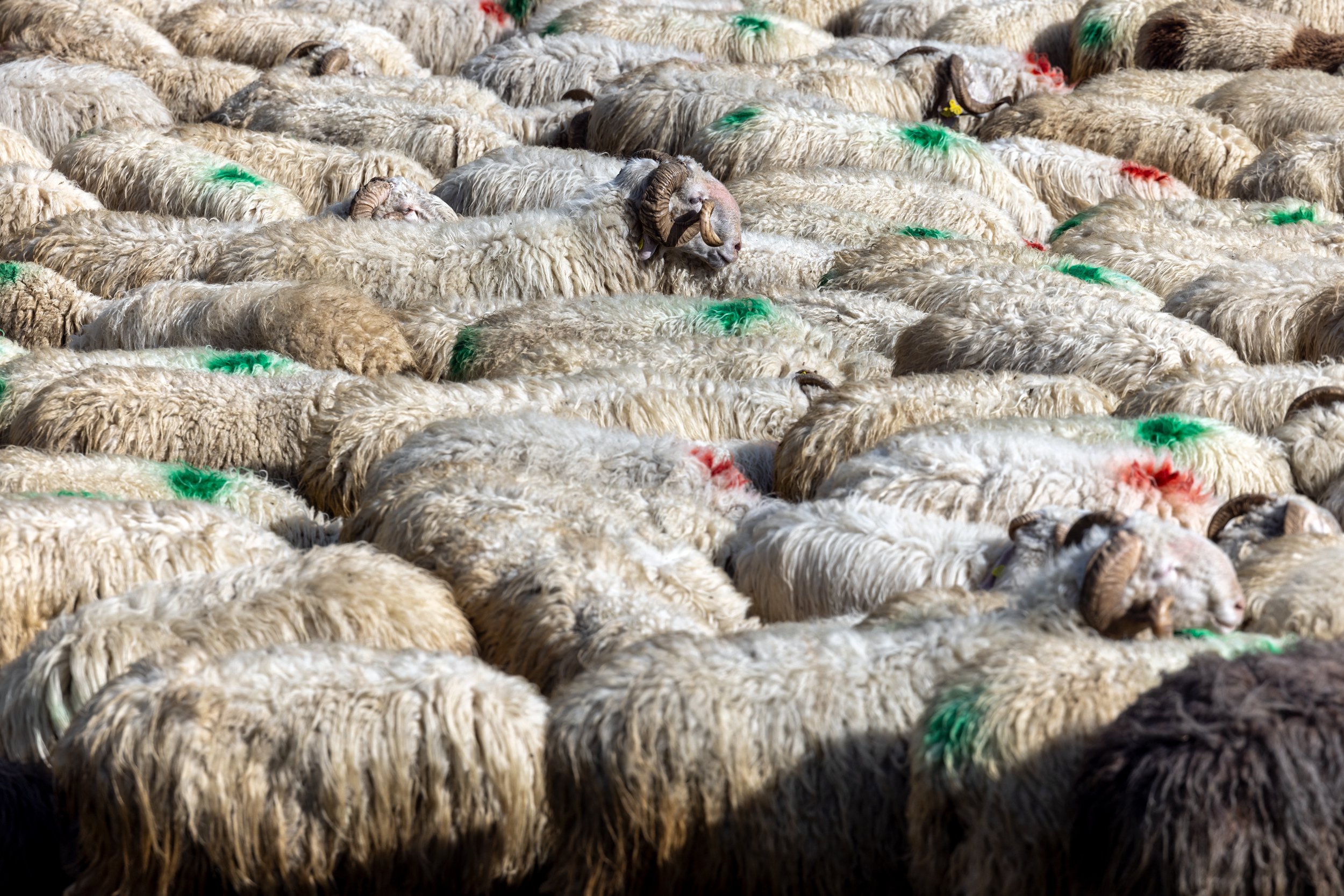
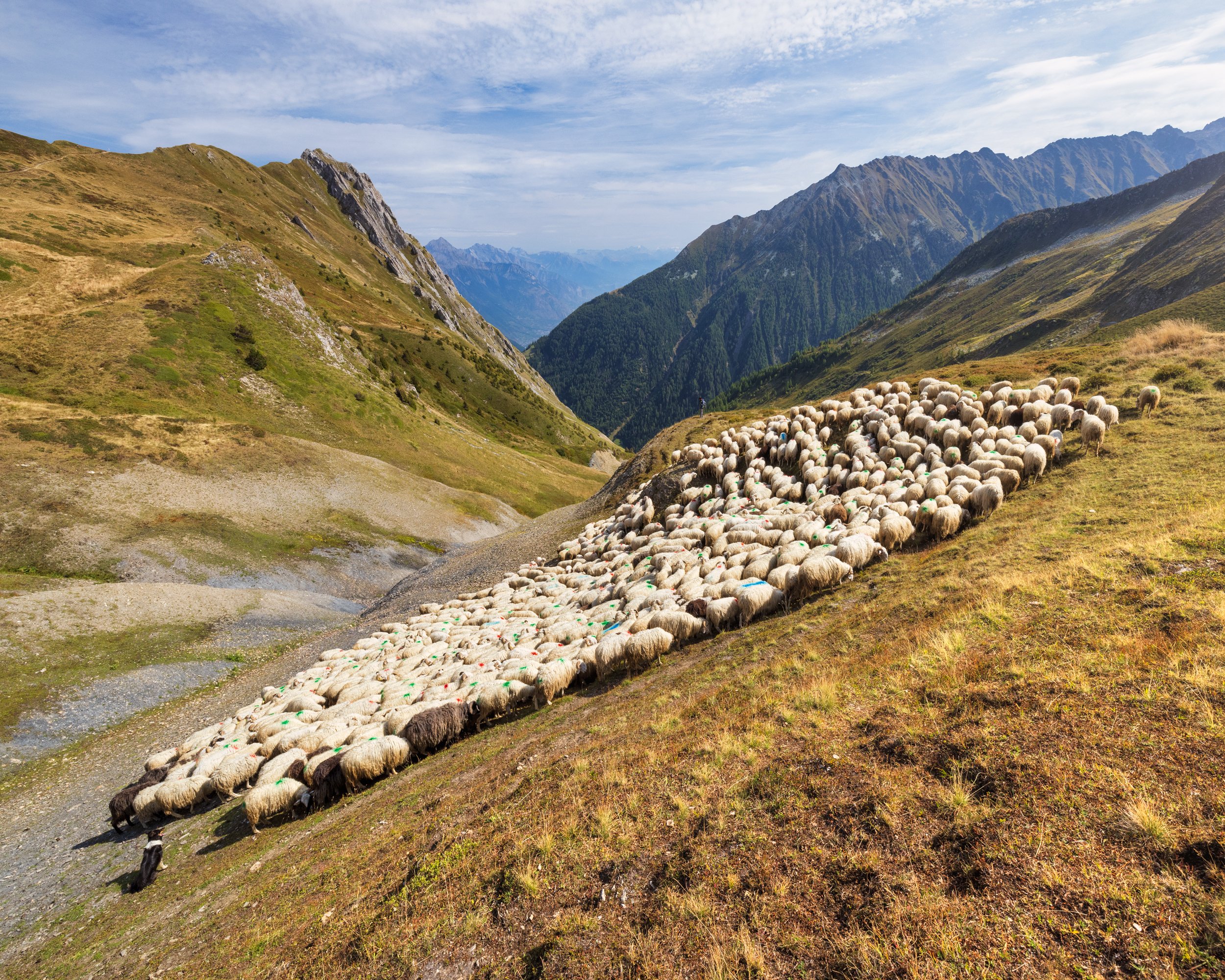
We hit the trail early after a quick breakfast, hoping to get ahead of a storm that was expected in the early afternoon. We pushed hard on the initial climb above Le Peuty, ascended almost 3000 feet to the Switzerland/France border located at the top of Col de Balme, passing the chalets at Les Herbagères as well as a sheep herder with his flock grazing the hillsides. A pair of well trained dogs kept the sheep in tight order, which meant some serious ass biting for the unlucky sheep that got out of line. It was amazing to watch the dogs work, with only a few whistles from the farmer as their commands.
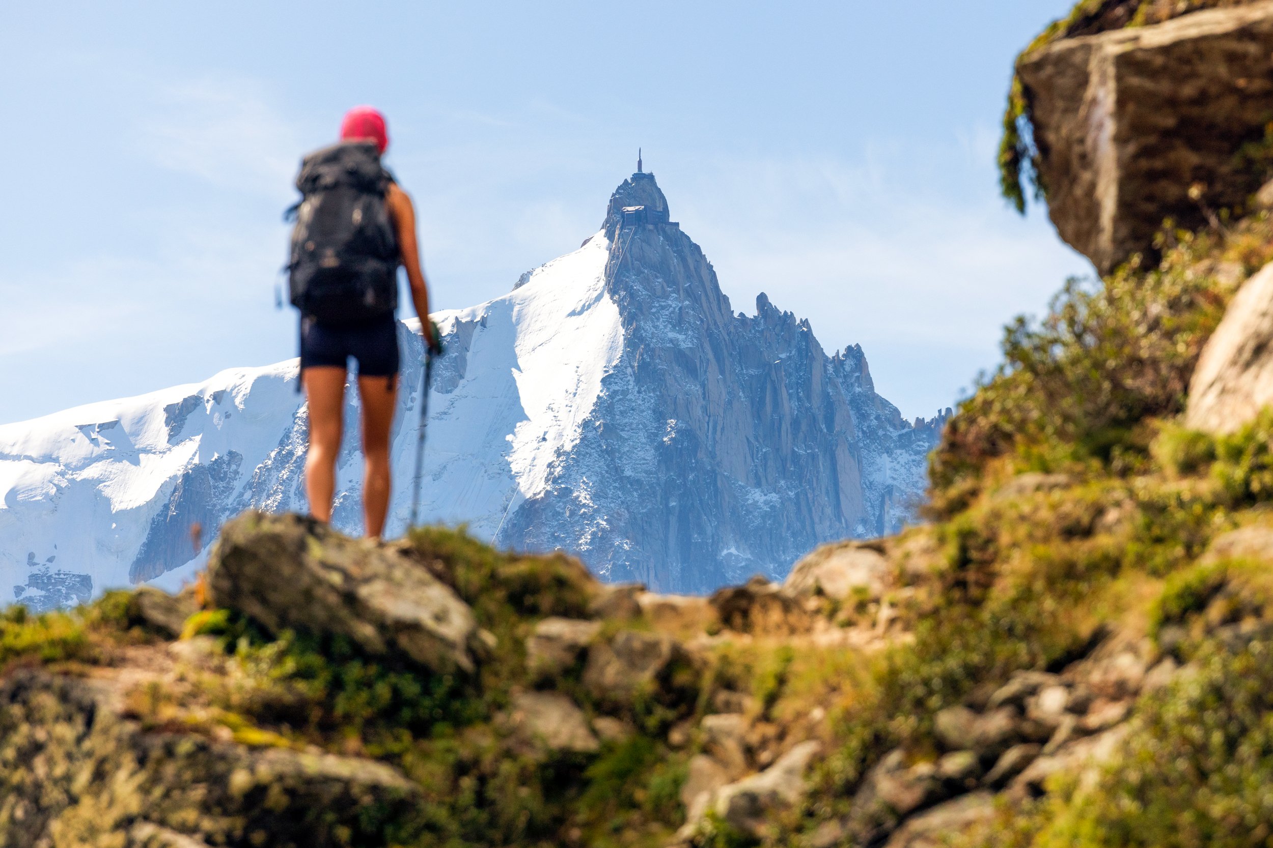
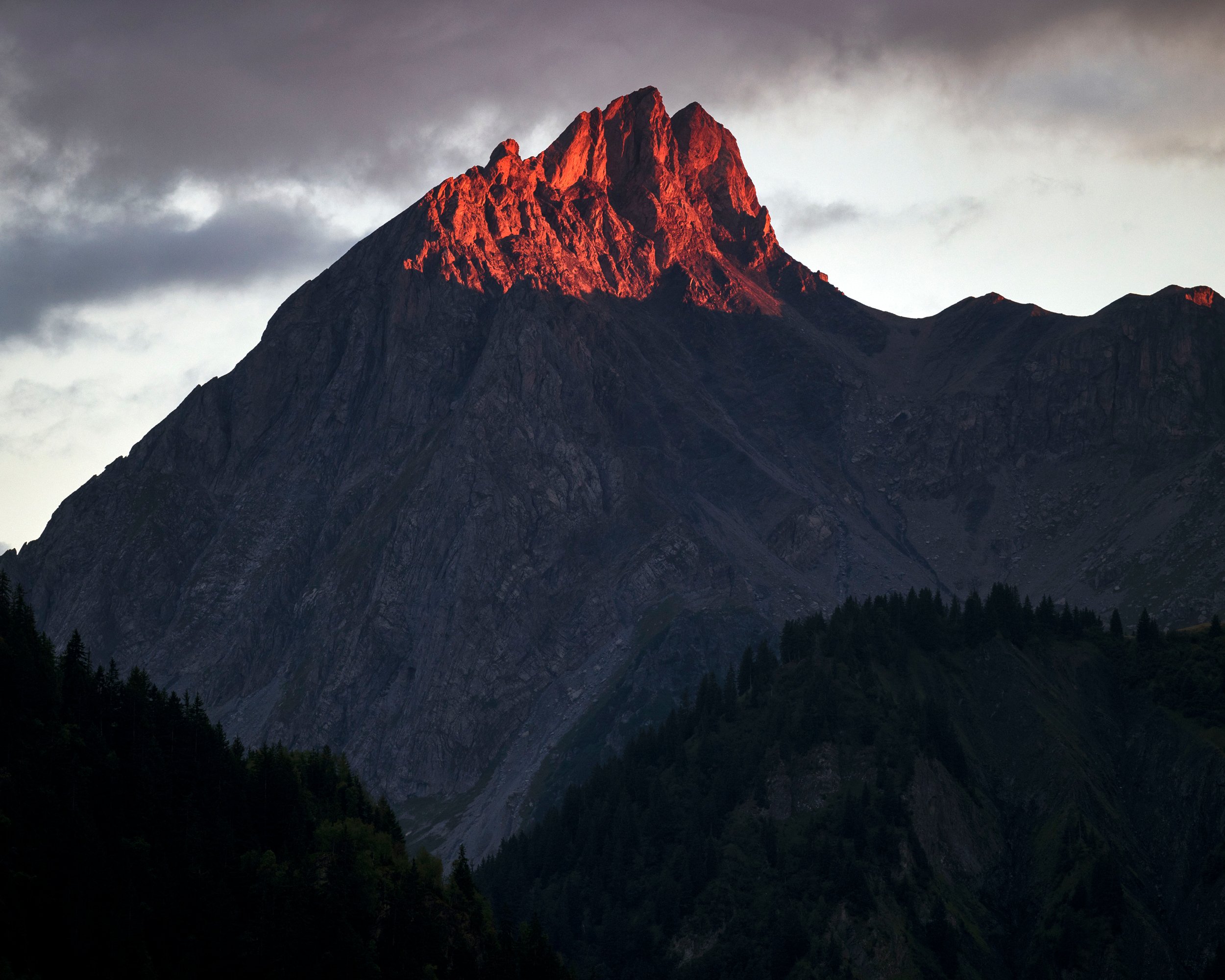
Throughout the morning’s climb, it felt great to breathe hard and feel the tiring burn in my legs. At the top of the pass, was the Refuge du Col de Balme. The bright red paint lining the windows and doors provided the perfect contrast against a deep blue sky. We stopped here and enjoyed a hot coffee while taking in the calm morning weather and panoramic views of the Mont Blanc summit and into the Chamonix Valley. With the end in sight, we both felt a great sense of achievement, but were sad to think that the trip was slowly and surely coming to a close.
The descent from the pass was smooth and easy on the knees, and we enjoyed spectacular views of Mont Blanc, and Aiguille du Midi looming off in the distance. The cool temps of the day were very pleasant and it never really felt too hot. We ended the day strolling through Argentière to our room at Hôtel La Couronne, drinking beer and Aperol Spritz and playing cribbage, a routine that we have both become very accustomed to on this journey over the past 9 days of hiking. Our half bord dinner was served next door at the restaurant Les Cheserys.
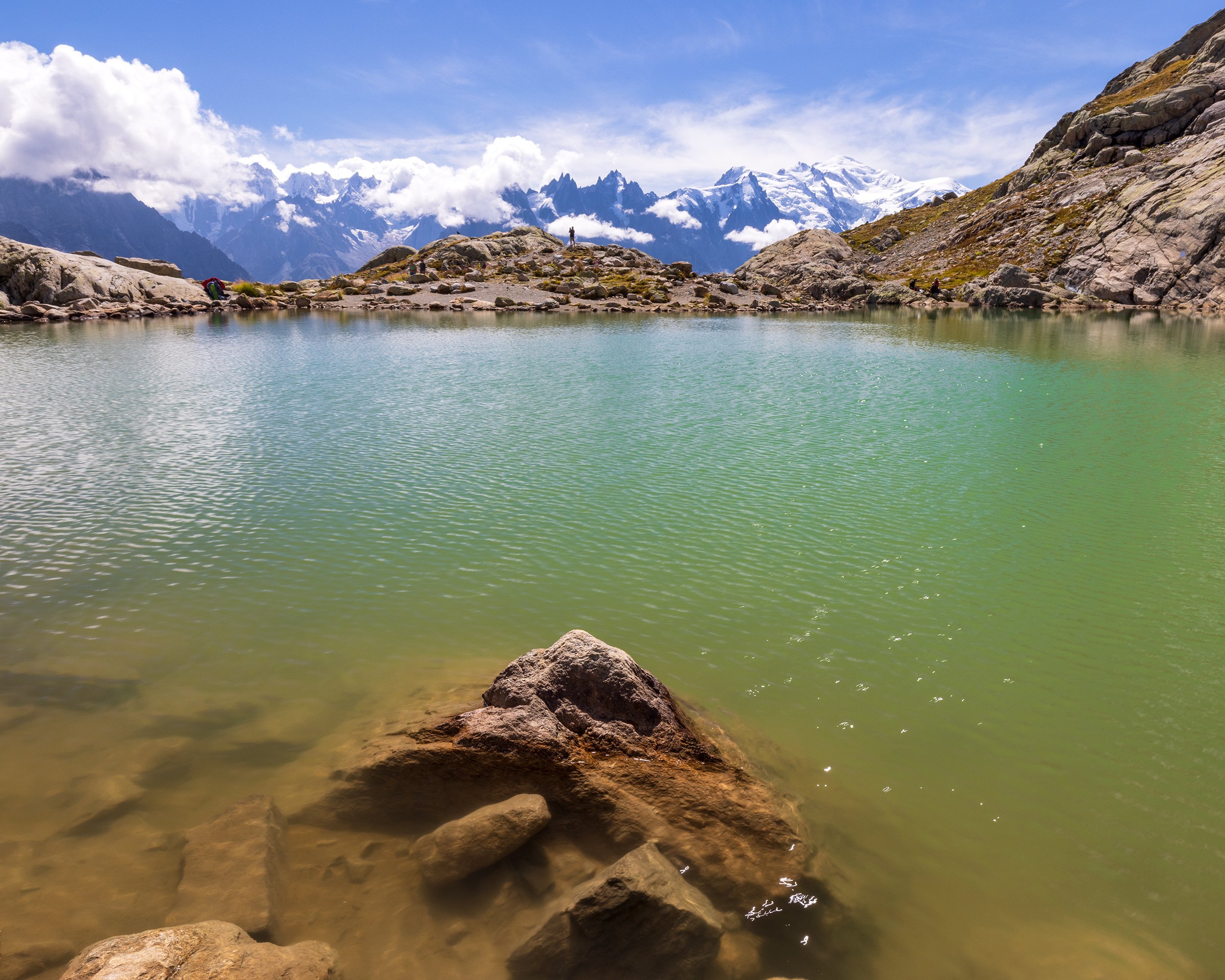
Day 10 - Argentière to Chamonix
Distance: 15.3km, Elevation Gain: 985m, Elevation Loss: 1405m
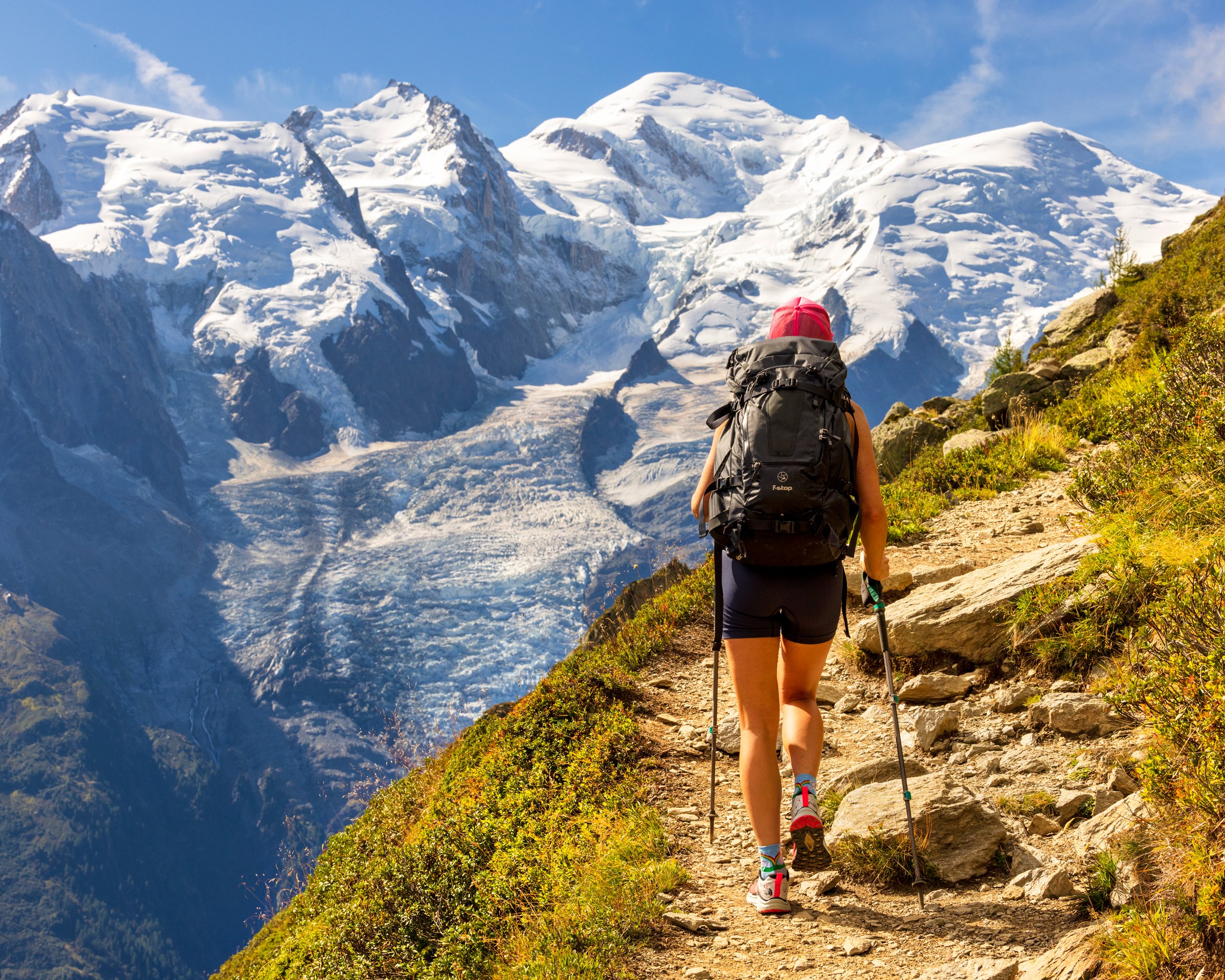
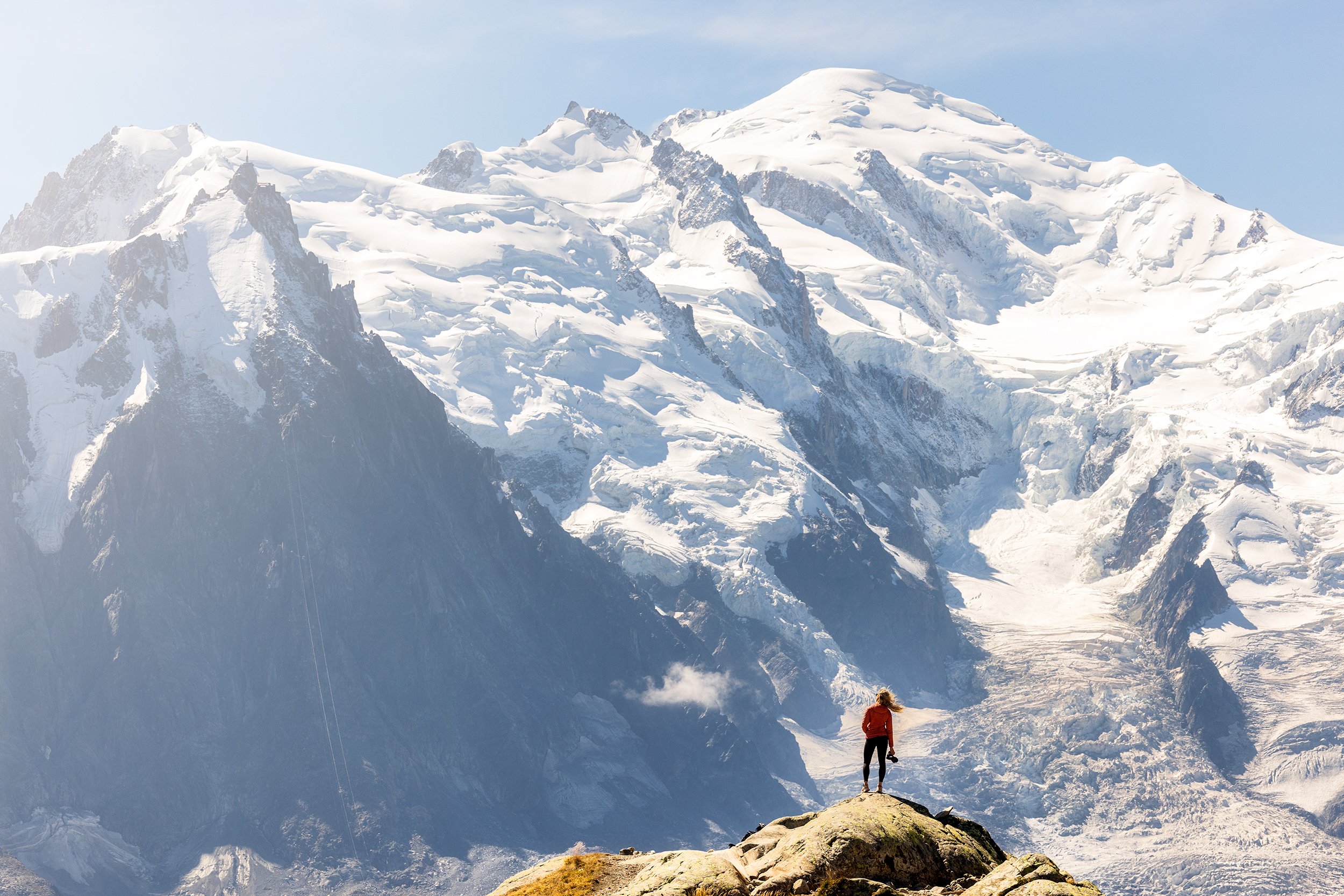
The weather report for the day indicated that there would be afternoon thunderstorms, so we hit the trail early to avoid the rain. From our hotel in Argentière, the trail climbed nearly 4000 feet through the massif of the Aiguilles-Rouges which is situated directly across the valley from the Mont Blanc summit. Once we reached the Montets Pass, we followed a trail to Chéserys Lake, before continuing on to Refuge du Lac Blanc. From here, we were treated with extraordinary views of the full Mont Blanc Range overlooking Chamonix. Sunshine and blue skies mixed with dynamic clouds that swirling around the jagged peaks of Mont Blanc.
We milled around the Lac Blanc for quite some time, sipping coffee and marinating in the views. We had initially talked about taking the tram at La Flégère down, but opted instead to hike and finish the trip properly. I found an offshoot trail that ended up being extremely steep, descending over 2000 feet in roughly one mile. After a few tricky sections, we were happy to reach the bottom and to our accommodations at the Excelsior Hotel. After checking into our room, we spent the rest of the afternoon lounging by the pool, calling our families back home, and drinking beer and Aperol Spritz.
What an amazing end to an amazing trip and things could not have gone more smoothly. Fortunately, we did not experience any significant problems along the way, and with the exception of a few two hand blisters from our trekking poles, both of us came away unscathed, without even as much as a minor rolled ankle. Quite amazing considering the amount of stepping that we did.
Conclusion and Afterthoughts:
At the end of each trip, I am reminded of the similarities that exist between the simple act of hiking and the art of living. In life, nothing that is worth doing is ever easy, and requires a fair amount of self motivation, endurance, and resilience to move past challenging obstacles. Getting to the top of a mountain summit or pass can require a great amount of effort and planning, but the reason we go is to see what lies on the other side. The views that await us have always, and will always be there, but it isn't until we put in the effort to climb up that our eyes are rewarded with new and expansive views. It is in this exact moment, that the fears, assumptions, and expectations that we made in our minds about these places seem to fade away. At the top, I always feel a great sense of pride and accomplishment, and the feeling of pain and hardships that was required to get here is always replaced with extreme happiness. They say that with life it is impossible to know what lies ahead or what the future holds. But just like hiking, once you get moving in a particular direction what you find tends to be more that what you initially set out looking for. By taking slow and methodical steps, one after another, we will eventually cover great distances and learn a lot about ourselves in the process.
Around each and every aspect of the Mont Blanc massif that we traversed, the views never failed to impress us. This place is amazing and my heart ached to think about returning to my normal life back in Montana. But with all trips, we cannot stay here forever, yet we carry bits and pieces of each of these visited places with us in our hearts and memories for the rest of our lives. These trips change us for the better and each one makes me yearn for more rich experiences. As with this life, just like those difficult mountain pass ascents, I can’t help but feel filled with anticipation thinking about what is on the other side of this life yet to be discovered and made real.